Loyal, Oklahoma
| Loyal, Oklahoma | |
|---|---|
| Town | |
 Location of Loyal, Oklahoma | |
| Coordinates: 35°58′25″N 98°7′9″W / 35.97361°N 98.11917°WCoordinates: 35°58′25″N 98°7′9″W / 35.97361°N 98.11917°W | |
| Country | United States |
| State | Oklahoma |
| County | Kingfisher |
| Area | |
| • Total | 0.1 sq mi (0.2 km2) |
| • Land | 0.1 sq mi (0.2 km2) |
| • Water | 0.0 sq mi (0.0 km2) |
| Elevation | 1,112 ft (339 m) |
| Population (2000) | |
| • Total | 81 |
| • Density | 1,030.2/sq mi (397.8/km2) |
| Time zone | Central (CST) (UTC-6) |
| • Summer (DST) | CDT (UTC-5) |
| ZIP code | 73756 |
| Area code(s) | 405 |
| FIPS code | 40-44300[1] |
| GNIS feature ID | 1095041[2] |
Loyal is a town in Kingfisher County, Oklahoma, United States. The population was 81 at the 2000 census.
History
A large share of the early settlers being natives of Germany caused the original name of Kiel to be selected, after Kiel, in northern Germany.[3] Following American entry into World War I, the name was changed to Loyal due to rampant anti-German sentiment.[4]
Geography
Loyal is located at 35°58′25″N 98°07′09″W / 35.973684°N 98.119052°W.[5]
According to the United States Census Bureau, the town has a total area of 0.1-square-mile (0.26 km2), all land.
Demographics
| Historical population | |||
|---|---|---|---|
| Census | Pop. | %± | |
| 1940 | 177 | — | |
| 1950 | 125 | −29.4% | |
| 1960 | 87 | −30.4% | |
| 1970 | 107 | 23.0% | |
| 1980 | 112 | 4.7% | |
| 1990 | 76 | −32.1% | |
| 2000 | 81 | 6.6% | |
| 2010 | 79 | −2.5% | |
| Est. 2015 | 81 | [6] | 2.5% |
As of the census[1] of 2000, there were 81 people, 35 households, and 22 families residing in the town. The population density was 1,030.2 people per square mile (390.9/km2). There were 43 housing units at an average density of 546.9 per square mile (207.5/km2). The racial makeup of the town was 81.48% White, 6.17% Native American, 9.88% from other races, and 2.47% from two or more races. Hispanic or Latino of any race were 9.88% of the population.
There were 35 households out of which 31.4% had children under the age of 18 living with them, 45.7% were married couples living together, 14.3% had a female householder with no husband present, and 34.3% were non-families. 31.4% of all households were made up of individuals and 11.4% had someone living alone who was 65 years of age or older. The average household size was 2.31 and the average family size was 2.65.
In the town the population was spread out with 28.4% under the age of 18, 4.9% from 18 to 24, 29.6% from 25 to 44, 28.4% from 45 to 64, and 8.6% who were 65 years of age or older. The median age was 38 years. For every 100 females there were 72.3 males. For every 100 females age 18 and over, there were 81.3 males.
The median income for a household in the town was $18,750, and the median income for a family was $21,250. Males had a median income of $32,500 versus $20,625 for females. The per capita income for the town was $12,673. There were 38.1% of families and 34.2% of the population living below the poverty line, including 35.0% of under eighteens and none of those over 64.
Notable people
- Al Brazle, baseball player.
References
- 1 2 "American FactFinder". United States Census Bureau. Retrieved 2008-01-31.
- ↑ "US Board on Geographic Names". United States Geological Survey. 2007-10-25. Retrieved 2008-01-31.
- ↑ McIntyre, Glen V. (4 February 2009). Kingfisher and Kingfisher County. Arcadia Publishing. p. 9. ISBN 978-1-4396-2120-2.
- ↑ Loyal at Oklahoma Historical Society's Encyclopedia of Oklahoma History & Culture
- ↑ "US Gazetteer files: 2010, 2000, and 1990". United States Census Bureau. 2011-02-12. Retrieved 2011-04-23.
- ↑ "Annual Estimates of the Resident Population for Incorporated Places: April 1, 2010 to July 1, 2015". Retrieved July 2, 2016.
- ↑ "Census of Population and Housing". Census.gov. Retrieved June 4, 2015.
Municipalities and communities of Kingfisher County, Oklahoma, United States | ||
|---|---|---|
| Cities | 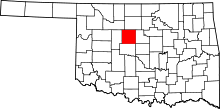 | |
| Towns | ||
| Unincorporated communities | ||
| Footnotes | ‡This populated place also has portions in an adjacent county or counties | |