Lowesby
| Lowesby | |
 Lowesby |
|
| Area | 2.22 sq mi (5.7 km2) |
|---|---|
| Population | 127 (2011)[1] |
| – density | 57/sq mi (22/km2) |
| OS grid reference | SK725075 |
| – London | 90 mi (140 km) |
| Shire county | Leicestershire |
| Region | East Midlands |
| Country | England |
| Sovereign state | United Kingdom |
| Police | Leicestershire |
| Fire | Leicestershire |
| Ambulance | East Midlands |
| EU Parliament | East Midlands |
|
|
Coordinates: 52°39′36″N 0°55′55″W / 52.66°N 0.931944°W
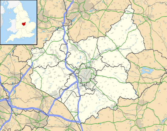
Lowesby is a small parish and township situated in the district of Harborough in Leicestershire county. It is 8 miles east of the county capital, Leicester, and 90 miles north of London.[2]
Geography
Lowesby parish is located 500 metres above sea level[3] in a relatively hilly region.Other than Queniborough brook there are no other sites of topographic interest in Lowesby, partially due to the intensive farming in the area.[4] Local farming may have been influenced by the geology of the area which is predominantly serpentine rock.[5] Lowesby Hall was first owned by Richard Wallaston from the mid 17th century and remained in his family until Anne Wallaston married into the Fowke family, in whose hands the Hall remained well into the 20th century. It is now under private ownership.[6]
Government
The Rutland and Melton District, which includes Lowesby, is represented by A. Duncan (Conservative), who has held the seat since 1992. In addition to his duties for the Rutland and Melton area, he is minister of state for international development, where he is involved with countries in Africa, the Caribbean, and the Middle East and Asia.[7] The councillor for Harborough is Michael Rook (Conservative), who was elected in May 2007.[8] The county councillor for Lowesby is Simon Galton (Liberal Democrat).[9]
History
The name Lowesby stems from Old Norse and is thought to mean Lausi's farm or settlement, which refers to the owner and subsequent land use.[10] Lowesby is recorded as early as 1086 in the Domesday Book, implying that the parish was founded sometime in the early 11th century. Lowesby is shown as a small agricultural centre with two plough teams consisting of five men each.[11] The manor was held from Countess Judith by a Norman called Hugh Burdet (aka Bourdet/Bordet), originally from Cuilly in Normandy, who made Loseby his family's home for many generations.
The Burdets founded Loseby church and gave its advowson to the Order of St Lazarus based at Burton Lazars who they supported for many generations to come.[12] Relations soured though when in about 1290 the Order started to appropriate part of the parish's tithes for itself.[12] Riots broke out over the ensuing years, Loseby's vicar was excommunicated and William Burdet's actions "polluted" the churchyard by bloodshed in 1297.[12] Gradually order was restored to the village and in 1298 Sir William agreed to pay for the reconsecration of the church and to reconfirm his family's former grants to the Order but relations were never to be the same again.[12]

In 1831 agriculture was by far the most prominent industry, with 64% of the male population of the age of 20 employed in this sector.[13] However, fifty years later, this number had dropped to 40%, and while agriculture was still the most common employment, the remainder of the population was working in other occupations, including as coachmen, gardeners for the manor, or as machinists.[14]
The parish's main land use in 2001 is still farming but just 9% of the population now work in agriculture and the manor no longer provides employment.[15]
Transport
Lowesby railway station has been closed since 7 December 1953, and is now part of a farm. It was the first station to open on the Great Northern Railway route to Leicester on 15 May 1882.[16]
Economy
The tertiary sector, otherwise described as the service sector, is the dominant area of employment in Lowesby with 62% (50 people) of the population working in this area. There has also been a movement into scientific and technical industries, which employs 10% of those working in tertiary industry in Lowesby.[17]
Demography

The population of Lowesby Parish was 127 in 2011.[18] This level of population has not always been constant throughout the parish's history. The population of Lowesby grew by almost 100 people during the first fifty years of the 19th century.[19] By the time of the 1851 census, a UK-wide railway network had almost been completed. Coupled with minor depressions and a second phase of British industrialisation, it may have led to a decline in the local population.[20] The population has not recovered since then, with Lowesby having averaged approximately one hundred inhabitants during the 20th century.
References
- ↑ "Lowesby (Parish): Key Figures for 2011 Census: Key Statistics". Neighbourhood Statisitcs. Office for National Statisitcs. Retrieved 5 February 2014.
- ↑ "Lowesby (Parish): Key Figures for 2011 Census: Key Statistics". Neighbourhood Statisitcs. Office for National Statisitcs. Retrieved 5 February 2014.
- ↑ "British War Office GSGS 4127, Ordnance Survey Popular and New Popular Editions". Ordnance Survey of Great Britain. 1945. pp. 122 Melton Mowbray. Retrieved 3 April 2014.
- ↑ "Land Utilisation Survey of Britain". Geographical Publications Limited. 1935. p. 63 - Leicester. Retrieved 2014-04-07.
- ↑ Ian West. "http://large.stanford.edu/publications/coal/references/west/". Stanford University. Retrieved 2014-04-26. External link in
|title=(help) - ↑ Parks and Gardens UK. "http://www.parksandgardens.org/places-and-people/site/2162/history". Retrieved 2014-04-26. External link in
|title=(help) - ↑ UK Government. "https://www.gov.uk/government/people/alan-duncan". Retrieved 2014-04-25. External link in
|title=(help) - ↑ The District of Harborough. "http://cmispublic.harborough.gov.uk/cmis5/People/tabid/62/ctl/ViewCMIS_Person/mid/480/id/2065/ScreenMode/Alphabetical/Default.aspx". Retrieved 2014-04-25. External link in
|title=(help) - ↑ Leicestershire County Council. "http://politics.leics.gov.uk/mgUserInfo.aspx?UID=279&J=2". Retrieved 2014-04-25. External link in
|title=(help) - ↑ "The Institute for Name-Studies.". University of Nottingham. Retrieved 2014-03-10.
- ↑ Palmer, J.J.N. "The first free online copy of Domesday Book". Retrieved 2014-03-10.
- 1 2 3 4 Marcombe, David (2003). Leper Knights. Woodbridge: Boydell Press. ISBN 1-84383-067-1.
- ↑ Lowesby AP/CP through time. "Males aged 20 & over, in 9 occupational categories". GB Historical GIS / University of Portsmouth. Retrieved 2014-03-10.
- ↑ Woollard, Mark. "Occupations of Males and Females in the Division and its Registration Counties". Retrieved 2014-03-10.
- ↑ "Occupation Groups - Males, 2001". Neighbourhood Statistics. Retrieved 2014-03-10.
- ↑ "Great Northern Railway and London & North Western Railway". Retrieved 2014-04-14.
- ↑ "Industry, 2011 (QS605EW)". Office for National Statistics. Retrieved 2014-04-09.
- ↑ "Lowesby (Parish): Key Figures for 2011 Census: Key Statistics". Neighbourhood Statisitcs. Office for National Statisitcs. Retrieved 5 February 2014.
- ↑ A Vision of Britain through Time. "Lowesby AP/CP through time". GB Historical GIS / University of Portsmouth. Retrieved 8 April 2014.
- ↑ Professor Mary Davis. "Timeline 1850-1880". London metropolitan university. Retrieved 2014-04-08.
External links
![]() Media related to Lowesby at Wikimedia Commons
Media related to Lowesby at Wikimedia Commons