Lower New York Bay
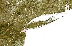

Lower New York Bay is a section of New York Bay south of the Narrows, the relatively narrow strait between the shores of Staten Island and Brooklyn. The southern end of the bay opens directly to the Atlantic Ocean between two spits of land, Sandy Hook, New Jersey, and Rockaway, Queens, on Long Island. The southern portion between Staten Island and New Jersey, at the mouth of the Raritan River, is named Raritan Bay. The Hudson Canyon, the ancient riverbed of the Hudson River which existed during the last ice age when the ocean levels were lower, extends southeast from Lower New York Bay for hundreds of miles into the Atlantic Ocean. The nearby part of the Atlantic Ocean between New Jersey and Long Island is the New York Bight.
History and geography
Since before the time of the Lenape, the Native American inhabitants of the area, the Lower Bay has sustained a rich marine ecosystem with multiple fish species and molluscs, especially oyster, clam and mussel beds. In the 20th century, due to increased population and industrial pollution, the water quality of the bay and its ability to support marine life was severely diminished. The water quality of the bay began to improve with the passage of the Clean Water Act.
The main shipping channel through Lower New York Bay is the Ambrose Channel, 2,000 feet wide and dredged to a depth of 40 feet. The channel is navigable by ships with up to a 37-foot draft at low tide.[1] The entrance to the Ambrose Channel was marked for many years by the Lightship Ambrose, which was superseded by the Ambrose Light.
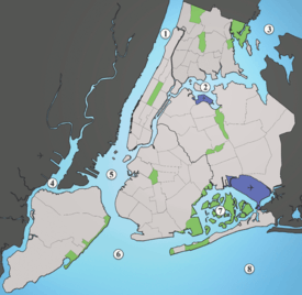
The bay contains popular beaches at Brighton Beach and Coney Island in Brooklyn. There are also beaches on Staten Island. Just outside the bay, facing the Atlantic, are the beaches of Sandy Hook and the Rockaways.
Lighthouses
Several lighthouses were built to aid navigation in and around Lower New York Bay, located both on land and in the bay itself. The earliest, at Sandy Hook, was built in colonial times.
In New Jersey:
In New York:
Within Lower New York Bay:
Islands
There are two small artificial islands in Lower New York Bay, both located a mile offshore from South Beach, Staten Island.
- Hoffman Island was created in 1873 from Orchard Shoals. It was named for former New York City mayor (1866–1868) and then-current New York Governor (1869–1871) John T. Hoffman. Hoffman Island covers 11 acres (4.45 hectares).
- Swinburne Island, with an area of about 4 acres (16,000 m²), lies immediately to the south.[2] Swinburne Island was originally called Dix Island, but was renamed in honor of Dr. John Swinburne, a noted military surgeon during the Civil War.[3]
In the early 20th century, both islands were used as a quarantine station, housing immigrants found to have been carrying contagious diseases when they landed at Ellis Island.[4] At the start of World War II the United States Merchant Marine used both islands as a training station (which opened in 1938);[2] the Quonset huts built during this period still stand on Swinburne Island.
The other major use for the two islands during World War II were as anchorages for antisubmarine nets that fenced off New York Bay from the Atlantic Ocean to keep enemy submarines out. Both islands are now part of Gateway National Recreation Area.[2]
Fort Lafayette was on a small island in the Narrows, just off the Brooklyn shore. That island was removed during construction of the Verrazano-Narrows Bridge. Coney Island, originally separated from the southern shore of Brooklyn by a narrow strait, has since been connected to the main part of Long Island by landfill, and is now a peninsula despite its name.
See also
- Upper New York Bay
- Hudson River
- Geography of New York-New Jersey Harbor Estuary
- Port of New York and New Jersey
- New York Harbor
References
- ↑ United States coast pilot: Atlantic coast. From Point Judith to New York, Part 4 By U.S. Coast and Geodetic Survey, Herbert Cornelius Graves, p. 187. Publisher: University of Michigan Library (January 27, 2010) Language: English ASIN: B0037CEPUY
- 1 2 3 Kenneth T. Jackson. The Encyclopedia of New York City. The New-York Historical Society; Yale University Press; 1995. p. 149
- ↑ Poole, M. O. (February 28, 1937). "Historic Islands At New York's Front Door.". The New York Times. Retrieved 2008-07-28.
- ↑ "Quarantine At New York". Harper's Weekly. September 6, 1879. Retrieved 2008-07-28.
Coordinates: 40°31′00″N 74°02′59″W / 40.51667°N 74.04972°W