Lower Nazareth Township, Northampton County, Pennsylvania
| Lower Nazareth Township | |
| Settlement | |
 Louise W. Moore Park | |
| Country | United States |
|---|---|
| State | Pennsylvania |
| County | Northampton |
| Elevation | 397 ft (121.0 m) |
| Coordinates | 40°42′30″N 75°22′36″W / 40.70833°N 75.37667°WCoordinates: 40°42′30″N 75°22′36″W / 40.70833°N 75.37667°W |
| Area | 13.4 sq mi (34.7 km2) |
| - land | 13.4 sq mi (35 km2) |
| - water | 0.0 sq mi (0 km2), 0% |
| Population | 5,259 (2000) |
| Density | 392.5/sq mi (151.5/km2) |
| Timezone | EST (UTC-5) |
| - summer (DST) | EDT (UTC-4) |
| Area code | 610 |
 Location of Lower Nazareth Township in Northampton County | |
 Location of Lower Nazareth Township in Pennsylvania | |
 Location of Pennsylvania in the United States | |
| Website: http://www.lowernazareth.com | |
Lower Nazareth Township is a township in Northampton County, Pennsylvania, United States. Lower Nazareth Township is located in the Lehigh Valley region of the state.
The population of Lower Nazareth Township was 5,259 at the 2000 census.
Geography
According to the United States Census Bureau, the township has a total area of 13.4 square miles (34.7 km2), all of it land. It is in the Delaware watershed and is drained by the Lehigh River tributary of the Monocacy Creek and by the Bushkill Creek. Its villages include Georgetown (also in Upper Nazareth Township,) Hecktown, Hollo, Newburg, Newburg Homes, and Steuben. Its primary north-to-south routes are the two-lane Nazareth Pike (Route 191) and the Route 33 Expressway. Nazareth Road (Route 248) crosses the NE portion of Lower Nazareth. Other local roads of note include Daniels Road (Route 946), Georgetown Road, Hanoverville Road/Hecktown Road, Newburg Road, Steuben Road, and Township Line Road.
Neighboring municipalities
- Upper Nazareth Township (north)
- Nazareth (north)
- Palmer Township (east)
- Bethlehem Township (south)
- Hanover Township (southwest)
- East Allen Township (west)
Demographics
As of the census[1] of 2000, there were 5,259 people, 1,788 households, and 1,534 families residing in the township. The population density was 392.5 people per square mile (151.5/km2). There were 1,821 housing units at an average density of 135.9/sq mi (52.5/km2). The racial makeup of the township was 96.98% White, 0.89% African American, 0.17% Native American, 1.20% Asian, 0.13% from other races, and 0.63% from two or more races. Hispanic or Latino of any race were 1.39% of the population.
There were 1,788 households, out of which 41.8% had children under the age of 18 living with them, 77.8% were married couples living together, 5.5% had a female householder with no husband present, and 14.2% were non-families. 11.5% of all households were made up of individuals, and 5.2% had someone living alone who was 65 years of age or older. The average household size was 2.94 and the average family size was 3.19.
In the township the population was spread out, with 27.6% under the age of 18, 6.2% from 18 to 24, 26.2% from 25 to 44, 30.8% from 45 to 64, and 9.1% who were 65 years of age or older. The median age was 40 years. For every 100 females there were 99.6 males. For every 100 females age 18 and over, there were 98.0 males.
The median income for a household in the township was $70,250, and the median income for a family was $76,193. Males had a median income of $48,343 versus $31,956 for females. The per capita income for the township was $26,624. About 1.5% of families and 2.1% of the population were below the poverty line, including 1.3% of those under age 18 and 7.7% of those age 65 or over.
Notable Residents
Niah Parker
Public education
The Township is served by the Nazareth Area School District.
References
- ↑ "American FactFinder". United States Census Bureau. Retrieved 2008-01-31.
External links
Municipalities and communities of Northampton County, Pennsylvania, United States | ||
|---|---|---|
| Cities | 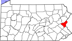 | |
| Boroughs | ||
| Townships | ||
| CDPs | ||
| Unincorporated communities | ||
| Footnotes | ‡This populated place also has portions in an adjacent county or counties | |