Lower Dauphin Street Historic District
|
Lower Dauphin Street Historic District | |
  | |
| Location | Mobile, Alabama |
|---|---|
| Coordinates | 30°41′21.80″N 88°2′56.17″W / 30.6893889°N 88.0489361°WCoordinates: 30°41′21.80″N 88°2′56.17″W / 30.6893889°N 88.0489361°W |
| Architectural style | Federal, Italianate, Queen Anne, Late 19th and 20th Century Revivals, Late Victorian |
| NRHP Reference # |
79000392[1] (original) 82002059 (increase 1) 95000779 (increase 2) 98001027 (increase 3) |
| Significant dates | |
| Added to NRHP | 19 February 1979, expanded multiple times thereafter.[1][2] |
| Boundary increases |
February 19, 1982 June 30, 1995 August 14, 1998 |
The Lower Dauphin Street Historic District is a historic district in the city of Mobile, Alabama, United States. It was placed on the National Register of Historic Places on 9 February 1979.[1] The district encompasses all of Dauphin Street from Water Street to Jefferson Street.[2] It covers 551 acres (2.23 km2) and contains 736 contributing buildings. The boundaries were increased on 19 February 1982, 30 June 1995, and 14 August 1998. The buildings range in age from the 1820s to the 20th century and include the Federal, Greek Revival, Queen Anne, Italianate, and various other Victorian architectural styles.[2]
Gallery
Examples of architecture within the Lower Dauphin Street Historic District:
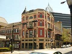 Pincus Building
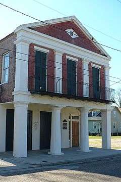
 Spira and Pincus Building
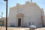
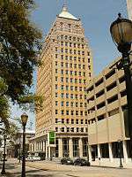 Merchants National Bank Building
References
- 1 2 3 National Park Service (2010-07-09). "National Register Information System". National Register of Historic Places. National Park Service.
- 1 2 3 "Alabama: Mobile County". "Nationalhistoricalregister.com". Retrieved 2008-01-28.

| Topics | |
|---|---|
| Lists by states |
|
| Lists by insular areas | |
| Lists by associated states | |
| Other areas | |
| |
| Wikimedia Commons has media related to Lower Dauphin Street Historic District. |
This article is issued from Wikipedia - version of the 11/26/2016. The text is available under the Creative Commons Attribution/Share Alike but additional terms may apply for the media files.