Lotsane River
| Lotsane River | |
| River | |
 Lotsane river near Palapye after a flood | |
| Country | Botswana |
|---|---|
| Source | Kalahari |
| - elevation | 1,300 m (4,265 ft) |
| Mouth | |
| - location | Limpopo River, South Africa/Botswana border |
| - elevation | 751 m (2,464 ft) |
| - coordinates | 22°40′42″S 28°11′25″E / 22.67833°S 28.19028°ECoordinates: 22°40′42″S 28°11′25″E / 22.67833°S 28.19028°E |
| Basin | 9,748 km2 (3,764 sq mi) |
 Location of the Lotsane River mouth | |
The Lotsane River is a river in southeastern Botswana. It is a seasonal left hand tributary of the Limpopo River and has a catchment area of 9,748 square kilometers.
Course
The Lotsane has its source in the sandveld, at the eastern fringes of the Kalahari Desert. It flows roughly eastwards, passing close to Serowe and through Palapye and flanking the feet of the Tswapong Hills on their northern side near Maunatlala. Finally it joins the left bank of the Limpopo River at the border with South Africa.[1]
Its main tributaries are the Morupule River and the Kutswe River, the latter of which cuts across the Mokgware Hills, a mountain rainge that divides the watershed of the rivers flowing northeastwards, such as the Maitsokgwane, from those flowing southeastwards like the Mahalapswe. Other tributaries are the Dikabeya River and Susuela River, which join the Lotsane east of the Tswapong area.
All the rivers in the Lotsane basin are dry throughout the year, experiencing ephemeral flow during the summer rainy season. People in nearby areas collect water stored in the sandy riverbed.[2]
There is one main dam in the Lotsane River. Currently, the construction of other dams is planned.[3] According to the Water Utilities Corporation, as of March 2012 the Lotsane Dam was almost completed.[4]
Gallery
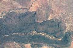 NASA picture of the Tswapong Hills with the Lotsane River flowing along the northern edge.
 Flash flood in Palapye, Central District, Botswana. Heavy rain caused a small dam to burst on the Lotsane River, which flows through the village
See also
References
- ↑ Limpopo RAK Retrieved 4 April 2012.
- ↑ Major rivers and streams within the Limpopo River Basin Retrieved 4 April 2012.
- ↑ Budget 2012: Fiscal Austerity Adhered to in Botswana - 3 Feb 2012 Retrieved 4 April 2012.
- ↑ "Lotsane Dam". Botswana Water Utilities Corporation. Retrieved 20 September 2012.
External links
| Wikimedia Commons has media related to Lotsane River. |
- Limpopo River Basin
- Morupule Colliery
- Settlement and Land use between the 11th and the 17th centuries in Botswana
- Mmabolela - History
- Drainage evolution in south-central Africa since the breakup of Gondwana
- African Dams Briefing 2010
- Lotsane Dam to supply Tswapong villages