Loretto, Pennsylvania
| Loretto, Pennsylvania | |
|---|---|
| Borough | |
|
The main house, cascades, and gardens of "Immergrün", Charles M. Schwab's retreat in Loretto | |
 Loretto | |
| Coordinates: 40°30′23″N 78°38′10″W / 40.50639°N 78.63611°WCoordinates: 40°30′23″N 78°38′10″W / 40.50639°N 78.63611°W | |
| Country | United States |
| State | Pennsylvania |
| County | Cambria |
| Settled | 1788 |
| Incorporated | 1845 |
| Government | |
| • Type | Borough council |
| Area | |
| • Total | 0.96 sq mi (2.48 km2) |
| • Land | 0.96 sq mi (2.48 km2) |
| • Water | 0.0 sq mi (0.0 km2) |
| Elevation | 1,929 ft (588 m) |
| Population (2010) | |
| • Total | 1,302 |
| • Density | 1,360/sq mi (525.2/km2) |
| Time zone | Eastern (EST) (UTC-5) |
| • Summer (DST) | EDT (UTC-4) |
| ZIP code | 15940 |
| Area code(s) | 814 |

Loretto is a borough in Cambria County, Pennsylvania, United States. As of the 2010 census it had a population of 1,302.[1] Like the rest of Cambria County, it is part of the Johnstown, Pennsylvania Metropolitan Statistical Area. Loretto is the home of Saint Francis University.
Geography
Loretto is located in east-central Cambria County at 40°30′23″N 78°38′10″W / 40.50639°N 78.63611°W (40.506355, -78.636066).[2] It is 6 miles (10 km) east of Ebensburg, the Cambria County seat, and 17 miles (27 km) west of Altoona. Johnstown is 25 miles (40 km) to the southwest.
According to the United States Census Bureau, the borough of Loretto has a total area of 0.97 square miles (2.5 km2), all of it land.[1]
Saint Francis University, an institute of higher learning with an enrollment of 2,210,[3] occupies the southwest quadrant of the borough.

History
Loretto was founded in 1799 by Demetrius Augustine Gallitzin as the first English-speaking Roman Catholic settlement west of the Allegheny Front. He named it after the town of Loreto, Italy,[4] site of a Catholic place of pilgrimage. Loretto was built adjoining the original settlement founded by Captain Michael McGuire, a Revolutionary War veteran, in 1788.[5] In his will, Captain McGuire donated land to the Catholic Church on which Prince Gallitzin built St. Michael's Church in 1799.
Federal Correctional Institution, Loretto, is a U.S. federal prison located 0.5 miles (0.80 km) southeast of Loretto, on the site of a former Catholic seminary.
Demographics
| Historical population | |||
|---|---|---|---|
| Census | Pop. | %± | |
| 1850 | 193 | — | |
| 1860 | 256 | 32.6% | |
| 1870 | 280 | 9.4% | |
| 1880 | 280 | 0.0% | |
| 1890 | 236 | −15.7% | |
| 1900 | 240 | 1.7% | |
| 1910 | 246 | 2.5% | |
| 1920 | 422 | 71.5% | |
| 1930 | 352 | −16.6% | |
| 1940 | 504 | 43.2% | |
| 1950 | 863 | 71.2% | |
| 1960 | 1,338 | 55.0% | |
| 1970 | 1,661 | 24.1% | |
| 1980 | 1,395 | −16.0% | |
| 1990 | 1,072 | −23.2% | |
| 2000 | 1,190 | 11.0% | |
| 2010 | 1,302 | 9.4% | |
| Est. 2015 | 1,376 | [6] | 5.7% |
| Sources:[7][8][9] | |||
As of the census[8] of 2000, there were 1,190 people, 133 households, and 82 families residing in the borough. The population density was 1,167.3 people per square mile (450.5/km²). There were 153 housing units at an average density of 150.1 per square mile (57.9/km²). The racial makeup of the borough was 96.39% White, 2.52% African American, 0.50% Asian, 0.08% Pacific Islander, 0.25% from other races, and 0.25% from two or more races. Hispanic or Latino of any race were 1.26% of the population.
There were 133 households, out of which 21.8% had children under the age of 18 living with them, 51.1% were married couples living together, 6.0% had a female householder with no husband present, and 37.6% were non-families. 27.8% of all households were made up of individuals, and 12.0% had someone living alone who was 65 years of age or older. The average household size was 2.52 and the average family size was 3.20.
In the borough the population was spread out, with 5.5% under the age of 18, 71.6% from 18 to 24, 8.7% from 25 to 44, 7.2% from 45 to 64, and 6.9% who were 65 years of age or older. The median age was 21 years. For every 100 females there were 70.7 males. For every 100 females age 18 and over, there were 69.8 males.
The median income for a household in the borough was $30,357, and the median income for a family was $40,750. Males had a median income of $30,417 versus $16,250 for females. The per capita income for the borough was $7,125. About 2.7% of families and 9.1% of the population were below the poverty line, including none of those under age 18 and 2.6% of those age 65 or over.
Notable people
- Demetrius Augustine Gallitzin, Servant of God
- Charles M. Schwab, Steel Titan and Industrialist
References
- 1 2 "Geographic Identifiers: 2010 Demographic Profile Data (G001): Loretto borough, Pennsylvania". U.S. Census Bureau, American Factfinder. Retrieved March 17, 2015.
- ↑ "US Gazetteer files: 2010, 2000, and 1990". United States Census Bureau. 2011-02-12. Retrieved 2011-04-23.
- ↑ About Saint Francis University
- ↑ Gannett, Henry (1905). The Origin of Certain Place Names in the United States. U.S. Government Printing Office. p. 190.
- ↑ Adams, Edmund (1989). Catholic Trails West: Founding Catholic Families of Pennsylvania, volume 2. Baltimore: Gateway Press. p. 354. ISBN 0806312122.
- ↑ "Annual Estimates of the Resident Population for Incorporated Places: April 1, 2010 to July 1, 2015". Retrieved July 2, 2016.
- ↑ "Census of Population and Housing". U.S. Census Bureau. Retrieved 11 December 2013.
- 1 2 "American FactFinder". United States Census Bureau. Retrieved 2008-01-31.
- ↑ "Incorporated Places and Minor Civil Divisions Datasets: Subcounty Resident Population Estimates: April 1, 2010 to July 1, 2012". Population Estimates. U.S. Census Bureau. Retrieved 11 December 2013.
External links
Municipalities and communities of Cambria County, Pennsylvania, United States | ||
|---|---|---|
| City | 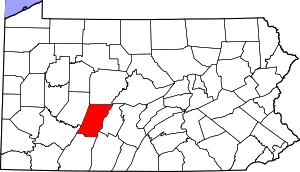 | |
| Boroughs |
| |
| Townships | ||
| CDPs | ||
| Unincorporated communities | ||
| Footnotes | ‡This populated place also has portions in an adjacent county or counties | |