Loomis, California
| Loomis, California | |
|---|---|
| Town | |
| Town of Loomis | |
| Motto: "A Small Town Is Like A Big Family"[1] | |
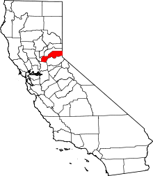
 Location in Placer County and the state of California | |
 Loomis, California Location in the United States | |
| Coordinates: 38°48′59″N 121°11′34″W / 38.81639°N 121.19278°WCoordinates: 38°48′59″N 121°11′34″W / 38.81639°N 121.19278°W | |
| Country |
|
| State |
|
| County | Placer |
| Incorporated | December 17, 1984[2] |
| Government | |
| • Mayor | Walt Scherer |
| • State Senate | Doug LaMalfa (R) |
| • State Assembly | Ted Gaines (R) |
| • U. S. Congress | Tom McClintock (R)[3] |
| Area[4] | |
| • Total | 7.267 sq mi (18.822 km2) |
| • Land | 7.267 sq mi (18.822 km2) |
| • Water | 0 sq mi (0 km2) 0% |
| Elevation | 404 ft (123 m) |
| Population (2010)[5] | |
| • Total | 6,430 |
| • Density | 880/sq mi (340/km2) |
| Time zone | PST (UTC-8) |
| • Summer (DST) | PDT (UTC-7) |
| ZIP code | 95650 |
| Area code(s) | 916 |
| FIPS code | 06-43140 |
| GNIS feature ID | 0277546 |
| Website | Town of Loomis California |
| U.S. Geological Survey Geographic Names Information System: Loomis, California | |
Loomis (formerly, Pine,[5] Pino,[5] Smithville,[6] and Placer[6]) is an incorporated town in Placer County, California, United States. It is part of the Sacramento–Arden-Arcade–Roseville Metropolitan Statistical Area. The population was 6,688 as estimated by the US Census in 2013.[7]
History
The Placer post office opened on the site in 1861, changed its name to Smithville in 1862, then changed it to Pino in 1869, and in 1890 the Southern Pacific Railroad finally decided on Loomis.[6] The railroad and Post Office found that Pino was confused with the town of Reno, hence the name change to Loomis.[8] The name Smithville honors L.G. Smith, who was one of the town's most prominent leaders.[6]
Loomis takes its name from one of the town's pioneers, James Loomis. At one time, James Loomis was the whole town—saloon keeper, railroad agent, express agent, and postmaster.[6] In the early part of the 20th century, Loomis was the second largest fruit-shipping station in Placer County.
Loomis remained part of unincorporated Placer County until December 17, 1984, when the Town of Loomis officially incorporated. The Town was in danger of being annexed by its neighbor Rocklin and the residents voted to incorporate to preserve local control, partly on the issue of preserving the "small town" character and historic structures such as the High Hand and Blue Goose fruit packing sheds which sit between Taylor Road (a segment of historic Highway 40) and the Union Pacific Railroad tracks.
Geography
Loomis is located at 38°48′59″N 121°11′34″W / 38.81639°N 121.19278°W (38.816436, -121.192778).[9]
According to the United States Census Bureau, the town has a total area of 7.27 square miles (18.8 km2), all of it land. Stream drainages are Antelope Creek and Secret Ravine.
Climate
Loomis has a hot-summer Mediterranean climate (Köppen Csa) that is characterized by cool, wet winters and hot, dry summers. As with the rest of cities in the northern Central Valley, Loomis has hot summers with a lack of rainfall and plenty of sunshine. Winters are cool and bring plenty of rain. Average daily high temperatures range from 53 °F (12 °C) in January to 94 °F (34 °C) in July with August remaining nearly as hot. Daily low temperatures range from 39 °F in winter to 61 °F in summer (4 to 16 °C). Snowfall is almost non-existent in Loomis.
| Climate data for Loomis, California | |||||||||||||
|---|---|---|---|---|---|---|---|---|---|---|---|---|---|
| Month | Jan | Feb | Mar | Apr | May | Jun | Jul | Aug | Sep | Oct | Nov | Dec | Year |
| Record high °F (°C) | 75 (24) |
78 (26) |
86 (30) |
98 (37) |
107 (42) |
110 (43) |
115 (46) |
110 (43) |
111 (44) |
102 (39) |
87 (31) |
76 (24) |
115 (46) |
| Average high °F (°C) | 53 (12) |
60 (16) |
64 (18) |
71 (22) |
80 (27) |
88 (31) |
94 (34) |
92 (33) |
87 (31) |
77 (25) |
63 (17) |
54 (12) |
73.6 (23.2) |
| Daily mean °F (°C) | 46 (8) |
51 (11) |
54 (12) |
60 (16) |
66 (19) |
73 (23) |
78 (26) |
76 (24) |
73 (23) |
65 (18) |
54 (12) |
47 (8) |
61.9 (16.7) |
| Average low °F (°C) | 39 (4) |
42 (6) |
44 (7) |
48 (9) |
53 (12) |
58 (14) |
61 (16) |
61 (16) |
58 (14) |
52 (11) |
44 (7) |
39 (4) |
49.9 (10) |
| Record low °F (°C) | 21 (−6) |
23 (−5) |
27 (−3) |
33 (1) |
36 (2) |
43 (6) |
48 (9) |
46 (8) |
41 (5) |
31 (−1) |
27 (−3) |
16 (−9) |
16 (−9) |
| Average precipitation inches (mm) | 3.98 (101.1) |
3.46 (87.9) |
3.07 (78) |
1.58 (40.1) |
0.58 (14.7) |
0.12 (3) |
0.04 (1) |
0.06 (1.5) |
0.35 (8.9) |
1.08 (27.4) |
2.80 (71.1) |
3.33 (84.6) |
20.45 (519.3) |
| Source: http://www.myforecast.com/bin/climate.m?city=11897&zip_code=95648&metric=false | |||||||||||||
Demographics
| Historical population | |||
|---|---|---|---|
| Census | Pop. | %± | |
| 1970 | 1,108 | — | |
| 1980 | 1,284 | 15.9% | |
| 1990 | 5,705 | 344.3% | |
| 2000 | 6,260 | 9.7% | |
| 2010 | 6,430 | 2.7% | |
| Est. 2015 | 6,733 | [10] | 4.7% |
2010
The 2010 United States Census[12] reported that Loomis had a population of 6,430. The population density was 884.8 people per square mile (341.6/km²). The racial makeup of Loomis was 5,733 (89.2%) White, 33 (0.5%) African American, 74 (1.2%) Native American, 169 (2.6%) Asian, 12 (0.2%) Pacific Islander, 149 (2.3%) from other races, and 260 (4.0%) from two or more races. Hispanic or Latino of any race were 568 persons (8.8%).
The Census reported that 6,409 people (99.7% of the population) lived in households, 5 (0.1%) lived in non-institutionalized group quarters, and 16 (0.2%) were institutionalized.
There were 2,356 households, out of which 832 (35.3%) had children under the age of 18 living in them, 1,361 (57.8%) were opposite-sex married couples living together, 266 (11.3%) had a female householder with no husband present, 138 (5.9%) had a male householder with no wife present. There were 142 (6.0%) unmarried opposite-sex partnerships, and 16 (0.7%) same-sex married couples or partnerships. 453 households (19.2%) were made up of individuals and 194 (8.2%) had someone living alone who was 65 years of age or older. The average household size was 2.72. There were 1,765 families (74.9% of all households); the average family size was 3.10.
The population was spread out with 1,588 people (24.7%) under the age of 18, 510 people (7.9%) aged 18 to 24, 1,377 people (21.4%) aged 25 to 44, 2,121 people (33.0%) aged 45 to 64, and 834 people (13.0%) who were 65 years of age or older. The median age was 42.1 years. For every 100 females there were 97.8 males. For every 100 females age 18 and over, there were 92.8 males.
There were 2,465 housing units at an average density of 339.2 per square mile (131.0/km²), of which 1,830 (77.7%) were owner-occupied, and 526 (22.3%) were occupied by renters. The homeowner vacancy rate was 1.2%; the rental vacancy rate was 4.9%. 4,911 people (76.4% of the population) lived in owner-occupied housing units and 1,498 people (23.3%) lived in rental housing units.
2000
As of the census[13] of 2000, there were 6,260 people, 2,206 households, and 1,729 families residing in the town. The population density was 851.9 people per square mile (328.8/km²). There were 2,273 housing units at an average density of 309.3 per square mile (119.4/km²). The racial makeup of the town was 89.06% White, 0.19% African American, 0.96% Native American, 3.23% Asian, 0.18% Pacific Islander, 2.01% from other races, and 4.38% from two or more races. Hispanic or Latino of any race were 6.87% of the population.
There were 2,206 households out of which 39.1% had children under the age of 18 living with them, 62.3% were married couples living together, 11.1% had a female householder with no husband present, and 21.6% were non-families. 16.8% of all households were made up of individuals and 6.6% had someone living alone who was 65 years of age or older. The average household size was 2.82 and the average family size was 3.17.
In the town the population was spread out with 28.8% under the age of 18, 6.4% from 18 to 24, 27.6% from 25 to 44, 25.5% from 45 to 64, and 11.7% who were 65 years of age or older. The median age was 38 years. For every 100 females there were 98.7 males. For every 100 females age 18 and over, there were 94.3 males.
The median income for a household in the town was $60,444, and the median income for a family was $64,837. Males had a median income of $50,458 versus $31,140 for females. The per capita income for the town was $30,384. About 2.5% of families and 3.4% of the population were below the poverty line, including 3.4% of those under age 18 and 0.4% of those age 65 or over.
Education
Loomis is home to Del Oro High School. Foundation elementary schools for Del Oro High School are Placer Elementary School, Franklin Elementary School, Loomis Grammar School, H. Clarke Powers Elementary School, Penryn School, Ophir School, Newcastle School, and the newly opened Loomis Basin Charter School.
References
- ↑ "Town of Loomis California Website". Town of Loomis California Website. Retrieved September 14, 2012.
- ↑ "California Cities by Incorporation Date" (Word). California Association of Local Agency Formation Commissions. Retrieved August 25, 2014.
- ↑ "California's 4th Congressional District - Representatives & District Map". Civic Impulse, LLC. Retrieved March 3, 2013.
- ↑ U.S. Census
- 1 2 3 U.S. Geological Survey Geographic Names Information System: Loomis, California
- 1 2 3 4 5 Durham, David L. (1998). California's Geographic Names: A Gazetteer of Historic and Modern Names of the State. Clovis, Calif.: Word Dancer Press. p. 516. ISBN 1-884995-14-4.
- ↑ Census.gov. United States Census http://quickfacts.census.gov/qfd/states/06/0643140.html. Retrieved 2015-02-25. Missing or empty
|title=(help) - ↑ Erwin, Gudde (2004). California Place Names: The origin and etymology of current geographical names. Berkeley, CA: University of California Press. p. 215.
- ↑ "US Gazetteer files: 2010, 2000, and 1990". United States Census Bureau. 2011-02-12. Retrieved 2011-04-23.
- ↑ "Annual Estimates of the Resident Population for Incorporated Places: April 1, 2010 to July 1, 2015". Retrieved July 2, 2016.
- ↑ "Census of Population and Housing". Census.gov. Retrieved June 4, 2015.
- ↑ "2010 Census Interactive Population Search: CA - Loomis town". U.S. Census Bureau. Retrieved July 12, 2014.
- ↑ "American FactFinder". United States Census Bureau. Retrieved 2008-01-31.
External links
| Wikimedia Commons has media related to Loomis, California. |
- Town of Loomis official website Portal style website, Government, Business, Library, Recreation and more
- South Placer Heritage Society
- Loomis Basin Horsemen's Association
- Loomis Fire Protection District
- City-Data.com Comprehensive Statistical Data and more about Loomis
 |
Lincoln | Penryn | Newcastle | |
| |
Coloma | |||
| ||||
| | ||||
| Rocklin | Granite Bay | Placerville |