Longueau–Boulogne railway
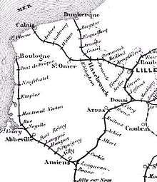
The Longueau–Boulogne railway is a French railway which runs from a junction with the Paris-Lille railway at Longueau to the coastal port of Boulogne. A double track railway it is 171 kilometres (106 miles) long. Until the start of the Eurostar service from London to Paris in 1994 via LGV Nord it was the main route for the boat trains to Paris which met the ships carrying passengers from Great Britain. As of August 2011 the line is used by Intercités services from Paris to Boulogne, TGV services from Rang-du-Fliers via Calais-Fréthun to Lille-Europe and local TER Picardy and Nord-Pas-de-Calais services.[1]
The line was built by Compagnie des chemins de fer du Nord from 1847 to 1848.[2] The section from Longueau through Amiens and to the junction with the line to Rouen is electrified at 25 kV 50 Hz.[3] From 2009 to 2010 the line from Boulogne to Rang-du-Fliers was also electrified to allow a TERGV service to run.[4]
References
- ↑ Paris-Amiens-Calais-Hazebrouck-Lille timetable (French)
- ↑ Direction Générale des Ponts et Chaussées et des Chemins de Fer (1869) (in French). Statistique centrale des chemins de fer. Chemins de fer français. Situation au 31 décembre 1869. Paris: Ministère des Travaux Publics. pp. 146–160
- ↑ "RFF - Map of electrified railway lines" (PDF).
- ↑ Bernard Collardey, "Amiens - Calais : La ligne de la côte se modernise", in Rail Passion, no 158, December 2010, p. 40-57 (ISSN 1261-3665) (in French)
Coordinates: 49°51′51″N 2°21′08″E / 49.8643°N 2.3521°E