Long Stratton
| Long Stratton | |
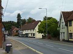 A140 through Long Stratton |
|
 Long Stratton |
|
| Area | 10.49 km2 (4.05 sq mi) |
|---|---|
| Population | 4,424 (2011 Census) |
| – density | 422/km2 (1,090/sq mi) |
| OS grid reference | TM1954292745 |
| District | South Norfolk |
| Shire county | Norfolk |
| Region | East |
| Country | England |
| Sovereign state | United Kingdom |
| Post town | NORWICH |
| Postcode district | NR15 |
| Dialling code | 01508 |
| Police | Norfolk |
| Fire | Norfolk |
| Ambulance | East of England |
| EU Parliament | East of England |
| UK Parliament | South Norfolk |
Coordinates: 52°29′17″N 1°14′02″E / 52.488°N 1.234°E
Long Stratton is a civil parish in South Norfolk, in the East of England, UK. It consists of two villages; the larger, Stratton St. Mary, is to the south, and the other, Stratton St. Michael, is to the north. It is home to a substantial population of 4,424(Census 2011).[1]
Location
The village is situated halfway between the regional capital, Norwich and the market town of Diss; along the Roman built road, the A140 (once known as Pye Road[2]) – which runs from Cromer (North Norfolk) to Ipswich (Suffolk).
Long Stratton borders five other parishes: Tharston and Hapton, Tasburgh, Morning Thorpe, Pulham Market, Wacton.
History
One of the ancient parishes that make up the modern village of Long Stratton was served by St Michael's church, whose rector from 1779 to 1823, Francis Wickham Swanton, was an Oxford contemporary of the celebrated Parson James Woodforde. The Blennerhasett family, later prominent in the Plantation of Ulster, were Lords of the Manor in the sixteenth century.
The church contains a rare example of a Sexton's wheel.[3] The only other example in the country is claimed to be at Yaxley, Suffolk.[4]

Long Stratton has two Church of England churches (St Mary and St Michael), as well as a Methodist church. The church of Long Stratton St Mary (see right) is one of 124 existing round-tower churches in Norfolk.
Village Demographics
According to the 2001 United Kingdom Census, Long Stratton CP is home to 3,701 people, who reside in a total of 1,598 dwellings, and have a mean age of 38.63. The statistics further confirm that Long Stratton is used as a commuter village, with the average employed person travelling 17.25 miles to their place of work.[5]
Governance
Long Stratton is part of the electoral ward of Stratton. This ward had a population of 5,519 at the 2011 census.[6]
Bypass proposals
There has been cause for the building of a bypass around Long Stratton for over 60 years. Builders of the new "Churchfields" housing estate to the east of the village proposed to build a bypass as part of the submission for planning permission in the mid-1990s, though this was rejected by the Highways Agency on the grounds that the planned road was not of a sufficiently high standard to redesignate it as part of the main A140 Trunk Road.
2006 was supposed to bring about the construction of the new bypass by Norfolk County Council, who had assumed responsibility for the A140 from the Highways Agency in 2001.[7]
There was considerable opposition to the bypass on either side of the A140, by residents of the village of Tharston to the west, and those of the hamlet of Wood Green Common to the east. Eventually, it was decided that a bypass to the east would have less environmental impact.
The total cost of the three miles stretch of dual carriageway, with a roundabout at either end, was estimated to be £21.8m (2004) – compared to earlier estimates of £6m to £16m (2002).
Following the May 2005 elections, the planning suffered a one-year delay, when changes to the planning permission laws meant that the application for the permission of the bypass had to be resubmitted.
Subsequent changes to the way in which local road building projects are prioritised and funded have led to a decision to suspend construction of the bypass until 2016 at the earliest, despite Norfolk County Council already having spent over £1m on site preparation & legal fees. This led local resident Jason Bunn to establish an online petition on the Prime Minister's website calling for the funding to be made available immediately. Local MP Richard Bacon also joined in the campaign, lobbying Transport Secretary Alistair Darling and Roads Minister Stephen Ladyman for a change in the decision.
Facilities and amenities

The village accommodates three schools first known as: Manor Field First School, St. Mary's Middle School, and Long Stratton High School. However, in September 2006, 'Manor Field First school' became 'Manor Field Infant school' and 'St. Mary's middle school' became 'St. Mary's church of England junior school'.
Shopping facilities are located along the main street which runs through the village (part of the A140 road), as well as in two small shopping centres (South Norfolk Shopping Precinct and The Icehouse Precinct – so called because it was built adjacent to the Victorian icehouse belonging to Long Stratton Manor). A coop supermarket is located in the centre of the village (see right). In August 2015, a Subway sandwich shop opened inside the supermarket. There are also two public houses (The Queen's Head and The Swan). Long Stratton also has a Doctors surgery, as well as a Leisure centre operated by South Norfolk District Council.
East of England Co-operative Society also owned a smaller convenience store at the Ice House precinct, as well as the supermarket, however this store closed permanently in September 2015.
In terms of public transport, numerous operators run bus services between the village and the city of Norwich.
The village has also seen the creation of two new housing estates for the new millennium, increasing the village population and size.
Barclays Bank Closure
Long Stratton had a branch of Barclays Bank branch in the centre of the village, but its closure was controversially announced in September 2015. South Norfolk MP, Richard Bacon said he was "very disappointed" and local residents petitioned against the decision, but on 18 September 2015 the bank closed. The closure of the ATM has caused some inconvenience, with only two other machines in the village.
SNYA Radio
SNYA Radio is a community youth internet radio station, established in 2008, and run by and for young people in Suffolk and Norfolk. Its original studios are based at Long Stratton Leisure Centre, with another in Attleborough.[8]
References
- ↑ "Neighbourhood Statistics for Long Stratton (Parish) – Household Composition – People, 2011". 2011 United Kingdom Census. Retrieved 30 March 2013.
- ↑ [approx 12 miles from norwich]LacusCurtius • Codrington's Roman Roads in Britain — Chapter 6
- ↑ "St Mary's church – the Sexton's wheel (C) Evelyn Simak :: Geograph Britain and Ireland". Geograph.org.uk. Retrieved 28 February 2014.
- ↑ Harold Mills West, 2002, Suffolk Villages, Newbury, Countryside Books, ISBN 1 85306 751 2, p.95
- ↑ "Neighbourhood Statistics for Long Stratton CP (Parish)". 2001 United Kingdom Census. Retrieved 2 January 2007.
- ↑ "Stratton ward population 2011". Retrieved 10 September 2015.
- ↑ Long Stratton Residents in 1996 protesting for a bypass (BBC News)
- ↑ SNYA Radio, Youth radio website.
External links
| Wikimedia Commons has media related to Long Stratton. |
- Website with photos of Long Stratton St Mary, a round-tower church
- Diss Express – village's local newspaper website
- Information from Genuki Norfolk on Long Stratton.