Londontowne, Maryland
| Londontowne, Maryland | |
|---|---|
| Former census-designated place | |
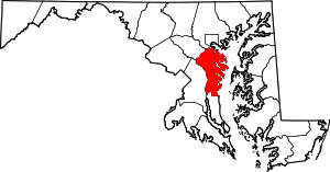
 Location of Londontowne, Maryland | |
| Coordinates: 38°56′10″N 76°33′15″W / 38.93611°N 76.55417°WCoordinates: 38°56′10″N 76°33′15″W / 38.93611°N 76.55417°W | |
| Country |
|
| State |
|
| County |
|
| Area | |
| • Total | 3.8 sq mi (9.8 km2) |
| • Land | 3.0 sq mi (7.8 km2) |
| • Water | 0.8 sq mi (2.0 km2) |
| Elevation | 26 ft (8 m) |
| Population (2000) | |
| • Total | 7,595 |
| • Density | 2,517.3/sq mi (971.9/km2) |
| Time zone | Eastern (EST) (UTC-5) |
| • Summer (DST) | EDT (UTC-4) |
| FIPS code | 24-47925 |
| GNIS feature ID | 0588901 |
Londontowne is an unincorporated area and former census-designated place (CDP) in Anne Arundel County, Maryland, United States. The population was 7,595 at the 2000 census. At the 2010 census, the area was delineated as the Edgewater CDP.
History
London Town was a colonial seaport town founded in 1683 near Annapolis. The original wharf was built by Colonel William Burgess, one of the area's original settlers. He parceled his land and sold it, leading to the creation of the town with the Act of 1683.[1] It was once considered as the site for the capital of Maryland, a state of the United States of America. It was as prominent a city in trade as Annapolis and Williamsburg, Virginia. A series of events caused it to decline and disappear by the 19th century, including its non-selection as a tobacco inspection station, economic depression, and the Revolutionary War.
Speculation exists that the South River Club's first clubhouse was built here.[2]
Historic London Town and Gardens
Today, a public museum and archeology lab and several of its buildings and the grounds have been reconstructed as Historic London Town and Gardens. The London Town Publik House, also known as Londontowne Public House, is listed on the National Register of Historic Places and further has been designated a National Historic Landmark.
Geography
Londontowne is located at 38°56′10″N 76°33′15″W / 38.93611°N 76.55417°W (38.936062, -76.554276).[3]
According to the United States Census Bureau, the CDP had a total area of 3.8 square miles (9.8 km²), of which, 3.0 square miles (7.8 km²) of it is land and 0.8 square miles (2.0 km²) of it (20.11%) is water.
Demographics
As of the census[4] of 2000, there were 7,595 people, 2,927 households, and 2,040 families residing in the CDP. The population density was 2,517.3 people per square mile (971.0/km²). There were 3,095 housing units at an average density of 1,025.8/sq mi (395.7/km²). The racial makeup of the CDP was 95.89% White, 1.97% African American, 0.32% Native American, 0.49% Asian, 0.01% Pacific Islander, 0.16% from other races, and 1.16% from two or more races. Hispanic or Latino of any race were 1.95% of the population.
There were 2,927 households out of which 31.8% had children under the age of 18 living with them, 55.2% were married couples living together, 10.1% had a female householder with no husband present, and 30.3% were non-families. 22.9% of all households were made up of individuals and 6.6% had someone living alone who was 65 years of age or older. The average household size was 2.56 and the average family size was 3.02.
In the CDP the population was spread out with 23.5% under the age of 18, 6.7% from 18 to 24, 33.3% from 25 to 44, 25.6% from 45 to 64, and 11.0% who were 65 years of age or older. The median age was 38 years. For every 100 females there were 98.7 males. For every 100 females age 18 and over, there were 95.9 males.
The median income for a household in the CDP was $63,021, and the median income for a family was $68,190. Males had a median income of $45,589 versus $34,555 for females. The per capita income for the CDP was $31,245. About 2.5% of families and 3.3% of the population were below the poverty line, including 2.6% of those under age 18 and 4.5% of those age 65 or over.
Gardens
London Town's woodland gardens (8 acres (32,000 m2)) began in the late 1960s as naturalized shade gardens. Today they include an azalea glade with both deciduous and evergreen plantings; a camellia walk with winter blooming camellias; a holly collection; and a winter garden featuring plants of winter interest, with evergreens such as mountain laurel (Kalmia latifolia).
See also
- List of botanical gardens in the United States
- Colonel Nicholas Gassaway, Commissioner of Londontowne 1683
References
- ↑ "RootsWeb's WorldConnect Project: Nicholson". wc.rootsweb.ancestry.com. Retrieved 2016-07-13.
- ↑ Richardson, Hester Dorsey (1913). Side-lights on Maryland History: With Sketches of Early Maryland Families. Baltimore, Maryland: Williams and Wilkins Company. pp. 197–204.
- ↑ "US Gazetteer files: 2010, 2000, and 1990". United States Census Bureau. 2011-02-12. Retrieved 2011-04-23.
- ↑ "American FactFinder". United States Census Bureau. Retrieved 2008-01-31.
External links
| Topics |  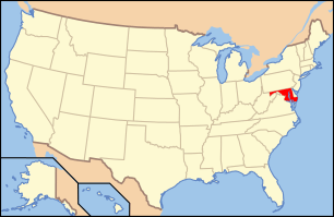 | |
|---|---|---|
| Lists by county | ||
| Lists by city | ||
| Other lists | ||
| ||