Wressle
| Wressle | |
 The main road through Wressle |
|
 Wressle |
|
| Population | 271 (2011 census)[1] |
|---|---|
| OS grid reference | SE709315 |
| – London | 160 mi (260 km) S |
| Civil parish | Wressle |
| Unitary authority | East Riding of Yorkshire |
| Ceremonial county | East Riding of Yorkshire |
| Region | Yorkshire and the Humber |
| Country | England |
| Sovereign state | United Kingdom |
| Post town | SELBY |
| Postcode district | YO8 |
| Dialling code | 01757 |
| Police | Humberside |
| Fire | Humberside |
| Ambulance | Yorkshire |
| EU Parliament | Yorkshire and the Humber |
| UK Parliament | Haltemprice and Howden |
Coordinates: 53°46′32″N 0°55′28″W / 53.775682°N 0.924430°W
Wressle (with spelling variations of Wressell, and Wressel, in Leland's 'Itinary' Wreshil, in the Domesday Book Weresa) is a village and civil parish in the East Riding of Yorkshire, England, lying on the eastern bank of the River Derwent approximately 3 miles (5 km) north-west of Howden.
Wressle village has a late 18th-century church, St John, and on the western fringe of the village is the Grade I listed structure and scheduled monument, the ruins of Wressle Castle.[2][3] Wressle railway station is located within the village.
The parish includes the hamlets of Brind, Newsholme and Loftshome. Wressle lies within the Parliamentary constituency of Haltemprice and Howden an area that mainly consists of middle class suburbs, towns and villages. The area is affluent, placed as the 10th most affluent in the country in a Barclays Private Clients survey,[4] and has one of the highest proportions of owner-occupiers in the country.[5]
Geography
The civil parish of Wressle is bounded by the civil parishes of Hemingbrough and Cliffe in the county of North Yorkshire to the west, separated by the River Derwent; by Bubwith to the north, separated by the Fleet Dike; by Spaldington and Howden to the east; and by Asselby and Barmby on the Marsh to the south.[6]
The civil parish contains Wressle and the hamlets of Brind and Newsholme.[1][6] The place of Loftsome lies less than 1km south of Wressle on the bank of the Derwent.[6] The Hull to Selby railway line runs east-west through the parish, passing Wressle on the southern edge, and the A63 also passes east-west through the southern part of the parish, skirting Newsholme, and passing Loftsome Bridge.[6] The parish contains predominately agricultural land at around 16 feet (5 m) above sea level.[6] cross
According to the 2011 UK Census, Wressle parish had a population of 271,[1] an increase on the 2001 UK Census figure of 261.[7]
History
Wressle Castle
Wressle Castle was a quadrangular castle originally was built for Thomas Percy in around 1380.[8]
Wressle village

Wressle was listed as a Manor (Weresa) in the Domesday survey.[9]
An early church is thought to have been destroyed during the English Civil War as it represented a potential fortification; church services were then held in the chapel in the remains of Wressle Castle, until that was destroyed by fire (1796).[10][11] The parish church of St. John of Beverley, now a Grade II listed building, was built in 1799 of brick with stone dressings, as a replacement.[12]
Other 18th-century buildings still extant include the Castle Farmhouse (1796) built to house the farmer after the fire in Wressle castle;[13] and the Long Barn (late 18th century) near to the castle site, Holly Cottage in Wressle village (mid-18th century); all built of brick.[14][15][16] Rowland Hall, east of the village was built in the late 18th century in brick with stone dressings.[17]
In 1840 the Hull and Selby Railway was opened, passing south of Wressle, with a cast iron bridge over the Derwent; services calling at Wressle are recorded as early as 1843, with a full train service at Wressle station by 1855.[18] A school with an attached schoolmaster's house was erected in 1854.[11]
A windmill was built at Mill Farm, east of the village church in the 19th century, by 1890 it was out of use.[19][20]
The village has had minimal urban growth in the industrial and modern age.[21] In 1997 planning permission was obtained for a new small street of 5 houses off main street, named 'Derwent Court'.[22]
Loftsome
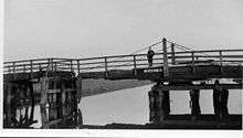
Loftsome and Loftsome Bridge were small hamlets in the parish of Wressle.[23] The Derwent was once crossed by a ferry at loftsome. A swing bridge crossing of the Derwent was built at Loftsome in 1804, operated as a toll bridge.[24][25][26]
There has been an inn at Loftsome Bridge since at least the 1800s.[27] By 1823 the inn was known as the Loftsome Bridge Inn.[28]
In the 1870s Loftsome's population was 20.[29]
The original loftsome bridge remained in use to the early 1930s, at which time a new bridge was built for the Hull-Selby road (part of the A63).[24][30]
(In the parish of Barmby on the Marsh) In the early 1980s Yorkshire Water constructed a water supply treatment works "Loftsome Water Treatment Works" approximately 1km southwest of Loftsome on the banks of the Derwent.[31] The site was refurbished and upgraded in 1994, including ozone treatment, giving a capacity of 114,000 cubic metres (4,000,000 cu ft) per day,[32][31] in 2005/6 the site added additional treatment units to deal with increased pesticide and trihalomethane content from the Derwent.[31]
In the late 2000s Yorkshire water had two 1.3 MW wind turbines installed at its site in Loftsome .[33][34][35]
References
- 1 2 3 "Key Figures for 2011 Census: Key Statistics: Area: Wressle CP (Parish)". Neighbourhood Statistics. Office for National Statistics. Retrieved 7 February 2013.
- ↑ Historic England. "Ruins of Wressle Castle (1083170)". National Heritage List for England. Retrieved 18 June 2015.
- ↑ Historic England. "Wressle Castle (1005210)". National Heritage List for England. Retrieved 18 June 2015.
- ↑ "North tops 'real' rich league". BBC News. 14 May 2003. Retrieved 4 July 2014.
- ↑ "Haltemprice and Howden". UK Polling Report. Retrieved 11 May 2015.
- 1 2 3 4 5 Ordnance Survey. 1:25000. 2006
- ↑ "2001 Census: Key Statistics: Parish Headcounts: Area: Wressle CP (Parish)". Neighbourhood Statistics. Office for National Statistics. Retrieved 20 May 2008.
- ↑ Pevsner & Neave 1995, pp. 766–7.
- ↑ Wressle in the Domesday Book
- ↑ Pevsner & Neave 1995, p. 766.
- 1 2 Bulmer (1892). "Wressle". History and Directory of East Yorkshire.
- ↑ Historic England. "Church of St. John of Beverley (1310488)". National Heritage List for England. Retrieved 7 February 2013.
- ↑ Pevsner & Neave 1995, p. 769.
- ↑ Historic England. "Holly Cottage, 37, Main Street (1310461)". National Heritage List for England. Retrieved 17 June 2014.
- ↑ Historic England. "The Long Barn and Wressle Castle farm, Breighton Road (1160659)". National Heritage List for England. Retrieved 17 June 2014.
- ↑ Historic England. "Castle Farmhouse (1346762)". National Heritage List for England. Retrieved 17 June 2014.
- ↑ Historic England. "Rowland Hall, Rowland Hall lane (1083172)". National Heritage List for England. Retrieved 17 June 2014.
- ↑ See Hull and Selby Railway and Wressle railway station
- ↑ Historic England. "Windmill Tower at Mill Farm (1346761)". National Heritage List for England. Retrieved 17 June 2014.
- ↑ Ordnance Survey. 1:2500. 1890
- ↑ Ordnance Survey. 1:2500. 1890–1, 1907–9, 1973
- ↑ "(97/20448/REM) MAIN STREET, WRESSLE AMENDED DESIGN FOR THE ERECTION OF 5 DWELLINGS AND CONSTRUCTION OF VEHICULAR AND PEDESTRIAN ACCESS at MAIN STREET, WRESSLE". East Riding of Yorkshire Council. 9 May 1997. Retrieved 17 June 2014.
- ↑ Langdale, Thomas (1822). A Topographical Dictionary of Yorkshire (2nd ed.). p. 180.
- 1 2 Baggs, A.P.; Kent, G.H.R.; Purdy, J.D. (1976). "Hemingbrough – Brackenholme with Woodhall". In Allison, K.J. Ouse and Derwent wapentake, and part of Harthill wapentake. A History of the County of York East Riding. 3.
- ↑ The Monthly Magazine, or, British Register. 16. 1 October 1803. p. 285.
It is intended to build a new swing bridge over the river Derwent, at or near a place called Loftsome Ferry House, ...
- ↑ Journals of the House of Lords. 44. 1802. p. 202.
(Loftsome Bridge Bill) An Act for building a Bridge over the River Derwent, at or near Loftsome Ferry, from the Parish of Wressel, to the opposite Shore, in the Parish of Hemingbrough, in the East Riding of the County of York
- ↑ "The History". Loftsome Bridge Coaching House Ltd. Retrieved 17 June 2014.
- ↑ Baines, Edward (1823). History, Directory & Gazetteer, of the County of York. 2. p. 364.
- ↑ University of Portsmouth. "Loftsome East Riding". A Vision of Britain through Time.
- ↑ Ordnance Survey. 1:2500. 1890–1, 1907–9, 1938, 1972
- 1 2 3 Corrigan, Peter J. (2006). "Loftsome Bridge WTW pesticide & trihalomethane reduction scheme" (PDF). www.waterprojectsonline.com. pp. 52–53. Retrieved 17 June 2014.
- ↑ "Loftsome Bridge – Yorkshire Water Services Ozone Plant" (PDF). Ozonia. 2000.
- ↑ Ward, Mike; Saunders, Steve; Carr, Russell (2009). "Loftsome Bridge WTW Wind Energy Scheme" (PDF). www.waterprojectsonline.com. pp. 191–2. Retrieved 17 June 2014.
- ↑ "(06/05245/STPLF) Erection of 2 wind turbines – resubmission of 06/02087/STPLF". East Riding of Yorkshire Council. 28 June 2006. Retrieved 17 June 2014.
- ↑ Grimshaw, Gerran (18 January 2008). "Name choice is simply a breeze". York Press. Retrieved 17 June 2014.
Sources
- Bigland, John (1812). Yorkshire. The Beauties of England and Wales, or, Original Delineations, Topographical, Historical, and Descriptive, of Each County. 16.
- Gazetteer — A–Z of Towns Villages and Hamlets. East Riding of Yorkshire Council. 2006. p. 12.
- Leland, John (1907) [1544]. Toulmin Smith, Lucy, ed. The Laboriouse Journey and Serche of Johan Leylande for Englandes Antiquitees. George Bell and Sons. pp. 52–54.
- Pevsner, Nikolaus; Neave, David (1995). Yorkshire : York and the East Riding. The Buildings of England (2nd ed.). pp. 766–769.
Further reading
- Brears, P. (2010). "Wressle Castle: functions, fixtures and furnishings for Henry Percy 'the magnificent', fifth earl of Northumberland, 1498–1527". Archaeological Journal. 167: 55–114.
- Emery, Anthony (1996). Northern England. Greater Medieval Houses of England and Wales, 1300–1500. 1. Cambridge University Press. pp. 414–419.
- Neave, D. (1984). "Wressle Castle". Archaeological Journal. 141: 58–60.
- Savage, James (1797). An Historical Account of the Parish of Wressle, in the East Riding of the County of York.
- Savage, James (1805). The History of the Castle and Parish of Wressle, in the East Riding of the County of York.
External links
 Media related to Wressle at Wikimedia Commons
- Historic England. "St John of Beverley's Church (165371)". Images of England.