Loddon River
| Loddon (Yolelerwil-meerin, Yarrayn, Woppoon, Byerr, Pullergil-yaluk, Gunbungwerro, Minne-minne, Mudyin gadjin[1][2]) | |
| River[3] | |
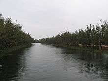
 Loddon River at Newstead | |
| Name origin: After River Loddon[4] | |
| Country | Australia |
|---|---|
| State | Victoria |
| Regions | Riverina bioregion (IBRA), Central Highlands, Loddon Mallee |
| Local government areas | Hepburn, Mount Alexander, Loddon, Gannawarra |
| Part of | Murray-Darling basin |
| Tributaries | |
| - left | Middleton Creek, Tarilta Creek, Jim Crow Creek, Joyces Creek, Boundary Gully, Tullaroop Creek, Bet Bet Creek, Bullabul Creek, Hope Creek, Sheepwash Creek |
| - right | Muckleford Creek, Bradford Creek, Little Creek (Loddon), Serpentine Creek, Sangus Creek, Twelve Mile Creek (Loddon), Bannacher Creek |
| Towns | Newstead, Bridgewater, Serpentine, Kerang |
| Source | Great Dividing Range |
| - location | Musk |
| - elevation | 638 m (2,093 ft) |
| - coordinates | 37°24′19.5″S 144°14′31.5″E / 37.405417°S 144.242083°E |
| Mouth | Little Murray River |
| - location | Kerang |
| - elevation | 71 m (233 ft) |
| - coordinates | 35°33′4.7″S 143°53′0.5″E / 35.551306°S 143.883472°ECoordinates: 35°33′4.7″S 143°53′0.5″E / 35.551306°S 143.883472°E |
| Length | 392 km (244 mi) |
| Basin | 15,320 km2 (5,915 sq mi) |
| Discharge | |
| - average | 8 m3/s (283 cu ft/s) |
| Nature reserve | Upper Loddon Flore Reserve |
| Reservoirs | Cairn Curran, Laanecoorie |
| Wikimedia Commons: Loddon River | |
| [5] | |
The Loddon River, an inland river of the north–central catchment, part of the Murray-Darling basin, is located in the lower Riverina bioregion and Central Highlands and Loddon Mallee regions of the Australian state of Victoria. The headwaters of the Loddon River rise on the northern slopes of the Great Dividing Range east of Daylesford and descend to flow north into the Little Murray River, near Swan Hill. The river is impounded by the Cairn Curran and Laanecoorie reservoirs.
An anabranch of the Loddon River may be found in the upper reaches of the river.[6]
Location and features

The Loddon River is the second longest river in Victoria after the Goulburn and, along with the Avoca River, drains a substantial part of central Victoria. From source to mouth, the river is joined by nineteen minor tributaries; and descends 567 metres (1,860 ft) over its 392-kilometre (244 mi) course.[5]
The river rises below Musk near Trentham and Lyonville from where it heads northward to Glenlyon and on to Loddon Falls. It then flows generally northward through Guildford and Newstead, 40 kilometres (25 mi) west of Bendigo. After Newstead the river flows into the Cairn Curran Reservoir before emerging at Baringhup and continuing north to Eddington. The river then flows into Laanecoorie Reservoir at Laanecoorie and then to Newbridge, where it flows due north to Bridgewater On Loddon, where waterskiing, swimming and fishing are popular recreational pursuits.[5][7]
The river then passes Serpentine with high summer flows that commence at the small concrete weir to the Loddon Weir, also known as Fernihurst Weir. After the weir, water is diverted to the Waranga Western Channel. Downstream from Loddon Weir the river averages 7 to 14 metres (23 to 46 ft) wide, and up to 26 metres (85 ft) wide at certain points, with a bank height of around 3 metres (9.8 ft).[8] Approximately 10 kilometres (6.2 mi) south of Kerang water flows are increased due to water entering from the Macorna Channel, and the higher flows are maintained for the next 15 kilometres (9.3 mi) of river up to the Kerang Weir.[8] The final stretch of the river flows through saltbush and Black Box forest. The river ends at its confluence with the Little Murray River at Benjeroop, near Swan Hill.[5]
Recreational pursuits
When reasonable water levels flow, the Mill Rapid downstream of the Calder Hwy bridge provides technical whitewater kayaking of Grade 3 standard featuring a short fast run. Access is usually via local roads on the west bank. Upstream of the Calder Hwy bridge kayakers and canoeists will have a pleasant paddling experience but may have to share the river with swimmers, fishers, and waterskiers.
At Bridgewater there is a designated 3.2-kilometre (2.0 mi) general waterskiing area, a 950-metre (3,120 ft) slalom and ski jump area. Waterskiing events held in this area include the Australian Masters in January, the pre-Moomba tournament in February and the Bridgewater Ski Club Tournament.[9] Additionally, a 90-metre (300 ft) swimming area is designated at the Flour Mill Weir.[9]
Fish found between Bridgewater to Serpentine include Murray cod and golden perch. The water downstream from the Loddon Weir can range between 5 to 7 metres (16 to 23 ft) deep and provides fishing opportunities for redfin, golden perch, silver perch, carp and to a lesser extent Murray cod. A vertical slot fishway was constructed next to the Kerang Weir in 2008. The main fish species in the river's lower reaches are redfin, golden perch and Murray cod.[8]
There are weirs in Bridgewater and Kerang to keep water in the towns, but otherwise the river can dry up in summer. There is current work going on to determine and implement suitable environmental flows in the river. The pool upstream of the Bridgewater weir is used for watersports such as waterskiing. Both reservoirs are also used for motor boats and sailing. At the Loddon Weir there is road access which enables boats to be launched from the bank.[8]
River crossings
The river is crossed by the Daylesford-Malmsbury Road at Glenlyon; the Drummond-Vaughan Forest Road crosses the river at three locations and the Porcupine Ridge Road crosses near the Vaughan Springs area. Further river crossings are encountered at Kemps Bridge Road, the Midland Highway south of Guildford, as well as Punt Road and the Pyrenees Highway in Newstead. The river is crossed by the Baringhup Road, and subsequently by the Baringhup West-Eastville Road, Rumbolds Road, Pickerings Lane, Back Eddington Road and Bendigo-Maryborough Road at Eddington. At Laanecoorie, the river is crossed by the Janevale bridge, a reinforced concrete girder bridge built in 1911 which is listed as a Heritage Place in the Victorian Heritage Register, and then northwards to Newbridge where it is crossed by the Wimmera Highway. At Bridgewater the river is crossed by the Calder Highway and the Eaglehawk-Inglewood railway line. A further road crossing is encountered at Bridgewater-Serpentine Road, to the south of Serpentine.[5]
Road crossings between Serpentine and Loddon weirs include Lagoona Road, Borung-Hurstwood Road, Ellerslie Road, Majors Line Road, Boort-Pyramid Road, Boort-Yando Road, Canary Island-Leaghur Road, Appin South Road, Hewitt Road and Wood Lane. In Kerang the river is crossed by the Old Kerang Road, Murray Valley Highway and the Yungera railway line. After Kerang the river is crossed by West Road, O'Donoghues Bridge Road, Baulch Road and the Wells Bridge which carries the Lake Charm Road.[5]
Etymology
As the river is relatively long, indigenous peoples from various cultural groups lived near the river course. In an undefined indigenous language, the names for the river are Yolelerwil-meerin and Byerr, both with no defined meaning. In the Djadjawurrung language, the names for the river are Yarrayn, Minne-minne and Pullergil-yaluk, all with no clearly defined meaning. In the Wembawemba language, the name for the river is Woppoon, with no clearly defined meaning. In the Djadjawurrung and the Barababaraba languages, the name for the river is Gunbungwerro, with werro and wurru meaning "lips" or "mouth." In the Gannawarra and Barababaraba languages, the names for the river is Mudyin gadjin, meaning "[he] picked up water".[1][2][10]
It was named by Thomas Mitchell in 1836 after the River Loddon in the English counties of Berkshire and Hampshire.[4]
See also
References
- 1 2 "Loddon River (entry 617745)". VICNAMES. Government of Victoria. Retrieved 19 October 2014.
- 1 2 Clark, Ian; Heydon, Toby (2011). "Loddon River: Traditional Names". Victorian Aboriginal Corporation for Languages.
- ↑ "Loddon River (VIC)". Gazetteer of Australia online. Geoscience Australia, Australian Government.
- 1 2 Mitchell, Thomas (1838). Three Expeditions into the interior of Eastern Australia. Vol. 2. London: Boone., entry for 8 July 1836
- 1 2 3 4 5 6 "Map of Loddon River, VIC". Bonzle Digital Atlas of Australia. Retrieved 19 October 2014.
- ↑ "Anabranch Loddon River (VIC)". Gazetteer of Australia online. Geoscience Australia, Australian Government.
- ↑ "Loddon River (South)". A Guide to the Inland Angling Waters of Victoria. Department of Environment and Primary Industries, Victorian Government. Retrieved 24 March 2014.
- 1 2 3 4 "Loddon River (North)". A Guide to the Inland Angling Waters of Victoria. Department of Environment and Primary Industries, Victorian Government. Archived from the original on 24 March 2014. Retrieved 24 March 2014.
- 1 2 "Information Statement: Operation of Loddon River at Bridgewater" (PDF) (PDF). Shire of Loddon. Retrieved 16 September 2010.
- ↑ Blair's Guide, Travel Guide to Victoria and Melbourne (6th ed.). Victoria: Universal Press. 1994. p. 301. ISBN 0-7319-0608-X.
External links
- "Loddon–Campaspe". Murray-Darling Basin Authority. Australian Government. 2014.
- "Loddon River longitudinal profile" (PDF). Murray-Darling Basin Authority (PDF). Australian Government.
- Goulburn-Murray Water Loddon storages
- "Loddon". Our rivers. Environment Victoria.
- Biodiversity Information, Resources, Data - Loddon River page
- North Central Catchment Management Authority
Rivers of the North–Central catchment of the Murray–Darling basin, in Victoria, Australia | |
|---|---|
| |
|