Lockhart Township, Pike County, Indiana
| Lockhart Township Pike County | |
|---|---|
| Township | |
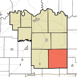 Location in Pike County | |
| Coordinates: 38°16′41″N 87°08′08″W / 38.27806°N 87.13556°WCoordinates: 38°16′41″N 87°08′08″W / 38.27806°N 87.13556°W | |
| Country |
|
| State |
|
| County | Pike |
| Government | |
| • Type | Indiana township |
| Area | |
| • Total | 48.93 sq mi (126.7 km2) |
| • Land | 48.02 sq mi (124.4 km2) |
| • Water | 0.91 sq mi (2.4 km2) 1.86% |
| Elevation | 509 ft (155 m) |
| Population (2010) | |
| • Total | 907 |
| • Density | 18.9/sq mi (7.3/km2) |
| ZIP codes | 47541, 47584, 47585, 47590, 47598 |
| GNIS feature ID | 0453577 |
Lockhart Township is one of nine townships in Pike County, Indiana, United States. As of the 2010 census, its population was 907 and it contained 433 housing units.[1]
History
Lockhart Township was organized in 1852.[2]
Geography
According to the 2010 census, the township has a total area of 48.93 square miles (126.7 km2), of which 48.02 square miles (124.4 km2) (or 98.14%) is land and 0.91 square miles (2.4 km2) (or 1.86%) is water.[1]
Unincorporated towns
- Augusta at 38°19′53″N 87°11′27″W / 38.331439°N 87.19084°W
- Fritz Corner at 38°17′51″N 87°09′32″W / 38.297551°N 87.158894°W
- Hartwell at 38°19′21″N 87°10′47″W / 38.322550°N 87.179728°W
- Pikeville at 38°19′19″N 87°06′41″W / 38.321996°N 87.111392°W
- Stendal at 38°16′00″N 87°08′40″W / 38.266718°N 87.144448°W
(This list is based on USGS data and may include former settlements.)
Cemeteries
The township contains these cemeteries: Barrett also known as Bethel Cemetery, Augusta IOOF also known as Odd Fellows, which is located southeast of the town of Augusta, Cup Creek which is located southwest of Pikeville and is also known as Pikeville Cemetery, Indian Mound Graveyard near Stendal, Log Creek also known as South Fork Cemetery southwest of Stendal, Miller which is northwest of Pikeville, Old Augusta Methodist Church Cemetery (church gone) which is located in the middle of the town of Augusta and is now obsolete, Pikeville Church of Christ (obsolete), Pikeville German Lutheran also known as the Primitive Baptist (obsolete cemetery with many unmarked graves), Russell which is southwest of Pikeville, Stendal St. Paul's Evangelical Lutheran Church on the north edge of the town of Stendal, Stendal St. Peter's Lutheran located in the town of Stendal, Zion's Hill located one mile south of Pikevill, also known as Zion's Hill Assembly of God, Zoar located four miles east of Stendal, and Stillwell located half-mile east of Pikeville.
Major highways
School districts
- Pike County School Corporation
Political districts
- State House District 63
- State Senate District 48
References
- "Lockhart Township, Pike County, Indiana". Geographic Names Information System. United States Geological Survey. Retrieved 2009-11-26.
- United States Census Bureau 2009 TIGER/Line Shapefiles
- IndianaMap
- 1 2 "Population, Housing Units, Area, and Density: 2010 - County -- County Subdivision and Place -- 2010 Census Summary File 1". United States Census. Retrieved 2013-05-10.
- ↑ History of Pike and Dubois Counties, Indiana. Goodspeed Brothers. p. 276. ISBN 978-5-87521-222-2.
External links
- Indiana Township Association
- United Township Association of Indiana
- City-Data.com page for Lockhart Township

Municipalities and communities of Pike County, Indiana, United States | ||
|---|---|---|
| City | ||
| Towns | ||
| Townships | ||
| CDP | ||
| Other unincorporated communities |
| |
| Footnotes | ‡This populated place also has portions in an adjacent county or counties | |