Little Britain, London
Coordinates: 51°31′01″N 0°05′52″W / 51.517002°N 0.097836°W

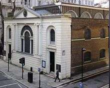
Little Britain is a street in the City of London running from St. Martin's Le Grand in the east to West Smithfield in the west. It forms the northern boundary of St Bartholomew's Hospital and is situated in the Aldersgate and Farringdon Within wards. Postman's Park is also bounded by Little Britain.
Historically, Little Britain referred to a small district in the City just north of London Wall, including this street. It is mentioned in Charles Dickens' novel Great Expectations as the location of Jaggers' office. It is also mentioned in Waverley by Sir Walter Scott in connection with the publication of a manuscript. It is not correct, as often said, that the name comes from a medieval Breton enclave, or a possession of the Dukes of Brittany.[1]
Washington Irving described this district in The Sketch Book of Geoffrey Crayon, Gent., published in 1820. The opening paragraph reads:
IN the centre of the great City of London lies a small neighborhood, consisting of a cluster of narrow streets and courts, of very venerable and debilitated houses, which goes by the name of LITTLE BRITAIN. Christ Church School and St Bartholomew's Hospital bound it on the west; Smithfield and Long Lane on the north; Aldersgate Street, like an arm of the sea, divides it from the eastern part of the city; whilst the yawning gulf of Bull-and-Mouth Street separates it from Butcher Lane and the regions of Newgate. Over this little territory, thus bounded and designated, the great dome of St. Paul's, swelling above the intervening houses of Paternoster Row, Amen Corner, and Ave-Maria Lane, looks down with an air of motherly protection.
Booksellers dominated the street from the mid-16th century, followed by goldsmiths and clothing trades from the mid-18th to the 20th centuries.[2]
The nearest London Underground stations are St. Paul's (Central line) and Barbican (Circle, Hammersmith & City and Metropolitan lines) and the closest mainline railway stations are City Thameslink and Moorgate.
Further reading
- Full text of Irving's account, at WikiSource
- Victorian London - Districts - Little Britain
References
- ↑ Simon Bradley and Nikolaus Pevsner, London 1: the City of London, 1997, p. 534
- ↑ Bradley and Pevsner, op. cit.