List of settlements in Leicestershire by population

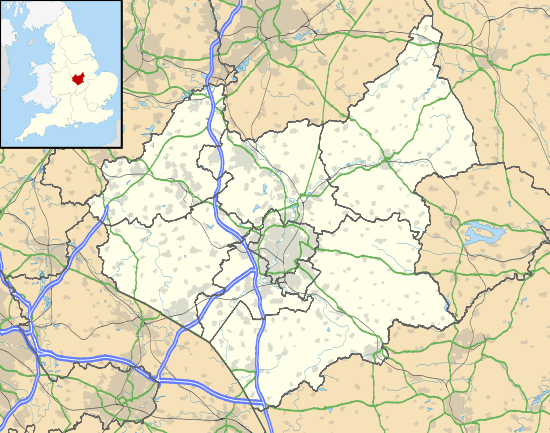
The 12 largest settlements of Leicestershire, with district centres in yellow including Glenfield for the county. Key towns and cities surrounding the county shown in blue.

This is a list of settlements in Leicestershire by population based on the results of the 2011 census. The next United Kingdom census will take place in 2021. In 2011, there were 29 built-up area subdivisions with 5,000 or more inhabitants in Leicestershire, shown in the table below.

List of settlements

# Built-up Area Subdivision Population (2001 census)[1] Population (2011 census)[2] District Local areas included and excluded
1 Leicester 330,574 443,760 City of Leicester Includes Beaumont Leys, Belgrave, Braunstone, Glenfield, Kirby Muxloe, Leicester Forest East, Oadby, Thurmaston, Wigston and others
2 Loughborough 55,258 59,932 Charnwood Includes Dishley, Nanpantan, Snell's Nook, Shelthorpe, Thorpe Acre. Excludes Cotes, Hathern, Woodthorpe
3 Hinckley 43,246 45,249 Hinckley and Bosworth Includes Burbage, Hollycroft, Middlefield, Sketchley. Excludes Aston Flamville, Wykin
4 Coalville 32,124 34,575 North West Leicestershire Includes Agar Nook, Donington le Heath, Greenhill, Hugglescote, Thringstone, Whitwick. Excludes Abbots Oak, Bardon, Coleorton, Ellistown, Grace-Dieu, Griffydam, Newbold, Osgathorpe, Peggs Green, Ravenstone, Sinope, Snibston, Swannington
5 Wigston 33,116 Oadby and Wigston Included within Leicester's figure in 2011
6 Melton Mowbray 25,554 27,158 Melton Includes New Guadaloupe. Excludes Asfordby, Brentingby, Burton Lazars, Eye Kettleby, Old Guadaloupe, Thorpe Arnold, Welby
7 Market Harborough 20,127 22,911 Harborough Includes Great Bowden, Little Bowden. Excludes Lubenham and East Farndon
8 Oadby 22,679 Oadby and Wigston Included within Leicester's figure in 2011
9 Earl Shilton 18,366 19,069 Hinckley and Bosworth Includes Barwell. Excludes Elmesthorpe
10 Shepshed 12,882 13,505 Charnwood Includes Finney (Fenney) Hill. Excludes Blackbrook, Oaks in Charnwood
11 Narborough/Enderby 14,119 12,996 Blaby Excludes Croft, Littlethorpe, Huncote, Thurlaston
12 Syston 12,804 Charnwood Included within Leicester in 2001. Excludes Barkby, East Goscote, Queniborough
13 Whetstone 6,100 12,760 Blaby 2011 figure includes Blaby Village. Excludes Cosby
14 Ashby-de-la-Zouch 11,409 12,370 North West Leicestershire Includes Cliftonthorpe and Rotherwood. Excludes Annswell, Blackfordby, Lount, Moira, Packington, Shellbrook, Smisby, Willesley
15 Birstall 11,480 12,216 Charnwood Excludes Thurcaston and Wanlip
16 Mountsorrel 11,306 12,120 Charnwood Includes Rothley. Excludes Cropston, Swithland
17 Lutterworth 8,752 9,907 Harborough Includes Bitteswell. Excludes Cotesbach, Misterton
18 Broughton Astley 8,290 8,940 Harborough Includes Primethorpe. Excludes Sutton in the Elms
19 Sileby 7,103 8,433 Charnwood Includes Cossington. Excludes Seagrave
20 Groby 6,256 6,782 Charnwood Excludes Ratby, Glenfield
21 Anstey 5,821 6,528 Charnwood Excludes Newtown Linford
22 Castle Donington 5,977 6,416 North West Leicestershire Includes Hill Top. Excludes Hemington, Lockington
23 Countesthorpe 6,393 6,377 Blaby Excludes Kilby
24 Blaby Village 6,163 Blaby See Whetstone for 2011
25 Barrow-upon-Soar 5,083 5,956 Charnwood
26 Ibstock 5,520 5,650 North West Leicestershire Excludes Heather
27 Kibworth Harcourt 4,788 5,433 Harborough Includes Kibworth Beauchamp. Excludes Carlton Curlieu, Fleckney, Smeeton Westerby, Tur Langton
28 Measham 4,849 5,209 North West Leicestershire Excludes Oakthorpe, Snarestone
29 Quorn 4,961 5,177 Charnwood Excludes Woodhouse, Woodthorpe
Markfield 4,969 4,993 Hinckley and Bosworth Includes Field Head, Little Markfield, Upper Grange. Excludes Stanton under Bardon
Fleckney 4,610 4,894 Harborough Excludes Saddington, Wistow

Notes:

  • The Office of National Statistics (ONS) subdivide built-up areas into sectors which do not respect administrative or political boundaries. If those areas have a strong city/town/village identity, for population purposes they are classed into a distinct area.
  • Leicester in particular will include population counts from suburbs which are not within the city boundaries - but are close enough to be counted together.

See also

References

External Links

Link to ONS built up area statistics


This article is issued from Wikipedia - version of the 11/29/2016. The text is available under the Creative Commons Attribution/Share Alike but additional terms may apply for the media files.