List of plantations in the United States
This is a list of plantations and/or plantation houses in the United States of America that are national memorials, National Historic Landmarks, listed on the National Register of Historic Places or other heritage register, or are otherwise significant for their history, association with significant events or people, or their architecture and design.[1][2][3]
| Color key | Historic register listing |
|---|---|
| National Historic Landmark | |
| National Register of Historic Places | |
| National Historic Site | |
| Not listed | |
Alabama
Main article: List of plantations in Alabama
Arkansas
| NRHP reference number | Name | Image | Date designated | Locality | County | Notes |
|---|---|---|---|---|---|---|
| 75000397 | Dortch Plantation | December 6, 1975 | Scott 34°42′55″N 92°03′13″W / 34.71528°N 92.05361°W |
Lonoke | Built 1904 | |
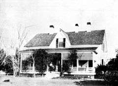
| 74000466 | Lakeport Plantation | 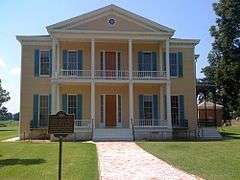 |
November 20, 1974 | Shives 33°15′24″N 91°09′19″W / 33.25667°N 91.15528°W |
Chicot | Built 1850 |
| 99000044 | Land's End Plantation | January 27, 1999 | Scott 34°53′36″N 92°07′08″W / 34.89333°N 92.11889°W |
Pulaski | Built 1925 | |
| 77000254 | Morrison Plantation | December 28, 1977 | Saginaw 34°16′12″N 92°56′50″W / 34.27°N 92.94722°W |
Hot Spring | Built 1854 | |
| 03001451 | Rosedale | January 21, 2004 | Arkadelphia 34°09′41″N 93°06′07″W / 34.161389°N 93.101944°W |
Clark | Built 1860 |
Delaware
| NRHP reference number | Name | Image | Date designated | Locality | County | Notes |
|---|---|---|---|---|---|---|
| 70000170 | Aspendale | %2C_Kenton_vicinity%2C_(Kent_County%2C_Delaware).jpg) |
April 15, 1970 | Kenton 39°06′10″N 75°26′58″W / 39.10278°N 75.44944°W |
Kent | Built 1773 |
| 74000602 | Hagley |  |
December 2, 1974 | Montchanin 39°47′03″N 75°39′44″W / 39.78422°N 75.66222°W |
New Castle | Built 1795 |
| 72000292 | Lombardy Hall | 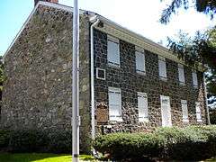 |
December 2, 1974 | Wilmington 39°46′46″N 75°32′41″W / 39.77949°N 75.54472°W |
New Castle | Built 1682 |
| 66000258 | Poplar Hall | .jpg) |
January 20, 1961 | Dover 39°06′10″N 75°26′58″W / 39.10277°N 75.44944°W |
Kent | Built 1740 |
| 73000524 | Stonum | .jpg) |
November 7, 1973 | New Castle 39°39′37″N 75°34′34″W / 39.66022°N 75.57602°W |
New Castle | Built 1750 |
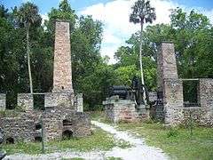
Florida


Georgia
Main article: List of plantations in Georgia (U.S. state)
Hawaii
| NRHP reference number | Name | Image | Date designated | Locality | County | Notes |
|---|---|---|---|---|---|---|
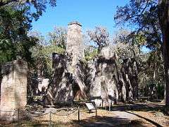
| 93000774, 93000775, 93000777, | Kilauea Plantation | 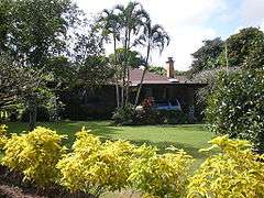  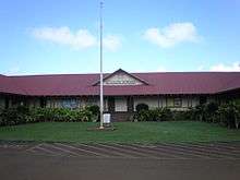 |
1983 | Kīlauea | Kauaʻi | Sugar cane plantation that operated from 1880 to 1971; 5 historic buildings NRHP-listed: Manager's House, Head Luna's House, Head Bookkeeper's House, Kilauea School, Kong Lung Store |
| 66000296 | Old Sugar Mill of Koloa |  |
December 29, 1962 | Kōloa 21°54′35″N 159°28′09″W / 21.90972°N 159.46916°W |
Kauaʻi |
Kentucky
| NRHP reference number | Name | Image | Date designated | Locality | County | Notes |
|---|---|---|---|---|---|---|
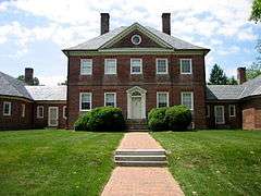
| 83002891 | Alexander Plantation House | Midway | Woodford | |||
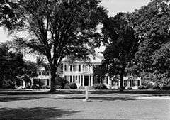
| 66000357 | Ashland |  |
December 19, 1960 | Lexington 38°01′43″N 84°28′48″W / 38.02861°N 84.48000°W |
Fayette | |
| 83002633 | Beechland | July 12, 1983 | Louisville | Jefferson | Site of the marriage of Jefferson Davis to Sarah Knox Taylor, daughter of President Zachary Taylor | |
| 93000045 | Coleman-Desha Plantation | Cynthiana | Harrison | |||
| 83002660 | Edgewood | 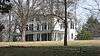 |
August 16, 1983 | Brownsboro Farm | Jefferson | |
| Elmwood | 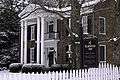 |
1972 | Perryville | Boyle | Designated a Kentucky landmark. Served as a hospital during the Battle of Perryville | |
| 72000536 | Farmington |  |
October 18, 1972 | Louisville | Jefferson | |
| 83002668 | Fishpool Plantation | Louisville | ||||
| 71000354 | Federal Hill | 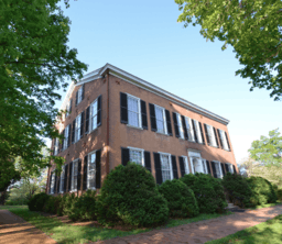 |
March 11, 1971 | Bardstown | Nelson | |
| 71000347 | Locust Grove |  |
June 23, 1986 | Louisville 38°17′13″N 85°39′43″W / 38.28706°N 85.66192°W |
Jefferson | |
| 84000292 | McCutcheon Meadows |  |
November 24, 1984 | Auburn | Logan | |
| Mount Brilliant | Lexington | Fayette | ||||
| Richwood Plantation | 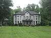 |
Milton | Trimble | |||
| Rocky Hill Plantation | Smithland | Livingston | Home to Thomas Jefferson's sister, Lucy Jefferson Lewis. Site of infamous 1811 slave murder. | |||
| 66000359 | Springfield |  |
July 4, 1961 | Louisville 38°16′45″N 85°38′50″W / 38.27917°N 85.64722°W |
Jefferson | |
| Springhill Plantation | Bloomfield | Nelson | ||||
| 71000342 | Waveland Plantation |  |
August 12, 1971 | Lexington | Fayette | |
| 85001841 | Ward Hall |  |
August 23, 1985 | Georgetown | Scott | |
| 71000352 | White Hall |  |
March 11, 1971 | Richmond | Madison | |
Louisiana
Main article: List of plantations in Louisiana
Maryland
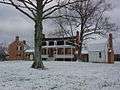
_(Rosaryville_vicinity)%2C_Clinton_(Prince_George's_County%2C_Maryland).jpg)
.jpg)


.jpg)
.jpg)
.jpg)
Mississippi
Main article: List of plantations in Mississippi
Missouri
| NRHP reference number | Name | Image | Date designated | Locality | County | Notes |
|---|---|---|---|---|---|---|
| 12000563 | Hunter-Dawson Home | August 28, 2012 | New Madrid | New Madrid | ||
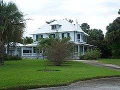
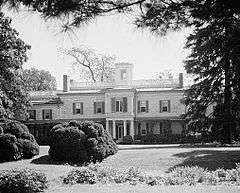
| 79003205 | White Haven | 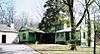 |
June 23, 1986 | Grantwood Village 38°33′04″N 90°21′07″W / 38.55111°N 90.35194°W |
St. Louis |
North Carolina
Main article: List of plantations in North Carolina
Oklahoma
| NRHP reference number | Name | Image | Date designated | Locality | County | Notes |
|---|---|---|---|---|---|---|
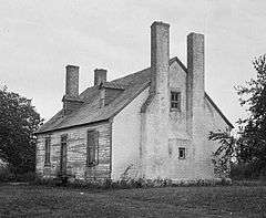
| 70000530 | Murrell Home |  |
May 30, 1974 | Park Hill 35°50′50″N 94°57′51″W / 35.84735°N 94.96418°W |
Cherokee | Built in 1845 |
South Carolina
Main article: List of plantations in South Carolina
Tennessee
| NRHP reference number | Name | Image | Date designated | Locality | County | Notes |
|---|---|---|---|---|---|---|
| 75001741 | Beechwood Hall | 1975 | Newport | Cocke | Constructed in 1803 | |
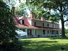
| 69000177 | Belle Meade Plantation | 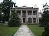 |
Belle Meade | Davidson | ||
| 75001780 | Brabson's Ferry Plantation |  |
Sevierville | Sevier | ||
| 73001857 | Carnton |  |
Franklin | Williamson | ||
| 75001787 | Davies Manor | 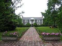 |
March 19, 1975 | Memphis | Shelby | |
| 75002162 | Fairvue | 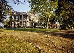 |
Gallatin | Sumner | ||
| 66000722 | The Hermitage |  |
December 19, 1960 | Nashville 36°12′54″N 86°36′47″W / 36.21497°N 86.61297°W |
Davidson | |
| 75001795 | Northcutt Plantation | McMinnville | ||||
| 71000825 | Rattle and Snap | .jpg) |
November 11, 1971 | Columbia 35°33′38″N 87°09′12″W / 35.56056°N 87.15333°W |
Maury | |
| 75001781 | Rose Glen |  |
Sevierville | Sevier | ||
| 69000180 | Ramsey House |  |
Knoxville | Knox | ||
| 75001785 | Wheatlands |  |
Sevierville | Sevier | ||
| 09000538 | White Plains | 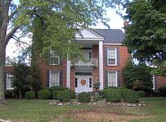 |
Algood | Putnam |
Texas
| NRHP reference number | Name | Image | Date designated | Locality | County | Notes |
|---|---|---|---|---|---|---|
| 80004081 | Durazno Plantation | Jones Creek | ||||
| 69000209 | Freeman Plantation House | Jefferson | ||||
| 77001474 | William Garrett Plantation House | San Augustine | ||||
| 71000971 | Hatfield Plantation | Brenham | Washington | |||
| 71000970 | Liendo Plantation | Hempstead | Waller | |||
| 75001961 | Old Brulay Plantation | Brownsville | ||||
| 83003084 | Col. Elijah Sterling Clack Robertson Plantation | Salado | ||||
| 80004082 | Varner-Hogg Plantation | 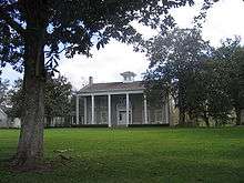 |
West Columbia | Brazoria |
Tod Robinson
Tod Robinson Point Blank, Texas ( San Jacinto County)
U.S. Virgin Islands
| NRHP reference number | Name | Image | Date designated | Locality | County | Notes |
|---|---|---|---|---|---|---|
| 81000089 | Brown Bay Plantation Historic District | Brown Bay | ||||
| 78000269 | Cinnamon Bay Plantation | 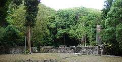 |
Cruz Bay | Saint John | ||
| 76002217 | Estate Carolina Sugar Plantation | Coral Bay | ||||
| 81000094 | Hermitage Plantation Historic District | Hurricane Hole | ||||
| 78000271 | Lameshur Plantation | Cruz Bay | ||||
| 81000093 | Rustenberg Plantation South Historic District | Cinnamon Bay | ||||
| 76001867 | Tutu Plantation House | Charlotte Amalie |
Virginia
Main article: List of plantations in Virginia
West Virginia
Main article: List of plantations in West Virginia
References
- ↑ "How to Apply the National Register Criteria for Evaluation," (PDF), National Register Bulletins, National Park Service. Retrieved March 22, 2007.
- ↑ National Park Service (April 2007). "National Historic Landmarks Survey: List of National Historic Landmarks by State" (PDF). Archived from the original (PDF) on 2007-06-09. Retrieved 2007-05-20.
- ↑ National Park Service. "National Historic Landmark Program: NHL Database". Retrieved 2007-08-14.
This article is issued from Wikipedia - version of the 9/19/2016. The text is available under the Creative Commons Attribution/Share Alike but additional terms may apply for the media files.