List of listed buildings in Boleskine And Abertarff, Highland
This is a list of listed buildings in the parish of Boleskine And Abertarff in Highland, Scotland.
List
| Name | Location | Date Listed | Grid Ref. [note 1] | Geo-coordinates | Notes | HB Number [note 2] | Image |
|---|---|---|---|---|---|---|---|
| Foyers, Jane Fraser Memorial Obelisk | 57°15′11″N 4°30′16″W / 57.253013°N 4.50449°W | Category B | 1852 | 
| |||
| Caledonian Canal Cullochy Lock, Pair Lock Keepers' Houses (East Bank) | 57°05′57″N 4°44′21″W / 57.099269°N 4.739079°W | Category C(S) | 1853 |
| |||
| Culachy House, Cottage And Steading Range | 57°07′12″N 4°40′58″W / 57.119918°N 4.682778°W | Category C(S) | 1858 |
| |||
| Fort Augustus, Length Of High Rubble Wall To Rear Of Lovat Arms Hotel | 57°08′37″N 4°40′58″W / 57.143599°N 4.682773°W | Category B | 1864 |
| |||
| Fort Augustus, Nos 1-10 (Inclusive) Lovat Terrace | 57°08′37″N 4°41′05″W / 57.143748°N 4.684619°W | Category B | 1868 |
| |||
| Oich, Bridge Of, Over River Oich | 57°05′34″N 4°44′48″W / 57.09276°N 4.746556°W | Category B | 1873 |
| |||
| Foyers, Upper Foyers, Bridge Over River Foyers | 57°14′44″N 4°29′27″W / 57.245562°N 4.490972°W | Category C(S) | 1882 |
| |||
| Inverfarigaig (Old) Bridge Over River Farigaig | 57°16′53″N 4°27′14″W / 57.281277°N 4.453828°W | Category B | 1870 |
| |||
| Whitebridge, Old Bridge Over River Foyers | 57°12′15″N 4°30′10″W / 57.204109°N 4.502683°W | Category A | 1874 |
| |||
| Caledonian Canal, Abercalder Cottage (Swing Bridge Keeper's Cottage) | 57°05′34″N 4°44′35″W / 57.092871°N 4.74313°W | Category C(S) | 1878 |
| |||
| Garthbeg | 57°13′11″N 4°27′21″W / 57.219645°N 4.455895°W | Category B | 1883 |
| |||
| Glendoe, Bridge Over Allt An Reidhean | 57°08′37″N 4°38′19″W / 57.143585°N 4.638516°W | Category B | 1884 |
| |||
| Foyers Hydroelectric Power Scheme And Former Aluminium Smelter, Loch Mhor Dam | 57°13′48″N 4°27′55″W / 57.230045°N 4.465369°W | Category C(S) | 51700 |
| |||
| Boleskine Parish Church (Church Of Scotland) And Burial Ground | 57°13′50″N 4°28′26″W / 57.23055°N 4.473969°W | Category B | 1846 |
| |||
| Boleskine, Old Boleskine Church, Burial Ground And Watch House | 57°15′57″N 4°28′34″W / 57.265699°N 4.476044°W | Category B | 1847 |
| |||
| Culachy House | 57°07′16″N 4°40′58″W / 57.121201°N 4.68287°W | Category B | 1857 |
| |||
| Fort Augustus, Old Bridge Over River Oich | 57°08′48″N 4°40′41″W / 57.146621°N 4.678032°W | Category B | 1865 |
| |||
| Fort Augustus, Road Bridge Carrying The A82 Over River Oich | 57°08′44″N 4°40′52″W / 57.145641°N 4.681003°W | Category B | 1866 |
| |||
| By Whitebridge, Knockie Lodge Hotel | 57°11′02″N 4°34′22″W / 57.183765°N 4.572766°W | Category C(S) | 1876 |
| |||
| Foyers Mains Steading | 57°15′02″N 4°30′00″W / 57.250548°N 4.500079°W | Category C(S) | 1879 |
| |||
| Fort Augustus, Former Railway Bridge Over Canal Side Road | 57°08′41″N 4°41′08″W / 57.144741°N 4.68565°W | Category C(S) | 44608 |
| |||
| Ardachy Bridge Over River Tarff | 57°07′46″N 4°40′42″W / 57.129467°N 4.678346°W | Category B | 1845 |
| |||
| Boleskine Old Manse | 57°13′39″N 4°28′37″W / 57.227463°N 4.47691°W | Category B | 1848 |
| |||
| Boleskine House Stables | 57°15′57″N 4°28′25″W / 57.265721°N 4.473558°W | Category B | 1850 |
| |||
| Caledonian Canal, Cullochy Lock, Lock Keeper's Cottage (West Bank) | 57°05′56″N 4°44′24″W / 57.09895°N 4.740128°W | Category C(S) | 1855 |
| |||
| Glendoe, Bridge Carrying Re-Aligned A862 Over Allt Doe | 57°08′31″N 4°37′54″W / 57.142032°N 4.631627°W | Category C(S) | 1869 |
| |||
| Foyers Hydroelectric Power Scheme And Former Aluminium Smelter, River Tarff Intake | 57°14′44″N 4°29′20″W / 57.245477°N 4.488927°W | Category C(S) | 51701 |
| |||
| Culachy House, Bridge Carrying Drive To House Over Sunken Farm Track | 57°07′26″N 4°41′02″W / 57.123883°N 4.68394°W | Category B | 1859 |
| |||
| Oich, Old Bridge Over River Oich | 57°05′36″N 4°44′43″W / 57.093372°N 4.745313°W | Category A | 1872 | 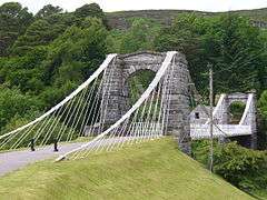
| |||
| Boleskine House Gate Lodge And Gate Piers With Gates | 57°16′00″N 4°28′27″W / 57.266572°N 4.474179°W | Category B | 1877 |
| |||
| Foyers, Lower Foyers Bridge Over River Foyers | 57°15′11″N 4°29′47″W / 57.253023°N 4.4963°W | Category B | 1881 |
| |||
| Glendoe, Old Bridge Over Allt Doe | 57°08′32″N 4°37′55″W / 57.142215°N 4.631855°W | Category B | 1885 |
| |||
| Fort Augustus Abbey, Gate Lodge | 57°08′37″N 4°40′44″W / 57.143502°N 4.678897°W | Category B | 1863 |
| |||
| Fort Augustus, Former Engine And Gunpowder House | 57°08′40″N 4°40′50″W / 57.144446°N 4.680553°W | Category B | 1867 |
| |||
| Whitebridge, New Bridge | 57°12′15″N 4°30′10″W / 57.204267°N 4.502859°W | Category B | 1875 |
| |||
| Foyers Hydroelectric Power Scheme, Former Aluminium Smelter, Powerhouse And Smelter | 57°15′19″N 4°29′35″W / 57.255359°N 4.493159°W | Category A | 1880 |
| |||
| Abercalder, Railway Cottage (L) And Mo Dhachaidh (R) | 57°05′50″N 4°43′51″W / 57.097286°N 4.730726°W | Category C(S) | 1844 |
| |||
| By Fort Augustus, Lochunagan | 57°07′47″N 4°41′28″W / 57.129849°N 4.691148°W | Category B | 1851 |
| |||
| Dell Lodge And Rear Service Cottages | 57°12′44″N 4°30′31″W / 57.21213°N 4.508708°W | Category B | 1860 |
| |||
| Fort Augustus Abbey Church | 57°08′41″N 4°40′36″W / 57.144664°N 4.676667°W | Category A | 1862 |
| |||
| Inverfarigaig Pier | 57°16′46″N 4°27′41″W / 57.279576°N 4.461297°W | Category B | 1871 |
| |||
| Boleskine House | 57°15′55″N 4°28′29″W / 57.265293°N 4.47479°W | Category B | 1849 |
| |||
| Caledonian Canal, Cullochy Lock, Storehouse (East Bank) | 57°05′54″N 4°44′21″W / 57.098349°N 4.739258°W | Category B | 1854 |
| |||
| Corrieyairack Pass, Bridge Over Allt Coire Uchdachan | 57°03′57″N 4°39′09″W / 57.065712°N 4.652615°W | Category B | 1856 |
| |||
| Fort Augustus Abbey, Monastery And School | 57°08′41″N 4°40′36″W / 57.144664°N 4.676667°W | Category A | 1861 |
|
Key
The scheme for classifying buildings in Scotland is:
- Category A: "buildings of national or international importance, either architectural or historic, or fine little-altered examples of some particular period, style or building type."[1]
- Category B: "buildings of regional or more than local importance, or major examples of some particular period, style or building type which may have been altered."[1]
- Category C(S): "buildings of local importance, lesser examples of any period, style, or building type, as originally constructed or moderately altered; and simple traditional buildings which group well with others in categories A and B."[1]
There are approximately 47,400 listed buildings in Scotland. Of these, around 8 per cent (some 3,800) are Category A, and 51 per cent (24,000) are Category B, with the rest listed at Category C(s).[2]
See also
Notes
- ↑ Sometimes known as OSGB36, the grid reference (where provided) is based on the British national grid reference system used by the Ordnance Survey.
• "Guide to National Grid". Ordnance Survey. Retrieved 2007-12-12.
• "Get-a-map". Ordnance Survey. Retrieved 2007-12-17. - ↑ The "HB Number" is a unique number assigned to each listed building by Historic Scotland.
References
- All entries, addresses and coordinates are based on data from Historic Scotland. This data falls under the Open Government Licence
- 1 2 3 "What is Listing?". Historic Scotland. Retrieved 2010-07-06.
- ↑ Guide to the Protection of Scotland’s Listed Buildings (PDF). Historic Scotland. 2009. p. 17. ISBN 978-1-84917-013-0. Retrieved 2010-07-06.
This article is issued from Wikipedia - version of the 10/15/2016. The text is available under the Creative Commons Attribution/Share Alike but additional terms may apply for the media files.