National Register of Historic Places listings in New Mexico

This is a list of properties and districts in New Mexico that are on the National Register of Historic Places. There are more than 1,100 listings. Of these, 44 are National Historic Landmarks. There are listings in each of the state's 33 counties.
- This National Park Service list is complete through NPS recent listings posted December 2, 2016.[1]
| Bernalillo – Catron – Chaves – Cibola – Colfax – Curry – De Baca – Doña Ana – Eddy – Grant – Guadalupe – Harding – Hidalgo – Lea – Lincoln – Los Alamos – Luna – McKinley – Mora – Otero – Quay – Rio Arriba – Roosevelt – San Juan – San Miguel – Sandoval – Santa Fe – Sierra – Socorro – Taos – Torrance – Union – Valencia |
Current listings by county
 Laguna Pueblo Valencia County  Las Trampas Historic District Taos County |
|
 Federal Building and U.S. Courthouse (Albuquerque) Bernalillo County | ||||||||||||||||||||||||||||||||||||||||||||||||||||||||||||||||||||||||||||||||||||||||||||||||||||||||||||
Bernalillo County
Catron County


Chaves County
Cibola County
Colfax County
Curry County
De Baca County
| [3] | Name on the Register | Image | Date listed[4] | Location | City or town | Description |
|---|---|---|---|---|---|---|
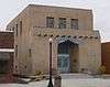
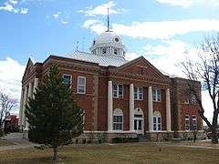
| 1 | De Baca County Courthouse | 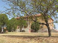 |
(#87000896) |
500 block of Ave. C 34°28′20″N 104°14′35″W / 34.472222°N 104.243056°W |
Fort Sumner | |
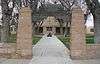
| 2 | Fort Sumner Cemetery Wall and Entry | 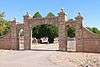 |
(#08000575) |
17th St. and Dunn Ave., 1 mile north of intersection of 17th and U.S. Route 60 34°28′39″N 104°13′43″W / 34.4775°N 104.228611°W |
Fort Sumner | |
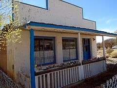
| 3 | Fort Sumner Community House |  |
(#03000798) |
Junction of U.S. Route 84 and Baker Ave. 34°28′42″N 104°14′40″W / 34.478333°N 104.244444°W |
Fort Sumner | |
| 4 | Fort Sumner Railroad Bridge | 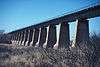 |
(#79001539) |
2 miles (3.2 km) west of Fort Sumner over the Pecos River 34°29′06″N 104°15′31″W / 34.485°N 104.258611°W |
Fort Sumner | |
| 5 | Fort Sumner Ruins |  |
(#74001194) |
Address Restricted |
Fort Sumner |
Doña Ana County
Eddy County
Grant County
Guadalupe County
| [3] | Name on the Register | Image | Date listed[4] | Location | City or town | Description |
|---|---|---|---|---|---|---|
| 1 | Abandoned Route 66-Cuervo to NM 156 | Upload image | (#93001206) |
Cuervo southwest to the junction with State Road 156 35°00′14″N 104°26′17″W / 35.003889°N 104.438056°W |
Cuervo | |
| 2 | Anton Chico de Abajo Historic District |  |
(#86002334) |
Address Restricted |
Anton Chico | |
| 3 | Jesus M. Casaus House |  |
(#82003324) |
628 3rd St. 34°56′09″N 104°40′52″W / 34.935833°N 104.681111°W |
Santa Rosa | |
| 4 | Colonias de San Jose Historic District | |
(#86002331) |
Address Restricted |
Colonias | |
| 5 | Alexander Grzelachowski House and Store | |
(#93000570) |
Southwest of the junction of State Roads 91 and 203 34°49′50″N 104°37′26″W / 34.83063°N 104.623777°W |
Puerto De Luna | |
| 6 | Guadalupe County Courthouse in Santa Rosa | 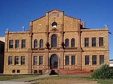 |
(#87000890) |
Northwestern corner of S. 4th St. and Parker Ave. 34°56′29″N 104°41′11″W / 34.941389°N 104.686389°W |
Santa Rosa | |
| 7 | La Placita De Abajo District | |
(#86002338) |
Address Restricted |
Colonias | |
| 8 | Julius J. Moise House |  |
(#84000633) |
400 Capitan 34°56′20″N 104°41′03″W / 34.93897°N 104.68414°W |
Santa Rosa | |
| 9 | Park Lake Historic District |  |
(#96000267) |
Junction of Will Rogers Dr. and Lake Dr. 34°56′28″N 104°40′40″W / 34.941111°N 104.677778°W |
Santa Rosa | |
| 10 | Route 66, State maintained from Montoya to Cuervo | 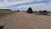 |
(#97001395) |
Along former U.S. Route 66 from west of Montoya to Cuervo 35°03′41″N 104°16′01″W / 35.061389°N 104.266944°W |
Cuervo |
Harding County
| [3] | Name on the Register | Image | Date listed[4] | Location | City or town | Description |
|---|---|---|---|---|---|---|
| 1 | Bueyeros School | Upload image | (#96000265) |
State Road 102, 0.25 miles west of Bueyeros Church 35°58′49″N 103°41′12″W / 35.980278°N 103.686667°W |
Bueyeros | |
| 2 | Harding County Courthouse | Upload image | (#87000895) |
Pine St. 35°46′30″N 103°57′24″W / 35.775°N 103.956667°W |
Mosquero |
Hidalgo County
Lea County
Lincoln County
Los Alamos County
Luna County
McKinley County
Mora County
Otero County
Quay County
Rio Arriba County
Roosevelt County
| [3] | Name on the Register | Image | Date listed[4] | Location | City or town | Description |
|---|---|---|---|---|---|---|
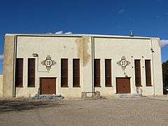
| 1 | Administration Building |  |
(#88001558) |
Southern side of University Pl. and campus green, Eastern New Mexico University 34°10′44″N 103°20′53″W / 34.179012°N 103.348044°W |
Portales | |
| 2 | Anderson Basin | |
(#66000483) |
New Mexico Highway 467, about 5 miles north of U.S. Highway 70[5] 34°16′35″N 103°19′11″W / 34.276337°N 103.319735°W |
Clovis | |
| 3 | Bank of Portales |  |
(#84000635) |
Near First and Main[6] 34°11′13″N 103°20′15″W / 34.187016°N 103.337409°W |
Portales | |
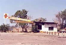
| 4 | Midway Service Station | |
(#04001479) |
38797 U.S. Highway 70 33°50′31″N 103°46′20″W / 33.841990°N 103.772221°W |
Kenna | |
| 5 | Roosevelt County Courthouse | 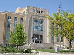 |
(#08001136) |
100 W. 2nd St. 34°11′09″N 103°20′11″W / 34.18592°N 103.3365°W |
Portales | |
| 6 | US Post Office-Portales Main |  |
(#90000140) |
116 W. 1st St. 34°11′11″N 103°20′17″W / 34.186356°N 103.338118°W |
Portales |
San Juan County
San Miguel County
Sandoval County
Santa Fe County
Sierra County
Socorro County
Taos County
Torrance County
| [3] | Name on the Register | Image | Date listed[4] | Location | City or town | Description |
|---|---|---|---|---|---|---|
| 1 | Abo | 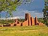 |
(#66000497) |
3 miles west of Abo on U.S. Route 60 34°26′56″N 106°22′17″W / 34.448889°N 106.371389°W |
Abo | |
| 2 | Greene Evans Garage | 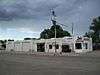 |
(#93001211) |
Northwestern corner of the junction of Broadway and former U.S. Route 66 35°00′19″N 106°03′00″W / 35.005278°N 106.05°W |
Moriarty | |
| 3 | Moriarty Eclipse Windmill | Upload image | (#79001561) |
2 miles (3.2 km) west of Moriarty off State Road 222 34°59′48″N 106°04′55″W / 34.996667°N 106.081944°W |
Moriarty | |
| 4 | Mountainair Municipal Auditorium |  |
(#87000651) |
Southwestern corner of Roosevelt Ave. and Beal St. 34°31′16″N 106°14′34″W / 34.521111°N 106.242778°W |
Mountainair | |
| 5 | Quarai |  |
(#66000498) |
1 mile south of Punta de Agua 34°35′45″N 106°17′42″W / 34.595833°N 106.295°W |
Punta de Agua | |
| 6 | Rancho Bonito |  |
(#78001834) |
South of Mountainair on Gran Quivera Rd. 34°30′23″N 106°14′21″W / 34.506389°N 106.239167°W |
Mountainair | |
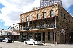
| 7 | Shaffer Hotel | 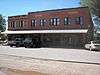 |
(#78003077) |
Broadway St. 34°31′08″N 106°14′31″W / 34.518889°N 106.241944°W |
Mountainair |
Union County


Valencia County
See also
| Wikimedia Commons has media related to National Register of Historic Places in New Mexico. |
- List of National Historic Landmarks in New Mexico
- List of bridges on the National Register of Historic Places in New Mexico
- New Mexico State Register of Cultural Properties
References
- ↑ "National Register of Historic Places: Weekly List Actions". National Park Service, United States Department of the Interior. Retrieved on December 2, 2016.
- ↑ Bandelier CCC Historic District in Los Alamos and Sandoval counties, Bandelier National Monument in Los Alamos, Sandoval, and Santa Fe Counties, Crow Canyon Archaeological District in San Juan and Rio Arriba Counties, Puye Ruins in Rio Arriba and Sandoval counties, Route 66, State maintained from Montoya to Cuervo in Guadalupe and Quay counties, Posi-ouinge in Rio Arriba and Taos counties, and Zuni-Cibola Complex in Cibola, McKinley, and Valencia counties.
- 1 2 3 4 5 6 7 8 Numbers represent an ordering by significant words. Various colorings, defined here, differentiate National Historic Landmarks and historic districts from other NRHP buildings, structures, sites or objects.
- 1 2 3 4 5 6 7 8 The eight-digit number below each date is the number assigned to each location in the National Register Information System database, which can be viewed by clicking the number.
- ↑ Location and provided coordinates are those of the "Blackwater Clovis Site", according to "Clovis Site", Eastern New Mexico University; the NRIS lists the site as "Address Restricted"
- ↑ See photo of intersection of First and Main. A cafe, Do Drop In, is located at 123 S. Main; see Roosevelt County Chamber website. The NRHP nominating form for the Bank of Portales gives "123 Main", which is either incomplete or incorrect.
| Topics | |
|---|---|
| Lists by states |
|
| Lists by insular areas | |
| Lists by associated states | |
| Other areas | |
| |
Santa Fe (capital) | |
| Topics |
|
| Society | |
| Regions | |
| Cities | |
| Counties | |
This article is issued from Wikipedia - version of the 12/4/2016. The text is available under the Creative Commons Attribution/Share Alike but additional terms may apply for the media files.