List of MAX Light Rail stations
Metropolitan Area Express (MAX) is a light rail transit system serving the Portland metropolitan area.[1] The system is operated by TriMet, a public agency that operates public transit in the Portland area. Serving an average of 130,000 passengers a day (in Fiscal Year 2012),[2] MAX Light Rail is one of the largest light rail systems in the United States in terms of ridership.[3]
The MAX system currently consists of five lines, each designated by a color.
- Blue Line: Hillsboro – City Center – Gresham[4]
- Green Line: Clackamas – City Center – Portland State University[5]
- Orange Line: Union Station – City Center – Portland State University – Milwaukie[6]
- Red Line: Portland International Airport – City Center – Beaverton[7]
- Yellow Line: Expo Center – City Center – Portland State University[8]
MAX Light Rail began service on September 5, 1986 with the opening of the original segment from Downtown Portland to Gresham.[9] An extension westward to Beaverton and Hillsboro opened in 1998.[10] The resulting 33-mile east-west line has always been operated as a single through route, and it became known as the Blue Line in 2001, after TriMet adopted color designations for its separate light rail routes after the Red Line opened to the airport.[11] The Yellow Line branch to the Expo Center opened in 2004.[12] In 2009, the Green Line opened, serving the Portland Transit Mall (along with the rerouted Yellow Line) and the new I-205 branch to Clackamas.
The system currently has a total of 97 stations. Fifty-one stations are served by the Blue Line, 28 stations by the Green Line, 17 by the Orange Line, 29 by the Red Line, and 17 by the Yellow Line, with 39 stations served by two or more lines and 8 by three. All trains connect at Pioneer Courthouse Square.
Since 2012, there is a flat fare for the entire TriMet system. Prior to 2012, fares on the MAX system were zonal (i.e. distance-based), the same as on TriMet's bus service.[13] The center of downtown was called Fareless Square (later the "Free Rail Zone") and included the area from the Library and Galleria stations to the Old Town/Chinatown Station. This was later expanded across the Steel Bridge into the Lloyd District as far as the Lloyd Center/NE 11th Ave station, and the Interstate/Rose Quarter station. When the Portland Transit Mall was remodeled in 2009 to accommodate light rail, all stations on the transit mall were included as part of Fareless Square. Moving out from the center of downtown, Zone 1 included the Albina/Mississippi station on the Yellow Line, and from Providence Park to Washington Park on the Red and Blue lines. Zone 2 consisted of the rest of the Yellow Line (from Overlook Park to the Expo Center) as well as the three stations next to Interstate 84 (Hollywood/NE 42nd, NE 60th, and NE 82nd). Zone 3 consisted of all other MAX stations, including all stations in Washington County and all stations beyond the Gateway/Northeast 99th Avenue Transit Center.
Stations
| † | Terminals |
| < | Westbound/southbound-only stations |
| > | Eastbound/northbound-only stations |
(Transit connections in italics are not part of the TriMet system)
| Station | Line(s) | Transit connections | Year opened | Park and ride | Image |
|---|---|---|---|---|---|
| Hatfield Government Center† | 1998 | Yes: 250 spaces |  | ||
| Hillsboro Central/Southeast 3rd Avenue Transit Center | 46-North Hillsboro[14] 47-Baseline/Evergreen[15] 48-Cornell[16] 57-TV Hwy/Forest Grove[17] Yamhill County Transit Area: 33-Hillsboro/MAX[18] | 1998 | No |  | |
| Tuality Hospital/Southeast 8th Avenue | 1998 | No |  | ||
| Washington/Southeast 12th Avenue | 1998 | No |  | ||
| Fair Complex/Hillsboro Airport | 46-North Hillsboro[14] | 1998 | Yes: 396 spaces |  | |
| Hawthorn Farm | 1998 |  | |||
| Orenco/Northwest 231st Avenue | 47-Baseline/Evergreen[15] | 1998 | Yes: 180 spaces | 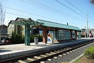 | |
| Quatama/Northwest 205th Avenue | 1998 | Yes: 310 spaces |  | ||
| Willow Creek/Southwest 185th Avenue Transit Center | 52-Farmington/185th[19] 59-Walker/Park Way[20] 88-Hart/198th[21] Columbia County Rider: 2-PCC Rock Creek[22] 6-Nehalem Valley[23] | 1998 | Yes: 595 spaces |  | |
| Elmonica/Southwest 170th Avenue | 1998 | Yes: 435 spaces |  | ||
| Merlo Road/Southwest 158th Avenue | 67-Bethany/158th[24] | 1998 | No |  | |
| Beaverton Creek | 1998 | Yes: 417 spaces |  | ||
| Millikan Way | 62-Murray Blvd[25] | 1998 | Yes: 400 spaces |  | |
| Beaverton Central | 1998 | No |  | ||
| Beaverton Transit Center† | 20-Burnside/Stark[26] 52-Farmington/185th[19] 53-Arctic/Allen[27] 54-Beaverton-Hillsdale Hwy[28] 57-TV Hwy/Forest Grove[17] 58-Canyon Rd[29] 61-Marquam Hill/Beaverton[30] 76-Beaverton/Tualatin[31] 78-Beaverton/Lake Oswego[32] 88-Hart/198th[21] Westside Express Service South Metro Area Regional Transit (SMART): 8X-Beaverton TC[33] | 1998 | No | | |
| Sunset Transit Center | 20-Burnside/Stark[26] 48-Cornell[16] 50-Cedar Mill[34] 59-Walker/Park Way[20] 62-Murray Blvd[25] The Wave: 5-Tillamook-Portland[35] | 1998 | Yes: 622 spaces | ||
| Washington Park | 63-Washington Park/Arlington Hts[36] | 1998 | No |  | |
| Goose Hollow/SW Jefferson St | 6-Martin Luther King Jr Blvd[37] 58-Canyon Rd[29] 68-Marquam Hill/Collins Circle[38] | 1998 | No |  | |
| Kings Hill/Southwest Salmon | 51-Vista[39] 63-Washington Park/Arlington Hts[36] | 1997 | No |  | |
| Providence Park | 15-Belmont/NW 23rd[40] 18-Hillside[41] 51-Vista[39] 63-Washington Park/Arlington Hts[36] | 1997 | No |  | |
| Galleria/Southwest 10th Avenue< | Portland Streetcar-NS Line Portland Streetcar-CL Line | 1986 | No |  | |
| Library/Southwest 9th Avenue> | Portland Streetcar-NS Line Portland Streetcar-CL Line | 1986 | No |  | |
| Pioneer Square North< | Transit Mall | 1986 | No |  | |
| Pioneer Square South> | Transit Mall | 1986 | No |  | |
| Mall/Southwest 5th Avenue< | Transit Mall | 1990 | No |  | |
| Mall/Southwest 4th Avenue> | Transit Mall | 1990 | No |  | |
| Morrison/Southwest 3rd Avenue< | 1986 | No |  | ||
| Yamhill District> | 1986 | No |  | ||
| Oak Street/Southwest 1st Avenue | 1986 | No |  | ||
| Skidmore Fountain | 12-Barbur/Sandy Blvd[42] 19-Woodstock/Glisan[43] 20-Burnside/Stark[26] | 1986 | No |  | |
| Old Town/Chinatown | 1986 | No |  | ||
| Union Station/Northwest 6th & Hoyt Street> | Transit Mall Amtrak & Greyhound Lines | 2009 | No |  | |
| Union Station/Northwest 5th & Glisan Street< | Transit Mall Amtrak & Greyhound Lines | 2009 | No |  | |
| Northwest 6th & Davis Street> | Transit Mall | 2009 | No |  | |
| Northwest 5th & Couch Street< | Transit Mall | 2009 | No |  | |
| Southwest 6th & Pine Street> | Transit Mall | 2009 | No |  | |
| Southwest 5th & Oak Street< | Transit Mall | 2009 | No |  | |
| Pioneer Courthouse/Southwest 6th> | Transit Mall | 2009 | No |  | |
| Pioneer Place/Southwest 5th< | Transit Mall | 2009 | No |  | |
| Southwest 6th & Madison Street> | Transit Mall | 2009 | No |  | |
| City Hall/Southwest 5th & Jefferson Street< | Transit Mall | 2009 | No |  | |
| PSU Urban Center/Southwest 6th & Montgomery Street> | Transit Mall | 2009 | No | ||
| PSU Urban Center/Southwest 5th & Mill Street< | Transit Mall | 2009 | No |  | |
| PSU South/Southwest 6th & College Street> | Transit Mall | 2012 | No |  | |
| PSU South/Southwest 5th & Jackson Street<† | Transit Mall | 2012 | No | ||
| Interstate/Rose Quarter | 35-Macadam/Greeley[44] | 2004 | No |  | |
| Albina/Mississippi | 35-Macadam/Greeley[44] 85-Swan Island[45] | 2004 | No |  | |
| Overlook Park | 2004 | No |  | ||
| North Prescott Street | 2004 | No |  | ||
| North Killingsworth Street | 72-Killingsworth/82nd Ave[46] | 2004 | No |  | |
| North Rosa Parks Way | 44-Capitol Hwy/Mocks Crest[47] | 2004 | No |  | |
| North Lombard Transit Center | 4-Division/Fessenden[48] 75-Cesar Chavez/Lombard[49] | 2004 | No |  | |
| Kenton/North Denver Avenue | 2004 | No |  | ||
| Delta Park/Vanport | C-Tran: 47-Battle Ground Limited[50]60-Delta Park Limited[51] |
2004 | Yes: 304 spaces |  | |
| Expo Center† | 11-Rivergate/Marine Dr[52] | 2004 | Yes: 300 spaces |  | |
| Rose Quarter Transit Center | 4-Division/Fessenden[48] 8-Jackson Park/NE 15th[53] 35-Macadam/Greeley[44] 44-Capitol Hwy/Mocks Crest[47] 77-Broadway/Halsey[54] 85-Swan Island[45] | 1986 | No | 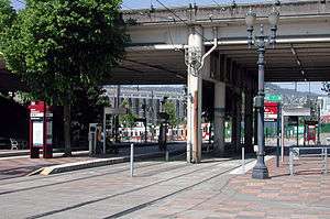 | |
| Convention Center | 6-Martin Luther King Jr Blvd[37] | 1990 | No |  | |
| Northeast 7th Avenue | Portland Streetcar-CL Line | 1986 | No |  | |
| Lloyd Center/Northeast 11th Avenue | 70-12th/NE 33rd Ave[55] C-Tran: 157-Lloyd District Express[56] |
1986 | No |  | |
| Hollywood/Northeast 42nd Avenue Transit Center | 66-Marquam Hill/Hollywood[57] 75-Cesar Chavez/Lombard[49] 77-Broadway/Halsey[54] | 1986 | No |  | |
| Northeast 60th Avenue | 71-60th Ave/122nd Ave[58] | 1986 | No |  | |
| Northeast 82nd Avenue | 72-Killingsworth/82nd Ave[46] 77-Broadway/Halsey[54] | 1986 | No |  | |
| Gateway/Northeast 99th Avenue Transit Center | 15-Belmont/NW 23rd[40] 19-Woodstock/Glisan[43] 22-Parkrose[59] 23-San Rafael[60] 24-Fremont[61] 25-Glisan/Rockwood[62] 87-Airport Way/181st[63] Columbia Area Transit: Portland Fixed Route[64] | 1986 | Yes: 690 spaces | | |
| Parkrose/Sumner Transit Center | 12-Barbur/Sandy Blvd[42] 21-Sandy Blvd/223rd[65] 71-60th Ave[58]73--122nd Ave C-Tran: 65–Parkrose Limited[66] | 2001 | Yes: 193 spaces |  | |
| Cascades | 2007 | No |  | ||
| Mount Hood Avenue | 2001 | No |  | ||
| Portland International Airport† | 2001 | No |  | ||
| Southeast Main Street | 15-Belmont/NW 23rd[40] | 2009 | Yes: 420 spaces |  | |
| Southeast Division Street | 4-Division/Fessenden[48] | 2009 | No |  | |
| Southeast Powell Boulevard | 9-Powell Blvd[67] | 2009 | Yes: 391 spaces |  | |
| Southeast Holgate Boulevard | 17-Holgate/Broadway[68] | 2009 | Yes: 125 spaces | 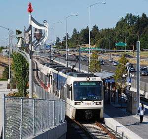 | |
| Lents Town Center/Southeast Foster Road | 10-Harold St[69] 14-Hawthorne[70] 73-122nd Ave | 2009 | No |  | |
| Southeast Flavel Street | 19-Woodstock/Glisan[43] | 2009 | No |  | |
| Southeast Fuller Road | 2009 | Yes: 630 spaces |  | ||
| Clackamas Town Center Transit Center†[71] | 29-Lake/Webster Rd 30-Estacada 33-McLoughlin/King Rd 34-Linwood/River Rd 71-60th Ave/122nd Ave 72-Killingsworth/82nd Ave 79-Clackamas/Oregon City 152-Milwaukie 155-Sunnyside 156-Mather Rd | 2009 | Yes: 750 spaces |  | |
| East 102nd Avenue | 15-Belmont/NW 23rd[40] 20-Burnside/Stark[26] | 1986 | No |  | |
| East 122nd Avenue | 73-122nd Ave | 1986 | Yes: 612 spaces |  | |
| East 148th Avenue | 1986 | No |  | ||
| East 162nd Avenue | 1986 | No |  | ||
| East 172nd Avenue | 1986 | No |  | ||
| East 181st Avenue | 87-Airport Way/181st[63] | 1986 | Yes: 247 spaces |  | |
| Rockwood/East 188th Avenue | 1986 | No |  | ||
| Ruby Junction/East 197th Avenue | 1986 | No |  | ||
| Civic Drive | 2010 | No |  | ||
| Gresham City Hall | 21-Sandy Blvd/223rd[65] | 1986 | Yes: 417 spaces |  | |
| Gresham Central Transit Center | 4-Division/Fessenden[48] 9-Powell Blvd[67] 20-Burnside/Stark[26] 21-Sandy Blvd/223rd[65] 80-Kane/Troutdale Rd[72] 81-Kane/257th[73] 84-Powell Valley/Orient Dr[74] 87-Airport Way/181st[63] | 1986 | Yes: 540 spaces | .jpg) | |
| Cleveland Avenue† | 1986 | Yes: 392 spaces | .jpg) | ||
| Lincoln/SW 3rd Ave[75] | 9-Powell Blvd 17-Holgate/Broadway | 2015 | No |  | |
| South Waterfront/SW Moody[76] | 9-Powell Blvd 17-Holgate/Broadway 35-Macadam/Greeley 36-South Shore | 2015 | No |  | |
| OMSI/SE Water[77] | 9-Powell Blvd 17-Holgate/Broadway | 2015 | No |  | |
| Clinton/SE 12th[78] | 9-Powell Blvd 17-Holgate/Broadway 10-Harold St | 2015 | No |  | |
| SE 17th & Rhine[79] | 7-Holgate/Broadway 70-12th/NE 33rd Ave | 2015 | No |  | |
| SE 17th & Holgate[80] | 7-Holgate/Broadway 70-12th/NE 33rd Ave | 2015 | No |  | |
| SE Bybee Blvd[81] | 19-Woodstock/Glisan | 2015 | No |  | |
| SE Tacoma/Johnson Creek[82] | 34-River Rd 99-McLoughlin Express | 2015 | Yes: 318 spaces |  | |
| Milwaukie/Main[83] | 29-Lake/Webster Rd 32-Oatfield 33-McLoughlin 34-River Rd | 2015 | No |  | |
| SE Park Ave†[84] | 33-McLoughlin 99-McLoughlin Express | 2015 | Yes: 401 spaces |  | |
References
- Specific
- ↑ "TriMet - MAX Light Rail Project History". TriMet. Retrieved 2009-09-12.
- ↑ "June 2012 Monthly Performance Report" (PDF). TriMet. p. 1. Retrieved September 2, 2012.
- ↑ "TriMet - Service and Ridership Information" (PDF). TriMet. October 19, 2011. Retrieved September 2, 2012.
- ↑ "TriMet - MAX Blue Line". TriMet. Retrieved 2008-11-02.
- ↑ "TriMet - MAX Green Line". TriMet. Retrieved 2009-09-12.
- ↑ "ORANGE LINE SCHEDULES". TriMet. Retrieved September 12, 2015.
- ↑ "TriMet - MAX Red Line". TriMet. Retrieved 2008-11-02.
- ↑ "TriMet - MAX Yellow Line". TriMet. Retrieved 2008-11-02.
- ↑ "TriMet - Eastside MAX Blue Line Project History". TriMet. Retrieved 2008-11-02.
- ↑ "Westside MAX Blue Line Project History". TriMet. Retrieved 2008-11-02.
- ↑ Stewart, Bill (September 21, 2000). "Local colors roll out: Tri-Met designates the Blue, Red and Yellow lines". The Oregonian.
- ↑ "Interstate MAX Yellow Line Project History". TriMet. Retrieved 2009-08-05.
- ↑ Bailey Jr., Everton (August 30, 2012). "TriMet boosts most fares starting Saturday; some routes changing". The Oregonian. Retrieved September 2, 2012.
- 1 2 "46-North Hillsboro". trimet.org. TriMet. Retrieved 15 January 2015.
- 1 2 "47-Baseline/Evergreen". trimet.org. TriMet. Retrieved 15 January 2015.
- 1 2 "48-Cornell". trimet.org. TriMet. Retrieved 15 January 2015.
- 1 2 "57-TV Hwy/Forest Grove". trimet.org. TriMet. Retrieved 15 January 2015.
- ↑ "McMinnville–Hillsboro" (PDF). yctransitarea.org. Yamhill County Transit Area. Retrieved 16 January 2015.
- 1 2 "52-Farmington/185th". trimet.org. TriMet. Retrieved 15 January 2015.
- 1 2 "59-Walker/Park Way". trimet.org. TriMet. Retrieved 15 January 2015.
- 1 2 "88-Hart/198th". trimet.org. TriMet. Retrieved 15 January 2015.
- ↑ "2 PCC Rock Creek" (PDF). Coulumbia County Rider. Retrieved August 3, 2015.
- ↑ "6 Nehalem Valley" (PDF). Columbia County Rider. Retrieved August 3, 2015.
- ↑ "67-Bethany/158th". trimet.org. TriMet. Retrieved 15 January 2015.
- 1 2 "62-Murray Blvd". trimet.org. TriMet. Retrieved 15 January 2015.
- 1 2 3 4 5 "20-Burnside/Stark". trimet.org. TriMet. Retrieved 15 January 2015.
- ↑ "53-Arctic/Allen". trimet.org. TriMet. Retrieved 15 January 2015.
- ↑ "54-Beaverton-Hillsdale Hwy". trimet.org. TriMet. Retrieved 15 January 2015.
- 1 2 "58-Canyon Rd". trimet.org. TriMet. Retrieved 15 January 2015.
- ↑ "61-Marquam Hill/Beaverton". trimet.org. TriMet. Retrieved 15 January 2015.
- ↑ "76-Beaverton/Tualatin". trimet.org. TriMet. Retrieved 15 January 2015.
- ↑ "78-Beaverton/Lake Oswego". trimet.org. TriMet. Retrieved 15 January 2015.
- ↑ "8X - Beaverton TC". ridesmart.com. SMART. Retrieved 16 January 2015.
- ↑ "50-Cedar Mill". trimet.org. TriMet. Retrieved 15 January 2015.
- ↑ "Bus Routes & Schedules - 7 Days a week". tillamookbus.com. Tillamook County Transportation District. Retrieved 16 January 2015.
- 1 2 3 "63-Washington Park/Arlington Hts". trimet.org. TriMet. Retrieved 15 January 2015.
- 1 2 "6-Martin Luther King Jr Blvd". trimet.org. TriMet. Retrieved 15 January 2015.
- ↑ "68-Marquam Hill/Collins Circle". trimet.org. TriMet. Retrieved 15 January 2015.
- 1 2 "51-Vista". trimet.org. TriMet. Retrieved 15 January 2015.
- 1 2 3 4 "15-Belmont/NW 23rd". trimet.org. TriMet. Retrieved 15 January 2015.
- ↑ "18-Hillside". trimet.org. TriMet. Retrieved 15 January 2015.
- 1 2 "12-Barbur/Sandy Blvd". trimet.org. TriMet. Retrieved 15 January 2015.
- 1 2 3 "19-Woodstock/Glisan". trimet.org. TriMet. Retrieved 15 January 2015.
- 1 2 3 "35-Macadam/Greeley". trimet.org. TriMet. Retrieved 15 January 2015.
- 1 2 "85-Swan Island". trimet.org. TriMet. Retrieved 15 January 2015.
- 1 2 "72-Killingsworth/82nd Ave". trimet.org. TriMet. Retrieved 15 January 2015.
- 1 2 "44-Capitol Hwy/Mocks Crest". trimet.org. TriMet. Retrieved 15 January 2015.
- 1 2 3 4 "4-Division/Fessenden". trimet.org. TriMet. Retrieved 15 January 2015.
- 1 2 "75-Cesar Chavez/Lombard". trimet.org. TriMet. Retrieved 15 January 2015.
- ↑ "#47 Battle Ground Limited". c-tran.com. C-Tran. Retrieved 16 January 2015.
- ↑ Horn, Dean. "#60 Delta Park Limited". c-tran.com. Retrieved 2016-09-04.
- ↑ "11-Rivergate/Marine Dr". trimet.org. TriMet. Retrieved 15 January 2015.
- ↑ "8-Jackson Park/NE 15th". trimet.org. TriMet. Retrieved 15 January 2015.
- 1 2 3 "77-Broadway/Halsey". trimet.org. TriMet. Retrieved 15 January 2015.
- ↑ "70-12th/NE 33rd Ave". trimet.org. TriMet. Retrieved 15 January 2015.
- ↑ Horn, Dean. "#157 Lloyd District Express". C-Tran. Retrieved 2016-08-20.
- ↑ "66-Marquam Hill/Hollywood". trimet.org. TriMet. Retrieved 15 January 2015.
- 1 2 "71-60th Ave/122nd Ave". trimet.org. TriMet. Retrieved 15 January 2015.
- ↑ "22-Parkrose". trimet.org. TriMet. Retrieved 15 January 2015.
- ↑ "23-San Rafael". trimet.org. TriMet. Retrieved 15 January 2015.
- ↑ "24-Fremont". trimet.org. TriMet. Retrieved 15 January 2015.
- ↑ "25-Glisan/Rockwood". trimet.org. TriMet. Retrieved 15 January 2015.
- 1 2 3 "87-Airport Way/181st". trimet.org. TriMet. Retrieved 15 January 2015.
- ↑ "Portland Fixed Route". community.gorge.net. Hood River County Transportation District. Retrieved 16 January 2015.
- 1 2 3 "21-Sandy Blvd/223rd". trimet.org. TriMet. Retrieved 15 January 2015.
- ↑ "#65 Parkrose Limited". c-tran.com. C-Tran. Retrieved 16 January 2015.
- 1 2 "9-Powell Blvd". trimet.org. TriMet. Retrieved 15 January 2015.
- ↑ "17-Holgate/Broadway". trimet.org. TriMet. Retrieved 15 January 2015.
- ↑ "10-Harold St". trimet.org. TriMet. Retrieved 15 January 2015.
- ↑ "14-Hawthorne". trimet.org. TriMet. Retrieved 15 January 2015.
- ↑ "Stop ID 13247". trimet.org. TriMet. Retrieved 14 September 2015.
- ↑ "80-Kane/Troutdale Rd". trimet.org. TriMet. Retrieved 15 January 2015.
- ↑ "81-Kane/257th". trimet.org. TriMet. Retrieved 15 January 2015.
- ↑ "84-Powell Valley/Orient Dr". trimet.org. TriMet. Retrieved 15 January 2015.
- ↑ "LINCOLN/SW 3RD". trimet.org. TriMet. Retrieved 12 September 2015.
- ↑ "SOUTH WATERFRONT/SW MOODY". trimet.org. TriMet. Retrieved 12 September 2015.
- ↑ "OMSI/SE WATER". trimet.org. TriMet. Retrieved 12 September 2015.
- ↑ "CLINTON/SE 12TH". trimet.org. TriMet. Retrieved 12 September 2015.
- ↑ "SE 17TH & RHINE". trimet.org. TriMet. Retrieved 12 September 2015.
- ↑ "SE 17TH & HOLGATE". trimet.org. TriMet. Retrieved 12 September 2015.
- ↑ "SE BYBEE". trimet.org. TriMet. Retrieved 12 September 2015.
- ↑ "SE TACOMA/JOHNSON CREEK". trimet.org. TriMet. Retrieved 12 September 2015.
- ↑ "MILWAUKIE/MAIN". trimet.org. TriMet. Retrieved 12 September 2015.
- ↑ "SE PARK". trimet.org. TriMet. Retrieved 12 September 2015.
- General
- "MAX Light Rail Stations". TriMet. Retrieved 2008-11-02.
External links
- List of MAX Light Rail Stations on TriMet website
![]() Media related to MAX stations at Wikimedia Commons
Media related to MAX stations at Wikimedia Commons