List of Indiana state historical markers in Boone County
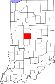
Location of Boone County in Indiana
This is a list of the Indiana state historical markers in Boone County.
This is intended to be a complete list of the official state historical markers placed in Boone County, Indiana, United States by the Indiana Historical Bureau. The locations of the historical markers and their latitude and longitude coordinates are included below when available, along with their names, years of placement, and topics as recorded by the Historical Bureau. There are 5 historical markers located in Boone County.[1]
Historical markers
| Marker title | Image | Year placed | Location | Topics |
|---|---|---|---|---|
| Indian Cemetery/Eel River Tribe of Miamis[2] | 1961 | Northern side of State Road 47, 0.5 miles east of Thorntown 40°7′42.6″N 86°35′39.6″W / 40.128500°N 86.594333°W |
Cemetery, American Indian/Native American | |
| Patrick H. Sullivan 1794-1879[3] | 1962 | 225 W. Hawthorne at the P.H. Sullivan Museum in Zionsville 39°56′55″N 86°15′45″W / 39.94861°N 86.26250°W |
Early Settlement and Exploration, Military | |
| Michigan Road[4] |  |
1966 | Western side of U.S. Route 421 north of 121st Street, north and east of Zionsville 39°57′50″N 86°14′53.5″W / 39.96389°N 86.248194°W |
Transportation, American Indian/Native American |
| The Boone County REMC[5] | 1985 | Interstate 65 northbound rest stop, 1 mile north of the State Road 47 interchange at Exit 146, and 7.5 miles north of Lebanon 40°9′27″N 86°32′15″W / 40.15750°N 86.53750°W |
Science, Medicine, and Inventions, Business, Industry, and Labor | |
| The Boone County REMC[6] | 1985 | Interstate 65 northbound rest stop, 1.5 miles north of the State Road 47 interchange at Exit 146, and 7.5 miles north of Lebanon 40°10′18″N 86°33′9″W / 40.17167°N 86.55250°W |
Science, Medicine, and Inventions, Business, Industry, and Labor |
See also
- List of Indiana state historical markers
- National Register of Historic Places listings in Boone County, Indiana
References
- ↑ "Indiana Historical Markers by County". State of Indiana. Retrieved 2012-03-15.
- ↑ Indian Cemetery/Eel River Tribe of Miamis, Indiana Historical Bureau, n.d. Accessed 2012-03-14.
- ↑ Patrick H. Sullivan 1794-1879, Indiana Historical Bureau, n.d. Accessed 2012-03-14.
- ↑ Michigan Road, Indiana Historical Bureau, n.d. Accessed 2012-03-14.
- ↑ The Boone County REMC, Indiana Historical Bureau, n.d. Accessed 2012-03-14.
- ↑ The Boone County REMC, Indiana Historical Bureau, n.d. Accessed 2012-03-14.
External links
Municipalities and communities of Boone County, Indiana, United States | ||
|---|---|---|
| City | ||
| Towns | ||
| Townships | ||
| Unincorporated communities |
| |
| Footnotes | ‡This populated place also has portions in an adjacent county or counties | |
This article is issued from Wikipedia - version of the 8/14/2012. The text is available under the Creative Commons Attribution/Share Alike but additional terms may apply for the media files.