Grade I listed buildings in Worcestershire
Worcestershire shown within England
There are over 6000 Grade I listed buildings in England. This page is a list of these buildings in the county of Worcestershire, by district.
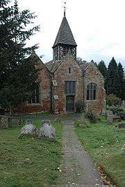
Bromsgrove
| Name | Location | Type | Completed [note 1] | Date designated | Grid ref.[note 2] Geo-coordinates |
Entry number [note 3] | Image |
|---|---|---|---|---|---|---|---|
| Church of St Leonard | Beoley | Church | 12th century | 16 November 1967 | SP0652069648 52°19′30″N 1°54′21″W / 52.324891°N 1.905758°W |
1167467 | 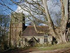 |
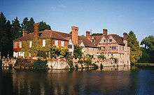
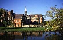
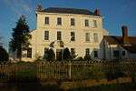
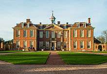
| Hagley Hall | Hagley Park, Hagley | Country House | 1754-60 | 23 April 1952 | SO9195980690 52°25′27″N 2°07′11″W / 52.424136°N 2.119673°W |
1296865 |  |
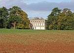
| Temple of Theseus about 1/2 mile north of Hagley Hall | Wychbury Hill, Hagley | Temple | 1758 | 23 April 1952 | SO9213281351 52°25′48″N 2°07′02″W / 52.430081°N 2.117145°W |
1348599 | .jpg) |
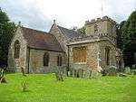
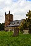
| Church of St Kenelm | Romsley | Chapel of Ease | 12th century | 16 November 1967 | SO9444480755 52°25′29″N 2°04′59″W / 52.424752°N 2.083131°W |
1100110 |  |
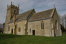
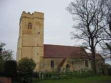
| Church of St Michael | Stoke Prior | Parish Church | Early 12th century | 16 November 1967 | SO9493467699 52°18′27″N 2°04′33″W / 52.307382°N 2.075724°W |
1100179 | .jpg) |
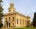
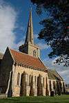
| Church of St John the Baptist | Bromsgrove | Church | 12th century | 28 April 1952 | SO9569770677 52°20′03″N 2°03′52″W / 52.334161°N 2.064572°W |
1100363 |  |
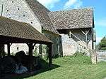
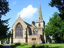
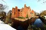
Malvern Hills
.jpg)


.jpg)


.jpg)


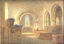

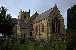


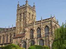

.jpg)


_-_geograph.org.uk_-_1457356.jpg)
Redditch
| Name | Location | Type | Completed [note 1] | Date designated | Grid ref.[note 2] Geo-coordinates |
Entry number [note 3] | Image |
|---|---|---|---|---|---|---|---|
| Norgrove Court | Feckenham | Farmhouse | c. 1823 | 10 April 1954 | SP0071965377 52°17′12″N 1°59′27″W / 52.286531°N 1.990881°W |
1167093 |  |
Worcester


.jpg)
Wychavon
.jpg)


.jpg)


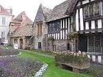


.jpg)


.jpg)


.jpg)
Wyre Forest


See also
Category:Grade I listed buildings in Worcestershire
Notes
- 1 2 3 4 5 6 The date given is the date used by Historic England as significant for the initial building or that of an important part in the structure's description.
- 1 2 3 4 5 6 Sometimes known as OSGB36, the grid reference is based on the British national grid reference system used by the Ordnance Survey.
- 1 2 3 4 5 6 The "List Entry Number" is a unique number assigned to each listed building and scheduled monument by Historic England.
References
English Heritage Images of England
External links
![]() Media related to Grade I listed buildings in Worcestershire at Wikimedia Commons
Media related to Grade I listed buildings in Worcestershire at Wikimedia Commons
This article is issued from Wikipedia - version of the 6/2/2016. The text is available under the Creative Commons Attribution/Share Alike but additional terms may apply for the media files.