Lisbon, Louisiana
| Lisbon, Louisiana | |
| Village | |
 Lisbon United Methodist Church | |
| Country | United States |
|---|---|
| State | Louisiana |
| Parish | Claiborne |
| Elevation | 331 ft (100.9 m) |
| Coordinates | 32°47′48″N 92°52′30″W / 32.79667°N 92.87500°WCoordinates: 32°47′48″N 92°52′30″W / 32.79667°N 92.87500°W |
| Area | 13.1 sq mi (33.9 km2) |
| - land | 13.1 sq mi (34 km2) |
| - water | 0.0 sq mi (0 km2), 0% |
| Population | 185 (2010) |
| Density | 14.1/sq mi (5.4/km2) |
| Timezone | CST (UTC-6) |
| - summer (DST) | CDT (UTC-5) |
| Area code | 318 |
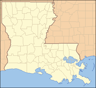 Location of Lisbon in Louisiana | |
 Location of Louisiana in the United States | |
Lisbon is a village in Claiborne Parish, Louisiana, United States. The population was 185 at the 2010 census.[1] Lisbon is located east of the parish seat of Homer.
In the late 19th century Lisbon was the location of the former Lisbon Academy, attended for a brief time by T. H. Harris, state superintendent of education from 1908 to 1940. Lisbon was the birthplace of another Louisiana educator, John Sparks Patton, who once lost a race for state superintendent to T. H. Harris and is remembered as the first advocate of taxpayer-funded school textbooks.
Still another Louisiana educator, E. R. Minchew, was an assistant principal and coach at the former Lisbon High School from 1930 to 1932, when he began a 32-year stint as principal of Castor High School in Castor, a village in Bienville Parish.[2]

Geography
Lisbon is located at 32°47′48″N 92°52′30″W / 32.79667°N 92.87500°W (32.796769, -92.874984).[3]
According to the United States Census Bureau, the village has a total area of 13.1 square miles (34 km2), all land.
Demographics
| Historical population | |||
|---|---|---|---|
| Census | Pop. | %± | |
| 1960 | 229 | — | |
| 1970 | 151 | −34.1% | |
| 1980 | 138 | −8.6% | |
| 1990 | 160 | 15.9% | |
| 2000 | 162 | 1.3% | |
| 2010 | 185 | 14.2% | |
| Est. 2015 | 173 | [4] | −6.5% |
As of the census[6] of 2000, there were 162 people, 69 households, and 48 families residing in the village. The population density was 12.3 inhabitants per square mile (4.8/km²). There were 87 housing units at an average density of 6.6 per square mile (2.6/km²). The racial makeup of the village was 65.43% White, 32.72% African American, 0.62% Pacific Islander, and 1.23% from two or more races.
There were 69 households out of which 24.6% had children under the age of 18 living with them, 55.1% were married couples living together, 11.6% had a female householder with no husband present, and 30.4% were non-families. 26.1% of all households were made up of individuals and 14.5% had someone living alone who was 65 years of age or older. The average household size was 2.35 and the average family size was 2.79.
In the village the population was spread out with 22.2% under the age of 18, 6.2% from 18 to 24, 24.1% from 25 to 44, 34.0% from 45 to 64, and 13.6% who were 65 years of age or older. The median age was 44 years. For every 100 females there were 105.1 males. For every 100 females age 18 and over, there were 106.6 males.
The median income for a household in the village was $41,667, and the median income for a family was $50,417. Males had a median income of $36,250 versus $19,375 for females. The per capita income for the village was $18,943. About 3.6% of families and 6.0% of the population were below the poverty line, including 6.3% of those under the age of eighteen and 9.1% of those sixty five or over.
Famous natives
- Willie Davis, defensive captain of the Green Bay Packers squads which won five National Football League championships and two Super Bowls under coach Vince Lombardi from 1961-1967
- Edith Killgore Kirkpatrick, musician and music educator
- Rebel Oakes, former Major League Baseball player
References
- ↑ "Profile of General Population and Housing Characteristics: 2010 Demographic Profile Data (DP-1): Lisbon village, Louisiana". U.S. Census Bureau, American Factfinder. Retrieved April 3, 2012.
- ↑ Dr. Elmer Reid Minchew, Shreveport Times, July 2, 2001, accessdate=December 2, 2010
- ↑ "US Gazetteer files: 2010, 2000, and 1990". United States Census Bureau. 2011-02-12. Retrieved 2011-04-23.
- ↑ "Annual Estimates of the Resident Population for Incorporated Places: April 1, 2010 to July 1, 2015". Retrieved July 2, 2016.
- ↑ "Census of Population and Housing". Census.gov. Retrieved June 4, 2015.
- ↑ "American FactFinder". United States Census Bureau. Retrieved 2008-01-31.
Municipalities and communities of Claiborne Parish, Louisiana, United States | ||
|---|---|---|
| Towns |  | |
| Villages | ||
| Unincorporated communities | ||
| Footnotes | ‡This populated place also has portions in an adjacent parish or parishes | |