Lindis Pass
| Lindis Pass | |
|---|---|
|
Road to Lindis Pass | |
| Elevation | 971 m (3,186 ft) |
| Traversed by | State Highway 8 |
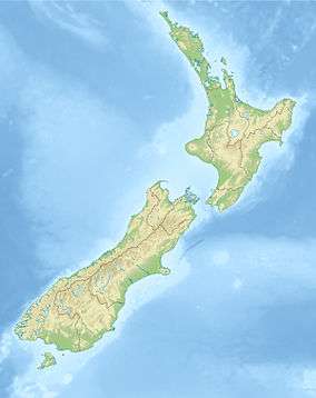
| Location | New Zealand |
| Range | Southern Alps |
| Coordinates | 44°35′16″S 169°38′52″E / 44.587786°S 169.647757°ECoordinates: 44°35′16″S 169°38′52″E / 44.587786°S 169.647757°E |
 | |
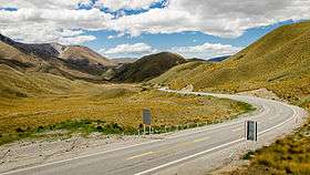
Lindis Pass (elevation 971 m) is located in the South Island of New Zealand.[1]
It lies between the towns of Cromwell in Central Otago and Omarama in North Otago, on the main inland route to the Mackenzie Basin in the Canterbury Region.
The pass lies between the valleys of the Lindis and Ahuriri Rivers.
State Highway 8 transverses the pass on its route from the Mackenzie Basin to Central Otago. The pass is the highest point on the South Island's state highway network, and the second highest point on the New Zealand state highway network, after the Desert Road (SH 1) in the Central North Island. Despite this, it is not considered one of the alpine passes as it located in the dry interior of the South Island.
References
![]() Media related to Lindis Pass at Wikimedia Commons
Media related to Lindis Pass at Wikimedia Commons
- ↑ "Place Name Detail: Lindis Pass". New Zealand Geographic Placenames Database. Land Information New Zealand. Retrieved 2010-03-25.