Lindetal
| Lindetal | |
|---|---|
 Lindetal | |
Location of Lindetal within Mecklenburgische Seenplatte district 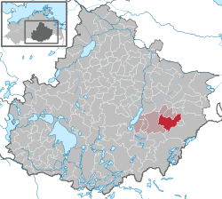 | |
| Coordinates: 53°28′43″N 13°25′52″E / 53.47861°N 13.43111°ECoordinates: 53°28′43″N 13°25′52″E / 53.47861°N 13.43111°E | |
| Country | Germany |
| State | Mecklenburg-Vorpommern |
| District | Mecklenburgische Seenplatte |
| Municipal assoc. | Stargarder Land |
| Government | |
| • Mayor | Michael Scheidt |
| Area | |
| • Total | 56.33 km2 (21.75 sq mi) |
| Population (2015-12-31)[1] | |
| • Total | 1,181 |
| • Density | 21/km2 (54/sq mi) |
| Time zone | CET/CEST (UTC+1/+2) |
| Postal codes | 17349 |
| Dialling codes | 03964, 03966 |
| Vehicle registration | MST |
| Website | www.stargarder-land.de |
Lindetal is a municipality in the district Mecklenburgische Seenplatte, in Mecklenburg-Vorpommern, Germany.
References
This article is issued from Wikipedia - version of the 6/20/2015. The text is available under the Creative Commons Attribution/Share Alike but additional terms may apply for the media files.