Lincoln County, Washington
| Lincoln County, Washington | |
|---|---|
|
Lincoln County Courthouse | |
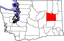 Location in the U.S. state of Washington | |
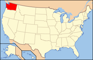 Washington's location in the U.S. | |
| Founded | November 24, 1883 |
| Named for | Abraham Lincoln |
| Seat | Davenport |
| Largest city | Davenport |
| Area | |
| • Total | 2,339 sq mi (6,058 km2) |
| • Land | 2,310 sq mi (5,983 km2) |
| • Water | 29 sq mi (75 km2), 1.2% |
| Population (est.) | |
| • (2015) | 10,321 |
| • Density | 4.4/sq mi (2/km²) |
| Congressional district | 5th |
| Time zone | Pacific: UTC-8/-7 |
| Website |
www |

Lincoln County is a county located in the U.S. state of Washington. As of the 2010 census, the population was 10,570,[1] making it the fifth-least populous county in Washington. The county seat and largest city is Davenport.[2] The county was created out of Whitman County on November 24, 1883[3] and is named for Abraham Lincoln, 16th President of the United States.[4]
Geography
According to the U.S. Census Bureau, the county has a total area of 2,339 square miles (6,060 km2), of which 2,310 square miles (6,000 km2) is land and 29 square miles (75 km2) (1.2%) is water.[5]
Geographic features
Major highways
Adjacent counties
- Ferry County – north
- Stevens County – northeast
- Spokane County – east
- Whitman County – southeast
- Adams County – south
- Grant County – west
- Okanogan County – northwest
National protected area
Demographics
| Historical population | |||
|---|---|---|---|
| Census | Pop. | %± | |
| 1890 | 9,312 | — | |
| 1900 | 11,969 | 28.5% | |
| 1910 | 17,539 | 46.5% | |
| 1920 | 15,141 | −13.7% | |
| 1930 | 11,876 | −21.6% | |
| 1940 | 11,361 | −4.3% | |
| 1950 | 10,970 | −3.4% | |
| 1960 | 10,919 | −0.5% | |
| 1970 | 9,572 | −12.3% | |
| 1980 | 9,604 | 0.3% | |
| 1990 | 8,864 | −7.7% | |
| 2000 | 10,184 | 14.9% | |
| 2010 | 10,570 | 3.8% | |
| Est. 2015 | 10,321 | [6] | −2.4% |
| U.S. Decennial Census[7] 1790–1960[8] 1900–1990[9] 1990–2000[10] 2010–2015[1] | |||
2000 census
As of the census[11] of 2000, there were 10,184 people, 4,151 households, and 2,914 families residing in the county. The population density was 4 people per square mile (2/km²). There were 5,298 housing units at an average density of 2 per square mile (1/km²). The racial makeup of the county was 95.64% White, 0.23% Black or African American, 1.63% Native American, 0.25% Asian, 0.07% Pacific Islander, 0.58% from other races, and 1.61% from two or more races. 1.88% of the population were Hispanic or Latino of any race. 36.6% were of German, 10.5% English, 9.3% United States or American and 5.8% Irish ancestry.
There were 4,151 households out of which 29.30% had children under the age of 18 living with them, 60.90% were married couples living together, 6.40% had a female householder with no husband present, and 29.80% were non-families. 26.00% of all households were made up of individuals and 12.30% had someone living alone who was 65 years of age or older. The average household size was 2.42 and the average family size was 2.91.
In the county, the population was spread out with 25.30% under the age of 18, 5.20% from 18 to 24, 23.20% from 25 to 44, 27.40% from 45 to 64, and 19.00% who were 65 years of age or older. The median age was 43 years. For every 100 females there were 98.40 males. For every 100 females age 18 and over, there were 94.70 males.
The median income for a household in the county was $35,255, and the median income for a family was $41,269. Males had a median income of $31,086 versus $22,444 for females. The per capita income for the county was $17,888. About 8.40% of families and 12.60% of the population were below the poverty line, including 17.60% of those under age 18 and 7.70% of those age 65 or over.
2010 census
As of the 2010 United States Census, there were 10,570 people, 4,422 households, and 3,059 families residing in the county.[12] The population density was 4.6 inhabitants per square mile (1.8/km2). There were 5,776 housing units at an average density of 2.5 per square mile (0.97/km2).[13] The racial makeup of the county was 95.0% white, 1.6% American Indian, 0.4% Asian, 0.3% black or African American, 0.5% from other races, and 2.2% from two or more races. Those of Hispanic or Latino origin made up 2.3% of the population.[12] In terms of ancestry, 42.3% were German, 14.6% were Irish, 13.9% were English, 5.5% were Norwegian, 5.3% were Scotch-Irish, and 3.6% were American.[14]
Of the 4,422 households, 25.9% had children under the age of 18 living with them, 57.3% were married couples living together, 7.7% had a female householder with no husband present, 30.8% were non-families, and 27.1% of all households were made up of individuals. The average household size was 2.37 and the average family size was 2.85. The median age was 47.6 years.[12]
The median income for a household in the county was $45,582 and the median income for a family was $52,083. Males had a median income of $44,491 versus $30,617 for females. The per capita income for the county was $24,757. About 7.1% of families and 12.1% of the population were below the poverty line, including 21.5% of those under age 18 and 6.0% of those age 65 or over.[15]
Government and politics
Like neighbouring Adams County, Lincoln County is one of the most conservative counties in Washington; the last Democrat to win a majority in the county was Harry Truman in 1948. In 1964 it was one of only three counties in the state to be carried by Barry Goldwater.[16] In the last seven elections no Democratic candidate for President has received more than 36 percent of the county’s vote. In 2016 Donald Trump carried to the county with over 70 percent of the vote;[17] in 2012 Mitt Romney carried the county with 68.7 percent,[18] and in 2008 John McCain won the county with 63.3 percent of votes.[19]
In the 2008 election Republicans carried the county in all races where party affiliation was listed. In many cases they did so with 65 percent or more of the vote. Hence Dino Rossi was the clear winner 65% to Governor Christine Gregoire’s 35%; Representative Cathy McMorris Rodgers received 78.1% of the county's vote; Sam Reed received 74.64% for Washington state Secretary of State; and Rob McKenna received 75.43% for Attorney General.[20]
Economy
The county is completely dependent on agriculture, primarily wheat farming. Lincoln County is generally considered the second-largest producer of wheat in the United States (following Whitman County, Washington), sometimes producing 25 million bushels (680,000 t) a year. Only about 500,000 of 900,000 acres (2,000 of 3,600 km2 (1,390 sq mi)) of farmland in the county are planted in any given year due to the practice of typically harvesting one crop every two years, a necessity in a region with only 12 inches (300 mm) of precipitation annually.
Communities
Cities
- Davenport (county seat)
- Harrington
- Sprague
Towns
Unincorporated communities
See also
Further reading
- An illustrated history of the Big Bend country : embracing Lincoln, Douglas, Adams, and Franklin counties, state of Washington. Western Historical Pub. Co. 1904.Available online through the Washington State Library's Classics in Washington History collection
References
- 1 2 "State & County QuickFacts". United States Census Bureau. Retrieved January 7, 2014.
- ↑ "Find a County". National Association of Counties. Retrieved 2011-06-07.
- ↑ "Milestones for Washington State History — Part 2: 1851 to 1900". HistoryLink.org. March 6, 2003.
- ↑ Gannett, Henry (1905). The Origin of Certain Place Names in the United States. U.S. Government Printing Office. p. 187.
- ↑ "2010 Census Gazetteer Files". United States Census Bureau. August 22, 2012. Retrieved July 7, 2015.
- ↑ "County Totals Dataset: Population, Population Change and Estimated Components of Population Change: April 1, 2010 to July 1, 2015". Retrieved July 2, 2016.
- ↑ "U.S. Decennial Census". United States Census Bureau. Retrieved January 7, 2014.
- ↑ "Historical Census Browser". University of Virginia Library. Retrieved January 7, 2014.
- ↑ "Population of Counties by Decennial Census: 1900 to 1990". United States Census Bureau. Retrieved January 7, 2014.
- ↑ "Census 2000 PHC-T-4. Ranking Tables for Counties: 1990 and 2000" (PDF). United States Census Bureau. Retrieved January 7, 2014.
- ↑ "American FactFinder". United States Census Bureau. Retrieved 2011-05-14.
- 1 2 3 "DP-1 Profile of General Population and Housing Characteristics: 2010 Demographic Profile Data". United States Census Bureau. Retrieved 2016-03-06.
- ↑ "Population, Housing Units, Area, and Density: 2010 – County". United States Census Bureau. Retrieved 2016-03-06.
- ↑ "DP02 SELECTED SOCIAL CHARACTERISTICS IN THE UNITED STATES – 2006–2010 American Community Survey 5-Year Estimates". United States Census Bureau. Retrieved 2016-03-06.
- ↑ "DP03 SELECTED ECONOMIC CHARACTERISTICS – 2006–2010 American Community Survey 5-Year Estimates". United States Census Bureau. Retrieved 2016-03-06.
- ↑ David Leip’s Presidential Atlas Map for Washington by election
- ↑ David Leip’s Presidential Atlas Map for Washington, 2016
- ↑ David Leip’s Presidential Atlas Map for Washington, 2012
- ↑ David Leip’s Presidential Atlas Map for Washington, 2008
- ↑ Washington Government site on election results for Lincoln County
 |
Okanogan County | Ferry County | Stevens County | |
| Grant County | |
Spokane County | ||
| ||||
| | ||||
| Adams County | Whitman County |
Municipalities and communities of Lincoln County, Washington, United States | ||
|---|---|---|
| Cities | | |
| Towns | ||
| Unincorporated communities | ||
| Ghost town | ||
Coordinates: 47°34′N 118°25′W / 47.57°N 118.41°W