Lincoln, Massachusetts
| Lincoln, Massachusetts | ||
|---|---|---|
| Town | ||
|
Codman House | ||
| ||
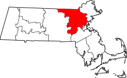
 Location in Middlesex County in Massachusetts | ||
| Coordinates: 42°25′33″N 71°18′16″W / 42.42583°N 71.30444°WCoordinates: 42°25′33″N 71°18′16″W / 42.42583°N 71.30444°W | ||
| Country | United States | |
| State | Massachusetts | |
| County | Middlesex | |
| Settled | 1650 | |
| Incorporated | 1754 | |
| Government | ||
| • Type | Open town meeting | |
| Area | ||
| • Total | 15.0 sq mi (38.9 km2) | |
| • Land | 14.4 sq mi (37.2 km2) | |
| • Water | 0.6 sq mi (1.7 km2) | |
| Elevation | 258 ft (79 m) | |
| Population (2010) | ||
| • Total | 6,362 | |
| • Density | 555.1/sq mi (214.9/km2) | |
| Time zone | Eastern (UTC-5) | |
| • Summer (DST) | Eastern (UTC-4) | |
| ZIP code | 01773 | |
| Area code(s) | 339 / 781 | |
| FIPS code | 25-35425 | |
| GNIS feature ID | 0619402 | |
| Website | http://www.lincolntown.org/ | |


Lincoln is a town in the historic area of Middlesex County, Massachusetts, United States. The population was 6,362 at the 2010 census, including residents of Hanscom Air Force Base that live within town limits.
History
Lincoln was settled by Europeans in 1654, as a part of Concord. The majority of Lincoln was formed by splitting of a substantial piece of southeast Concord, and incorporated as a separate town in 1754. Due to their "difficulties and inconveniences by reason of their distance from the places of Public Worship in their respective Towns," local inhabitants petitioned the General Court to be set apart as a separate town. The new town comprised parts "nipped" off from the adjacent towns of Concord, Weston (which itself had been part of Watertown) and Lexington (which itself had been part of Cambridge), it was sometimes referred to as "Niptown."[1]
Chambers Russell, a Representative in the Court in Boston, was influential in the town's creation. In gratitude, Russell was asked to name the new town. He chose Lincoln, after his family home in Lincolnshire, England. His homestead in Lincoln was later known as the Codman House property, which was occupied after his death by his relatives, the Codman family.
Lincoln is reportedly the only town in America named after Lincoln, England (and not the Revolutionary War Major General, Benjamin Lincoln or President Abraham Lincoln),[2] although Lincoln, New Hampshire was named for the 9th Earl of Lincoln, an English nobleman and incorporated in 1764, 45 years before Abraham Lincoln's birth.
Paul Revere was captured by British soldiers in Lincoln on the night of April 18, 1775. Minutemen from Lincoln were the first to arrive to reinforce the colonists protecting American stores of ammunition and arms in Concord. Colonel Abijah Pierce of Lincoln led his troops, armed with a cane. He upgraded his weapon to a British musket after the battle. Several British soldiers who fell in Lincoln are buried in the town cemetery.
Reverend Charles Stearns (1753–1826), a Harvard-trained minister, served the Congregational Church in Lincoln from late 1781 until his death. Only a handful of his sermons were printed, most in the early 19th century. In addition, Stearns was principal of the Liberal School, a relatively progressive and coeducational institution that opened in early 1793. While at the school, Stearns wrote and published a number of education-related works, including Dramatic Dialogues for Use in Schools (1798), a collection of 30 original plays that were performed by the students. After the school closed in 1808, Stearns continued to tutor students privately. Among his pupils were Nathan Brooks, a Concord lawyer, and George Russell, a Lincoln physician. Stearns's published works can be accessed at Early American Imprints, a microform and digital collection produced by the American Antiquarian Society. A summary article that surveys Stearns as a producer of children's drama is The Dramatic Dialogues of Charles Stearns: An Appreciation by Jonathan Levy, in Spotlight on the Child: Studies in the History of American Children’s Theatre, ed. Roger L. Bedard and C. John Tolch (New York: Greenwood, 1989): 5-24.
Geography
Lincoln has a total area of 15.0 square miles (39 km2), of which 14.4 square miles (37 km2) is land and 0.6 square miles (1.6 km2) is water, representing 4.26% of the town's total area. (Source: United States Census Bureau).
Police and fire department
The Lincoln Police and Fire Department building was upgraded recently. The Police Department is staffed with 13 full-time officers, broken down as follows: one chief, one lieutenant, three sergeants, one inspector, seven patrol officers and one traffic enforcement officer. Ten part-time special officers supplement the full-time officers in filling details and special events request for the department.[3]
The Fire Department employs a full-time chief, four full-time lieutenants, nine full-time firefighter/E.M.T.s, and ten call firefighter/E.M.T.s. The department staffs a minimum of four firefighters per shift at all times.
Demographics
| Historical population | ||
|---|---|---|
| Year | Pop. | ±% |
| 1850 | 719 | — |
| 1860 | 718 | −0.1% |
| 1870 | 791 | +10.2% |
| 1880 | 907 | +14.7% |
| 1890 | 987 | +8.8% |
| 1900 | 1,127 | +14.2% |
| 1910 | 1,175 | +4.3% |
| 1920 | 1,042 | −11.3% |
| 1930 | 1,493 | +43.3% |
| 1940 | 1,783 | +19.4% |
| 1950 | 2,427 | +36.1% |
| 1960 | 5,613 | +131.3% |
| 1970 | 7,567 | +34.8% |
| 1980 | 7,098 | −6.2% |
| 1990 | 7,666 | +8.0% |
| 2000 | 8,056 | +5.1% |
| 2010 | 6,362 | −21.0% |
| * = population estimate. Source: United States Census records and Population Estimates Program data.[4][5][6][7][8][9][10][11][12][13] | ||
At the 2000 census,[14] there were 8,056 people, 2,790 households and 2,254 families residing in the town. The population density was 560.7 per square mile (216.5/km²). There were 2,911 housing units at an average density of 202.6 per square mile (78.2/km²). The racial makeup of the town was 87.16% White, 4.84% African American, 0.38% Native American, 4.17% Asian, 0.02% Pacific Islander, 1.33% from other races, and 2.09% from two or more races. Hispanic or Latino of any race were 2.97% of the population. The 21.03% drop in population between the 2010 and 2000 censuses was the largest of any municipality in Massachusetts.
There were 2,790 households of which 45.6% had children under the age of 18 living with them, 73.4% were married couples living together, 5.4% had a female householder with no husband present, and 19.2% were non-families. 15.8% of all households were made up of individuals and 7.0% had someone living alone who was 65 years of age or older. The average household size was 2.83 and the average family size was 3.18.
Age distribution was 30.7% under the age of 18, 5.4% from 18 to 24, 31.2% from 25 to 44, 21.7% from 45 to 64, and 11.0% who were 65 years of age or older. The median age was 35 years. For every 100 females there were 94.5 males. For every 100 females age 18 and over, there were 90.7 males.
The median household income was $120,844, and median family income was $202,704. Males had a median income of $142,788 versus $61,786 for females. The per capita income for the town was $74,402. About 0.3% of families and 0.8% of the population were below the poverty line, including 0.2% of those under age 18 and 2.4% of those age 65 or over. Voting patterns in recent decades indicate that Lincoln is among the wealthiest towns in the United States.
The majority of the land in the town is zoned for residential and agricultural use.
Points of interest
- Bemis Hall
- Codman Community Farm
- Codman House
- DeCordova Museum and Sculpture Park
- The Food Project
- Gropius House
- Hanscom Field and Hanscom Air Force Base
- Lincoln Center Historic District
- Pierce House
- South Lincoln Business District
- Stonehedge Road
Transportation
Commuter rail service from Boston's North Station is provided by the MBTA with a stop in Lincoln on its Fitchburg Line.[15]
Notable residents
- Robert J. Art, Professor of International Relations at Brandeis University
- Mike Barnicle, print and broadcast journalist
- Matthew Barzun, United States Ambassador to the United Kingdom
- Marcel Breuer, bauhaus architect
- Rodney Brooks, MIT professor
- Richard Bolt, MIT professor
- Sarah Caldwell, opera conductor, impresario, and stage director
- Bradford Cannon, pioneer in the field of Reconstructive Surgery
- Robert M. Cunningham, cloud physicist
- Bruce Randall Donald, computer scientist and computational biologist.
- David Herbert Donald, historian
- John Flansburgh, rock musician, member of They Might Be Giants
- Julia Glass, author
- Patrick Greene, composer
- Walter Gropius, architect
- Greg Hawkes, rock musician
- Dudley R. Herschbach, Nobel laureate
- Charles P. Kindleberger, historical economist
- George Kistiakowsky, chemistry professor
- Christopher Langton, computer scientist
- Jane Langton, author
- John Linnell, rock musician, member of They Might Be Giants
- Cam Neely, ice hockey player and executive
- Martin Nowak, mathematical biologist
- Ken Olsen, engineer
- Roger Payne, biologist and environmentalist
- Paul Pierce, basketball player
- Joseph Waldo Rice, entrepreneur and early Australia pioneer
- Joan Risch, a housewife who disappeared from her Old Bedford Road home in 1961
- Rajon Rondo, basketball player
- Karen Smyers, triathlete
- Lester Thurow, author and former dean of the MIT Sloan School of Management
- Randy Vataha, an NFL player
- An Wang, computer industry pioneer (founder of Wang Computers in 1960s)
- Nicholi Rogatkin, professional bike rider
In popular culture
Lincoln, Massachusetts is featured prominently in the 2013 video game The Last of Us, although in the game evacuation placards and signs indicate that Lincoln is part of Amherst County, which does not exist. Amherst is a city approximately 75 miles west of Lincoln.
The 1988 They Might Be Giants album Lincoln is named after the town, childhood home of band founders John Linnell and John Flansburgh.
See also
References
- ↑ https://ia902700.us.archive.org/32/items/accountofcelebra00lincrich/accountofcelebra00lincrich.pdf, p.27 (p.63 of the PDF)
- ↑ "Town History". Lincoln Historical Society. Retrieved 22 June 2016.
- ↑ http://lincolntown.org/police/main.html
- ↑ "TOTAL POPULATION (P1), 2010 Census Summary File 1". American FactFinder, All County Subdivisions within Massachusetts. United States Census Bureau. 2010.
- ↑ "Massachusetts by Place and County Subdivision - GCT-T1. Population Estimates". United States Census Bureau. Retrieved July 12, 2011.
- ↑ "1990 Census of Population, General Population Characteristics: Massachusetts" (PDF). US Census Bureau. December 1990. Table 76: General Characteristics of Persons, Households, and Families: 1990. 1990 CP-1-23. Retrieved July 12, 2011.
- ↑ "1980 Census of the Population, Number of Inhabitants: Massachusetts" (PDF). US Census Bureau. December 1981. Table 4. Populations of County Subdivisions: 1960 to 1980. PC80-1-A23. Retrieved July 12, 2011.
- ↑ "1950 Census of Population" (PDF). Bureau of the Census. 1952. Section 6, Pages 21-10 and 21-11, Massachusetts Table 6. Population of Counties by Minor Civil Divisions: 1930 to 1950. Retrieved July 12, 2011.
- ↑ "1920 Census of Population" (PDF). Bureau of the Census. Number of Inhabitants, by Counties and Minor Civil Divisions. Pages 21-5 through 21-7. Massachusetts Table 2. Population of Counties by Minor Civil Divisions: 1920, 1910, and 1920. Retrieved July 12, 2011.
- ↑ "1890 Census of the Population" (PDF). Department of the Interior, Census Office. Pages 179 through 182. Massachusetts Table 5. Population of States and Territories by Minor Civil Divisions: 1880 and 1890. Retrieved July 12, 2011.
- ↑ "1870 Census of the Population" (PDF). Department of the Interior, Census Office. 1872. Pages 217 through 220. Table IX. Population of Minor Civil Divisions, &c. Massachusetts. Retrieved July 12, 2011.
- ↑ "1860 Census" (PDF). Department of the Interior, Census Office. 1864. Pages 220 through 226. State of Massachusetts Table No. 3. Populations of Cities, Towns, &c. Retrieved July 12, 2011.
- ↑ "1850 Census" (PDF). Department of the Interior, Census Office. 1854. Pages 338 through 393. Populations of Cities, Towns, &c. Retrieved July 12, 2011.
- ↑ "American FactFinder". United States Census Bureau. Retrieved 2008-01-31.
- ↑ MBTA website.mbta.com. Accessed August 31, 2007.
Further reading
- 1871 Atlas of Massachusetts. by Wall & Gray.Map of Massachusetts. Map of Middlesex County.
- History of Middlesex County, Massachusetts, Volume 1 (A-H), Volume 2 (L-W) compiled by Samuel Adams Drake, published 1879 and 1880. 572 and 505 pages. Lincoln section by William F. Wheeler in volume 2 pages 34–43.
- 1940 US Census: enumeration districts 9-207 and 9-208
External links
| Wikimedia Commons has media related to Lincoln, Massachusetts. |