Limestone Township, Lycoming County, Pennsylvania
| Limestone Township, Lycoming County, Pennsylvania | |
|---|---|
| Township | |
|
Farmland in Limestone Township | |
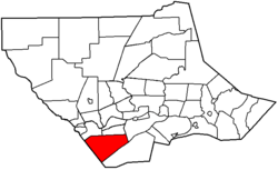 Map of Lycoming County, Pennsylvania highlighting Limestone Township | |
 Map of Lycoming County, Pennsylvania | |
| Coordinates: 41°8′35″N 77°10′1″W / 41.14306°N 77.16694°WCoordinates: 41°8′35″N 77°10′1″W / 41.14306°N 77.16694°W | |
| Country | United States |
| State | Pennsylvania |
| County | Lycoming |
| Settled | 1789 |
| Incorporated | 1824 |
| Area | |
| • Total | 34.2 sq mi (88.5 km2) |
| • Land | 34.1 sq mi (88.3 km2) |
| • Water | 0.1 sq mi (0.2 km2) |
| Elevation[1] | 1,493 ft (455 m) |
| Population (2000) | |
| • Total | 2,136 |
| • Density | 62.7/sq mi (24.2/km2) |
| Time zone | Eastern (EST) (UTC-5) |
| • Summer (DST) | EDT (UTC-4) |
| Area code(s) | 570 |
| FIPS code | 42-43352[2] |
| GNIS feature ID | 1216754[1] |

Limestone Township is a township in Lycoming County, Pennsylvania, United States. The population was 2,136 at the 2000 census. It is part of the Williamsport, Pennsylvania Metropolitan Statistical Area.
History
Limestone Township was established on December 4, 1824 by an act of the Pennsylvania General Assembly. It was formed from parts of Nippenose and Wayne Townships. Limestone Township was originally known as Adams Township in honor of United States President John Adams until April 14, 1835 when the name as changed to what was deemed to be a more appropriate title.[3]
Upon arriving in present-day Limestone Township in 1789, the first settlers deemed it barren because the base of valley was covered by thickets of thorny bushes and was largely free of trees. At first the land sold for as little as fifty cents an acre. After the initial settlers cleared the shrubbery and planted wheat, the land was found to be quite fertile, and prices rose to $5.00 per acre. Later settlers to Limestone Township established the communities of Collomsville, Oriole and Oval. These small towns were the locations of small taverns, general stores and sawmills. By the 1890s, land sold for as much as $100 per acre.[3]
Much of the farmland in the southeastern portion of Limestone Township was purchased by the Williamsport Water Authority in the early 1900s as part of its watershed. Visitors to the "water company" lands can see the stone remains of the early settlers homesteads spread throughout the watershed.
The water authority built a multimillion-dollar water filtration plant in the 1990s in Mosquito Valley. With the construction of this plant, the lands of the water authority were opened to the general public as a nature preserve, with limited hunting permitted at certain times of the year.[4]
Geography
Limestone Township is bordered by Washington Township to the south and east, Armstrong Township to the east, Bastress and Nippenose Townships to the north, and Clinton County to the west.[5] As the crow flies, Lycoming County is about 130 miles (209 km) northwest of Philadelphia and 165 miles (266 km) east-northeast of Pittsburgh.
According to the United States Census Bureau, the township has a total area of 34.2 square miles (88.5 km2).34.1 square miles (88.3 km2) of it is land and 0.1 square miles (0.2 km2) of it (0.23%) is water. Limestone Township is in the southwestern corner of Lycoming County.
Nippenose Valley
The region includes anticlinal karst Nippenose Valley part of the northernmost fold sequence of the Ridge and Valley Physiographic Province. Nippenose Valley is uniquely bowl-shaped and consists of a doubly plunging anticline. According to a research paper from the University of Akron, The center has been eroded, exposing carbonate rocks in the valley. There is an average total of about 470 meters of Lower to Middle Ordovician limestone and dolomite underlying the valley. The Reedsville Shale is stratigraphically above them, and overlain by the ridge forming Bald Eagle Sandstone. The valley has been intensely karstified, as evidenced by the numerous sinkholes, springs, caves, and disappearing streams.[6]
Within a number of caves in this valley a new species of fish, a type of troglomorphic sculpin, was identified in 2003 by Luis Espinasa, an associate professor of biology at Marist College.[7]
Demographics
As of the census[2] of 2000, there were 2,136 people, 689 households, and 580 families residing in the township. The population density was 62.7 people per square mile (24.2/km2). There were 732 housing units at an average density of 21.5/sq mi (8.3/km2). The racial makeup of the township was 98.78% White, 0.05% African American, 0.14% Native American, 0.23% Asian, 0.42% from other races, and 0.37% from two or more races. Hispanic or Latino of any race were 0.80% of the population.
There were 689 households, out of which 44.1% had children under the age of 18 living with them, 75.5% were married couples living together, 4.9% had a female householder with no husband present, and 15.8% were non-families. 13.2% of all households were made up of individuals, and 5.5% had someone living alone who was 65 years of age or older. The average household size was 3.10 and the average family size was 3.41.
In the township the population was spread out, with 32.0% under the age of 18, 8.3% from 18 to 24, 28.6% from 25 to 44, 22.6% from 45 to 64, and 8.6% who were 65 years of age or older. The median age was 34 years. For every 100 females there were 109.8 males. For every 100 females age 18 and over, there were 106.1 males.
The median income for a household in the township was $41,375, and the median income for a family was $44,219. Males had a median income of $31,543 versus $21,250 for females. The per capita income for the township was $15,180. About 5.7% of families and 7.0% of the population were below the poverty line, including 10.0% of those under age 18 and 7.0% of those age 65 or over.
References
- 1 2 "US Board on Geographic Names". United States Geological Survey. 2007-10-25. Retrieved 2008-01-31.
- 1 2 "American FactFinder". United States Census Bureau. Retrieved 2008-01-31.
- 1 2 Meginness, John Franklin (1892). "Nippenose, Limestone, Susquehanna, and Bastress". History of Lycoming County, Pennsylvania: including its aboriginal history; the colonial and revolutionary periods; early settlement and subsequent growth; organization and civil administration; the legal and medical professions; internal improvement; past and present history of Williamsport; manufacturing and lumber interests; religious, educational, and social development; geology and agriculture; military record; sketches of boroughs, townships, and villages; portraits and biographies of pioneers and representative citizens, etc. etc. (1st ed.). Chicago: Brown, Runk & Co. ISBN 0-7884-0428-8. Retrieved 2006-02-18.
(Note: ISBN refers to Heritage Books July 1996 reprint. URL is to a scan of the 1892 version with some OCR typos).
- ↑ "Williamsport Municipal Water Authority Visitor Information". WMWA-WSA Williamsport Municipal Water Authority-Williamsport Sanitation Authority. Retrieved 2008-11-17.
- ↑ "2007 General Highway Map Lycoming County Pennsylvania" (PDF) (Map). 1:65,000. Pennsylvania Department of Transportation, Bureau of Planning and Research, Geographic Information Division. Retrieved 2009-12-24.
- ↑ Ulmer, Jennifer L. (1999). "Interbasin Groundwater Flow Between Sugar Valley and Nippenose Valley: Two Karst Systems in Central Pennsylvania". The University of Akron. Retrieved 2009-12-22.
- ↑ Long, Eric (2008-01-26). "A new species". Williamsport Sun-Gazette. Retrieved 2009-12-22.
Municipalities and communities of Lycoming County, Pennsylvania, United States | ||
|---|---|---|
| City | | |
| Boroughs | ||
| Townships |
| |
| CDPs | ||
| Unincorporated communities | ||
| Ghost town | ||
| Footnotes | ‡This populated place also has portions in an adjacent county | |