Liberia, North Carolina
| Liberia, North Carolina | |
|---|---|
| Unincorporated community | |
 Liberia, North Carolina  Liberia, North Carolina | |
| Coordinates: 36°21′24″N 78°05′47″W / 36.35667°N 78.09639°WCoordinates: 36°21′24″N 78°05′47″W / 36.35667°N 78.09639°W | |
| Country | United States |
| State | North Carolina |
| County | Warren |
| Elevation | 400 ft (100 m) |
| Time zone | Eastern (EST) (UTC-5) |
| • Summer (DST) | EDT (UTC-4) |
| Area code(s) | 252 |
| GNIS feature ID | 1021140[1] |
Liberia is an unincorporated community in Warren County, North Carolina, United States. The community is located at the junction of North Carolina Highway 43 and North Carolina Highway 58, which connect Rocky Mount and Wilson respectively to the county seat at Warrenton. A predominantly African-American community, Liberia was founded after the Civil War; it was named for the African nation of Liberia, where many freed slaves migrated to after the war.[2]
The Liberia School and the Warren County Fire Tower, which are both listed on the National Register of Historic Places, are located in the vicinity of Liberia.[3]
References
- ↑ "Liberia". Geographic Names Information System. United States Geological Survey.
- ↑ Nancy Van Dolsen (January 2005). "Liberia School" (pdf). National Register of Historic Places - Nomination and Inventory. North Carolina State Historic Preservation Office. Retrieved 2015-06-01.
- ↑ National Park Service (2010-07-09). "National Register Information System". National Register of Historic Places. National Park Service.
Municipalities and communities of Warren County, North Carolina, United States | ||
|---|---|---|
| Towns | 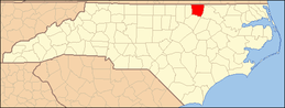 | |
| Unincorporated communities | ||
This article is issued from Wikipedia - version of the 7/27/2016. The text is available under the Creative Commons Attribution/Share Alike but additional terms may apply for the media files.