Lexington, Oklahoma
| Lexington, Oklahoma | |
|---|---|
| City | |
 Location of Lexington in Oklahoma | |
| Coordinates: 35°0′55″N 97°20′10″W / 35.01528°N 97.33611°WCoordinates: 35°0′55″N 97°20′10″W / 35.01528°N 97.33611°W | |
| Country | United States |
| State | Oklahoma |
| County | Cleveland |
| Area | |
| • Total | 2.4 sq mi (6.2 km2) |
| • Land | 2.4 sq mi (6.2 km2) |
| • Water | 0.0 sq mi (0.0 km2) |
| Elevation | 1,033 ft (315 m) |
| Population (2010) | |
| • Total | 2,152 |
| • Density | 899/sq mi (347.2/km2) |
| Time zone | Central (CST) (UTC-6) |
| • Summer (DST) | CDT (UTC-5) |
| ZIP code | 73051 |
| Area code(s) | 405 |
| FIPS code | 40-42700[1] |
| GNIS feature ID | 1094597[2] |
| Website |
cityoflexington |
Lexington is a city in Cleveland County, Oklahoma, United States. The city population was 2,152 at the 2010 census.[3]
Geography
Lexington is located in southern Cleveland County at 35°0′55″N 97°20′10″W / 35.01528°N 97.33611°W. It is bordered on the west by the Canadian River, which forms the McClain County line. The city of Purcell is directly across the river from Lexington, connected by U.S. Route 77. US 77 leads north from Lexington 16 miles (26 km) to Norman and 38 miles (61 km) to the center of Oklahoma City.
According to the United States Census Bureau, Lexington has a total area of 2.4 square miles (6.2 km2), all of it land.[3]
Demographics
| Historical population | |||
|---|---|---|---|
| Census | Pop. | %± | |
| 1890 | 223 | — | |
| 1900 | 861 | 286.1% | |
| 1910 | 768 | −10.8% | |
| 1920 | 950 | 23.7% | |
| 1930 | 836 | −12.0% | |
| 1940 | 1,084 | 29.7% | |
| 1950 | 1,176 | 8.5% | |
| 1960 | 1,216 | 3.4% | |
| 1970 | 1,516 | 24.7% | |
| 1980 | 1,731 | 14.2% | |
| 1990 | 1,776 | 2.6% | |
| 2000 | 2,086 | 17.5% | |
| 2010 | 2,152 | 3.2% | |
| Est. 2015 | 2,161 | [4] | 0.4% |
As of the census[1] of 2010 there were 2,152 people, 761 households, and 541 families residing in the city. The population density was 979.3 people per square mile (378.1/km²). There were 842 housing units at an average density of 395.3 per square mile (152.6/km²). The racial makeup of the city was 85.62% White, 0.58% African American, 6.47% Native American, 0.10% Asian, 3.74% from other races, and 3.50% from two or more races. Hispanic or Latino of any race were 7.29% of the population.
There were 761 households out of which 36.9% had children under the age of 18 living with them, 53.5% were married couples living together, 13.5% had a female householder with no husband present, and 28.8% were non-families. 25.5% of all households were made up of individuals and 10.9% had someone living alone who was 65 years of age or older. The average household size was 2.60 and the average family size was 3.06.
In the city the population was spread out with 26.8% under the age of 18, 9.4% from 18 to 24, 27.5% from 25 to 44, 19.6% from 45 to 64, and 16.7% who were 65 years of age or older. The median age was 35 years. For every 100 females there were 96.1 males. For every 100 females age 18 and over, there were 86.4 males.
The median income for a household in the city was $27,538, and the median income for a family was $32,155. Males had a median income of $27,292 versus $20,000 for females. The per capita income for the city was $13,322. About 13.1% of families and 15.5% of the population were below the poverty line, including 18.6% of those under age 18 and 15.8% of those age 65 or over.
History
In 1835, north of the present town, Major Richard B. Mason established Camp Holmes. Here, the Five Civilized Tribes, many of the Plains Indians and the Osage Nation met and signed the treaty of Camp Holmes, pledging peace and friendship among themselves and the United States. Later, Auguste P. Chouteau established a trading post here and renamed the place Camp Mason. Jesse Chisholm operated a store here.[6]
The area of Lexington was in the Unassigned Lands, and the town was planned before the Land Rush of 1889. The town was named after Lexington, Kentucky. The post office was established in 1890.[6]
The first incorporation of Lexington in 1890 was dissolved after political infighting and a dispute over high taxes on liquor sales. After a compromise was reached, the town reincorporated in 1892.[6]
Before Oklahoma statehood in 1907, Lexington was known as a "whiskey town". Much of the business came from across the Canadian River from the thriving railroad town of Purcell which was located in dry Indian Territory. The Weitzenhoffer and Turk Distillery, the largest distillery in Oklahoma Territory, opened near Lexington in 1900 and operated until statewide prohibition in 1907.[6]
During World War II, the Navy operated a gunnery school east of Lexington. After the war, the State of Oklahoma acquired the property and built an annex to Central State Mental Hospital (later Griffin Memorial Hospital). In 1971, the Department of Corrections acquired the property and opened a minimum security prison called the Regional Treatment Center. In 1976, the state began construction on the Lexington Assessment and Reception Center (LARC) which processes all new prisoners entering the state correctional system. The Regional Treatment Center was re-designated as the Joseph Harp Correctional Center, a medium-security prison.[6]
Notable people
- Harold Hamm (December 11, 1945 - ), an oil baron, the 30th richest person in America, and the 76th richest person in the world, according to Forbes, March, 2012 issue, was born and raised in Lexington, Oklahoma
- Gordon L. Park (1937–2010), a Republican member of the Wyoming House of Representatives from 1993–1996, was born in Lexington, Oklahoma.
- Woody Crumbo (1912—1989), a 1978 Potawatomi Native American inductee into the Oklahoma Hall of Fame for his paintings which can be found in the Smithsonian Institution, the Metropolitan Museum of Art, and the Gilcrease Museum.
References
- 1 2 "American FactFinder". United States Census Bureau. Archived from the original on September 11, 2013. Retrieved 2008-01-31.
- ↑ "Lexington". Geographic Names Information System. United States Geological Survey. Retrieved 2009-02-16.
- 1 2 "Geographic Identifiers: 2010 Demographic Profile Data (G001): Lexington city, Oklahoma". U.S. Census Bureau, American Factfinder. Retrieved February 20, 2015.
- ↑ "Annual Estimates of the Resident Population for Incorporated Places: April 1, 2010 to July 1, 2015". Retrieved July 2, 2016.
- ↑ "Census of Population and Housing". Census.gov. Archived from the original on May 11, 2015. Retrieved June 4, 2015.
- 1 2 3 4 5 O'Dell, Larry. "Lexington - Oklahoma Encyclopedia of History & Culture". Oklahoma Historical Society. Retrieved 10 April 2011.
External links
Municipalities and communities of Cleveland County, Oklahoma, United States | ||
|---|---|---|
| Cities | 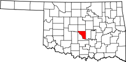 | |
| Towns | ||
| Neighborhood | ||
| Footnotes | ‡This populated place also has portions in an adjacent county or counties | |