Lewis, Kansas
| Lewis, Kansas | |
|---|---|
| City | |
|
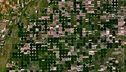
Satellite view of Lewis and surrounding Center pivot irrigation farms (2005) | |
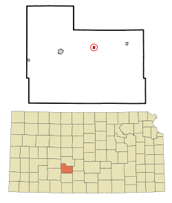 Location within County and Kansas | |
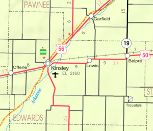 KDOT map of Edwards County (legend) | |
| Coordinates: 37°56′13″N 99°15′17″W / 37.93694°N 99.25472°WCoordinates: 37°56′13″N 99°15′17″W / 37.93694°N 99.25472°W | |
| Country | United States |
| State | Kansas |
| County | Edwards |
| Government | |
| • Type | Mayor–Council |
| Area[1] | |
| • Total | 0.33 sq mi (0.85 km2) |
| • Land | 0.33 sq mi (0.85 km2) |
| • Water | 0 sq mi (0 km2) |
| Elevation | 2,146 ft (654 m) |
| Population (2010)[2] | |
| • Total | 451 |
| • Estimate (2015)[3] | 434 |
| • Density | 1,400/sq mi (530/km2) |
| Time zone | Central (CST) (UTC-6) |
| • Summer (DST) | CDT (UTC-5) |
| ZIP code | 67552 |
| Area code(s) | 620 |
| FIPS code | 20-39725 [4] |
| GNIS feature ID | 0473549 [5] |
Lewis is a city in Edwards County, Kansas, United States. As of the 2010 census, the city population was 451.[6]
History
Lewis was founded about 1885.[7] It was named for journalist M. M. Lewis.[8]
The first post office in Lewis was established in November, 1886.[9]
Geography
Lewis is located at 37°56′13″N 99°15′17″W / 37.93694°N 99.25472°W (37.937014, -99.254728).[10] According to the United States Census Bureau, the city has a total area of 0.33 square miles (0.85 km2), all of it land.[1]
Demographics
| Historical population | |||
|---|---|---|---|
| Census | Pop. | %± | |
| 1910 | 557 | — | |
| 1920 | 439 | −21.2% | |
| 1930 | 512 | 16.6% | |
| 1940 | 481 | −6.1% | |
| 1950 | 475 | −1.2% | |
| 1960 | 486 | 2.3% | |
| 1970 | 525 | 8.0% | |
| 1980 | 551 | 5.0% | |
| 1990 | 451 | −18.1% | |
| 2000 | 486 | 7.8% | |
| 2010 | 451 | −7.2% | |
| Est. 2015 | 434 | [3] | −3.8% |
| U.S. Decennial Census | |||
2010 census
As of the census[2] of 2010, there were 451 people, 183 households, and 127 families residing in the city. The population density was 1,366.7 inhabitants per square mile (527.7/km2). There were 221 housing units at an average density of 669.7 per square mile (258.6/km2). The racial makeup of the city was 73.4% White, 1.3% African American, 1.3% Native American, 23.1% from other races, and 0.9% from two or more races. Hispanic or Latino of any race were 43.7% of the population.
There were 183 households of which 31.1% had children under the age of 18 living with them, 56.3% were married couples living together, 7.1% had a female householder with no husband present, 6.0% had a male householder with no wife present, and 30.6% were non-families. 26.2% of all households were made up of individuals and 13.1% had someone living alone who was 65 years of age or older. The average household size was 2.46 and the average family size was 2.99.
The median age in the city was 43.3 years. 23.7% of residents were under the age of 18; 6.8% were between the ages of 18 and 24; 23% were from 25 to 44; 28.6% were from 45 to 64; and 17.7% were 65 years of age or older. The gender makeup of the city was 52.1% male and 47.9% female.
2000 census
As of the census[4] of 2000, there were 486 people, 183 households, and 133 families residing in the city. The population density was 1,523.1 people per square mile (586.4/km²). There were 226 housing units at an average density of 708.3 per square mile (272.7/km²). The racial makeup of the city was 75.72% White, 0.21% African American, 0.82% Native American, 21.19% from other races, and 2.06% from two or more races. Hispanic or Latino of any race were 34.16% of the population.
There were 183 households out of which 35.5% had children under the age of 18 living with them, 60.1% were married couples living together, 7.1% had a female householder with no husband present, and 26.8% were non-families. 26.2% of all households were made up of individuals and 12.0% had someone living alone who was 65 years of age or older. The average household size was 2.66 and the average family size was 3.16.
In the city the population was spread out with 30.0% under the age of 18, 7.2% from 18 to 24, 27.6% from 25 to 44, 22.0% from 45 to 64, and 13.2% who were 65 years of age or older. The median age was 34 years. For every 100 females there were 99.2 males. For every 100 females age 18 and over, there were 96.5 males.
The median income for a household in the city was $35,238, and the median income for a family was $36,750. Males had a median income of $25,114 versus $18,929 for females. The per capita income for the city was $14,085. About 11.1% of families and 13.6% of the population were below the poverty line, including 23.5% of those under age 18 and none of those age 65 or over.
Media
References
- 1 2 "US Gazetteer files 2010". United States Census Bureau. Retrieved 2012-07-06.
- 1 2 "American FactFinder". United States Census Bureau. Retrieved 2012-07-06.
- 1 2 "Annual Estimates of the Resident Population for Incorporated Places: April 1, 2010 to July 1, 2015". Retrieved July 2, 2016.
- 1 2 "American FactFinder". United States Census Bureau. Retrieved 2008-01-31.
- ↑ "US Board on Geographic Names". United States Geological Survey. 2007-10-25. Retrieved 2008-01-31.
- ↑ "2010 City Population and Housing Occupancy Status". U.S. Census Bureau. Retrieved September 15, 2011.
- ↑ Kansas State Historical Society (1916). Biennial Report of the Board of Directors of the Kansas State Historical Society. Kansas State Printing Plant. p. 183.
- ↑ "Profile for Lewis, Kansas". ePodunk. Retrieved 9 June 2014.
- ↑ "Kansas Post Offices, 1828-1961 (archived)". Kansas Historical Society. Archived from the original on October 9, 2013. Retrieved 8 June 2014.
- ↑ "US Gazetteer files: 2010, 2000, and 1990". United States Census Bureau. 2011-02-12. Retrieved 2011-04-23.
External links
| Wikimedia Commons has media related to Lewis, Kansas. |
- Lewis - Directory of Public Officials
- Lewis City Map, EdwardsCounty.org
- Lewis City Map, KDOT
Municipalities and communities of Edwards County, Kansas, United States | ||
|---|---|---|
| Cities | 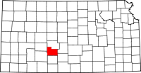 | |
| Unincorporated communities | ||
| Townships | ||