Lettret
| Lettret | |
|---|---|
|
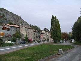
A view of the village of Lettret | |
 Lettret | |
|
Location within Provence-A.-C.d'A. region  Lettret | |
| Coordinates: 44°28′09″N 6°03′42″E / 44.4692°N 6.0617°ECoordinates: 44°28′09″N 6°03′42″E / 44.4692°N 6.0617°E | |
| Country | France |
| Region | Provence-Alpes-Côte d'Azur |
| Department | Hautes-Alpes |
| Arrondissement | Gap |
| Canton | Tallard |
| Intercommunality | Tallard-Barcillonnette |
| Government | |
| • Mayor (2009–2014) | Michel Rousselle |
| Area1 | 4.2 km2 (1.6 sq mi) |
| Population (2008)2 | 165 |
| • Density | 39/km2 (100/sq mi) |
| Time zone | CET (UTC+1) |
| • Summer (DST) | CEST (UTC+2) |
| INSEE/Postal code | 05074 / 05130 |
| Elevation |
591–960 m (1,939–3,150 ft) (avg. 600 m or 2,000 ft) |
|
1 French Land Register data, which excludes lakes, ponds, glaciers > 1 km² (0.386 sq mi or 247 acres) and river estuaries. 2 Population without double counting: residents of multiple communes (e.g., students and military personnel) only counted once. | |
Lettret is a commune in the Hautes-Alpes department in southeastern France.
Population
| Historical population | ||
|---|---|---|
| Year | Pop. | ±% |
| 1962 | 49 | — |
| 1968 | 61 | +24.5% |
| 1975 | 55 | −9.8% |
| 1982 | 81 | +47.3% |
| 1990 | 92 | +13.6% |
| 1999 | 109 | +18.5% |
| 2008 | 165 | +51.4% |
See also
References
| Wikimedia Commons has media related to Lettret. |
This article is issued from Wikipedia - version of the 1/30/2015. The text is available under the Creative Commons Attribution/Share Alike but additional terms may apply for the media files.