Lete, Nepal
| Lete लेते | |
|---|---|
| Village development committee | |
|
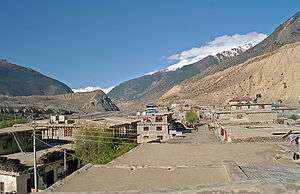
Lete in 2007 | |
 Lete Location in Nepal | |
| Coordinates: 28°37′12″N 83°36′0″E / 28.62000°N 83.60000°ECoordinates: 28°37′12″N 83°36′0″E / 28.62000°N 83.60000°E | |
| Country |
|
| Zone | Dhawalagiri Zone |
| District | Mustang District |
| Population (1991) | |
| • Total | 914 |
| Time zone | Nepal Time (UTC+5:45) |
a.jpg)
Lete is a village development committee in Mustang District in the Dhawalagiri Zone of northern Nepal. At the time of the 1991 Nepal census it had a population of 914 people living in 189 individual households.[1]It is a scenic village surrounded by Dhawalagiri, Annapurna and Nilgiri. This village is governed by chairman the, Ama-Samuha, and other members.
References
- ↑ "Nepal Census 2001", Nepal's Village Development Committees, Digital Himalaya, archived from the original on October 12, 2008, retrieved 15 November 2009.
External links
Headquarter: Jomsom | |||
 |  | ||
This article is issued from Wikipedia - version of the 9/11/2016. The text is available under the Creative Commons Attribution/Share Alike but additional terms may apply for the media files.