Leon Valley, Texas
| Leon Valley, Texas | |
|---|---|
| City | |
 Location of Leon Valley, Texas | |
| Coordinates: 29°29′54″N 98°36′45″W / 29.49833°N 98.61250°WCoordinates: 29°29′54″N 98°36′45″W / 29.49833°N 98.61250°W | |
| Country |
|
| State |
|
| County | Bexar |
| Government | |
| • Type | Council-Manager |
| • City Council |
Mayor Chris Riley David Edwards Belinda Ealy Monica Alcocer Benny Martinez David Jordan |
| • City Manager | Kelly Kuenstler |
| Area | |
| • Total | 3.4 sq mi (8.8 km2) |
| • Land | 3.4 sq mi (8.8 km2) |
| • Water | 0.0 sq mi (0.0 km2) |
| Elevation | 827 ft (252 m) |
| Population (2010) | |
| • Total | 10,151 |
| Time zone | Central (CST) (UTC-6) |
| • Summer (DST) | CDT (UTC-5) |
| ZIP codes | 78238, 78240, 78268 |
| Area code(s) | 210, 726 (planned) |
| FIPS code | 48-42388[1] |
| GNIS feature ID | 1339825[2] |
| Website | leonvalleytexas.gov |
Leon Valley is a city in Bexar County, Texas, United States. It is an enclave on the northwest side of San Antonio and is part of the San Antonio-New Braunfels Metropolitan Statistical Area. The population was 10,151 at the 2010 census. Leon Valley is an independent municipality surrounded by the city of San Antonio.
History
Leon Valley was developed in the 1940s as a farming community on Bandera Road between Helotes and San Antonio. In 1952 residents filed a petition for incorporation as an independent city since the residents did not wish to be annexed by San Antonio. Leon Valley incorporated in 1954 under the leadership of its founding mayor, Raymond Rimkus. In 1960, it had a population of 536 and by 1970 Its population grew to 1,960. In 1990 it had 9,581 people.
Geography
Leon Valley is located at 29°29′54″N 98°36′45″W / 29.49833°N 98.61250°W (29.498280, -98.612594).[3] This is 3 miles southwest of the South Texas Medical Center, 8 miles west of Uptown San Antonio, and 10 miles northwest of Downtown San Antonio.
According to the United States Census Bureau, the city has a total area of 3.4 square miles (8.8 km2), all of it land.
Demographics
| Historical population | |||
|---|---|---|---|
| Census | Pop. | %± | |
| 1960 | 536 | — | |
| 1970 | 2,487 | 364.0% | |
| 1980 | 9,088 | 265.4% | |
| 1990 | 9,581 | 5.4% | |
| 2000 | 9,239 | −3.6% | |
| 2010 | 10,151 | 9.9% | |
| Est. 2015 | 11,174 | [4] | 10.1% |
2010 Census
As of the census of 2010, there were 10,151 people, 4,158 households, and 2,636 families residing in the city. The racial makeup of the city was 80.98% White, 3.98% African American, 0.57% Native American, 3.71% Asian, 0.19% Pacific Islander, 8.06% from other races, and 2.51% from two or more races. Hispanic or Latino of any race were 56.22% of the population.
There were 4,158 households out of which 24.22% had children under the age of 18 living with them, 45.98% were married couples living together, 12.70% had a female householder with no husband present, and 36.60% were non-families. 29.89% of all households were made up of individuals and 11.54% had someone living alone who was 65 years of age or older. The average household size was 2.44 and the average family size was 3.03.
In the city the population was spread out with 23.09% under the age of 19, 6.82% from 20 to 24, 27.32% from 25 to 44, 25.85% from 45 to 64, and 16.92% who were 65 years of age or older. The median age was 39.4 years. For every 100 females there were 92.66 males. For every 100 females age 18 and over, there were 88.62 males
2000 Census
As of the census[1] of 2000, there were 9,239 people, 3,576 households, and 2,521 families residing in the city. The population density was 2,708.0 people per square mile (1,046.1/km²). There were 3,672 housing units at an average density of 1,076.3 per square mile (415.8/km²). The racial makeup of the city was 78.07% White, 2.77% African American, 0.67% Native American, 1.95% Asian, 0.15% Pacific Islander, 13.19% from other races, and 3.19% from two or more races. Hispanic or Latino of any race were 44.65% of the population.
There were 3,576 households out of which 29.7% had children under the age of 18 living with them, 56.0% were married couples living together, 11.0% had a female householder with no husband present, and 29.5% were non-families. 24.8% of all households were made up of individuals and 8.3% had someone living alone who was 65 years of age or older. The average household size was 2.56 and the average family size was 3.07.
In the city the population was spread out with 23.4% under the age of 18, 9.0% from 18 to 24, 28.1% from 25 to 44, 26.0% from 45 to 64, and 13.5% who were 65 years of age or older. The median age was 38 years. For every 100 females there were 94.9 males. For every 100 females age 18 and over, there were 90.3 males.
The median income for a household in the city was $49,079, and the median income for a family was $56,543. Males had a median income of $32,917 versus $28,700 for females. The per capita income for the city was $21,743. About 4.8% of families and 8.1% of the population were below the poverty line, including 12.6% of those under age 18 and 6.6% of those age 65 or over. The median home price for Leon Valley has appreciated every year since 2000. In 2005 the median home price in Leon Valley was $95,480.
Government and infrastructure
The United States Post Office operates the Leon Valley Post Office at 6825 Huebner Road.[6]
Education
Leon Valley Residents are zoned to schools in the Northside Independent School District.[7]
Leon Valley is served by the following elementary schools:[8]
- Glen Oaks Elementary School (San Antonio)
- Rita Kay Driggers Elementary School (Leon Valley)
- Leon Valley Elementary School (Leon Valley)
- Oak Hills Terrace Elementary School (San Antonio)
- Powell Elementary School (San Antonio)
Leon Valley is served by the following middle schools:[9]
- Neff Middle School (San Antonio)
- Ross Middle School (San Antonio)
- Rudder Middle School (San Antonio)
Leon Valley is served by the following high schools:[10]
- John Marshall High School (Leon Valley)
- Holmes High School (San Antonio)
Leon Valley also operates the Leon Valley Public Library .
References
- 1 2 "American FactFinder". United States Census Bureau. Retrieved 2008-01-31.
- ↑ "US Board on Geographic Names". United States Geological Survey. 2007-10-25. Retrieved 2008-01-31.
- ↑ "US Gazetteer files: 2010, 2000, and 1990". United States Census Bureau. 2011-02-12. Retrieved 2011-04-23.
- ↑ "Annual Estimates of the Resident Population for Incorporated Places: April 1, 2010 to July 1, 2015". Retrieved July 2, 2016.
- ↑ "Census of Population and Housing". Census.gov. Retrieved June 4, 2015.
- ↑ "Post Office Location - LEON VALLEY." United States Post Office. Retrieved on September 8, 2016.
- ↑ "Map 7-7-2016.pdf Map." Leon Valley, Texas. Retrieved on September 8, 2016.
- ↑ "2016-17 Elementary School Attendance Areas." Northside Independent School District. Retrieved on September 8, 2016.
- ↑ "2016-17 Middle School Attendance Areas." Northside Independent School District. Retrieved on September 8, 2016.
- ↑ "2016-17 High School Attendance Areas." Northside Independent School District. Retrieved on September 8, 2016.
External links
Municipalities and communities of Bexar County, Texas, United States | ||
|---|---|---|
| Cities | 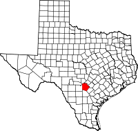 | |
| Towns | ||
| CDPs | ||
| Other unincorporated communities | ||
| Footnotes | ‡This populated place also has portions in an adjacent county or counties | |