Leith, North Dakota
| Leith, North Dakota | |
|---|---|
| City | |
|
Leith in 2009 | |
 Location within Grant County and North Dakota | |
| Coordinates: 46°21′32″N 101°38′10″W / 46.35889°N 101.63611°WCoordinates: 46°21′32″N 101°38′10″W / 46.35889°N 101.63611°W[1] | |
| Country | United States |
| State | North Dakota |
| County | Grant |
| Government | |
| • Mayor | Ryan Schock |
| Area | |
| • Total | 1.24 sq mi (3.21 km2) |
| • Land | 1.23 sq mi (3.19 km2) |
| • Water | 0.01 sq mi (0.03 km2) |
| Elevation[1] | 2,343 ft (714 m) |
| Population (2010)[2] | |
| • Total | 16 |
| • Estimate (2014)[3] | 16 |
| • Density | 13/sq mi (5.0/km2) |
| Time zone | MST (UTC-7) |
| • Summer (DST) | MDT (UTC-6) |
| ZIP code | 58529 [4] |
| Area code(s) | 701 |
| FIPS code | 38-45860 [1] |
| GNIS feature ID | 1029862 [1] |

Leith (/ˈliːθ/ LEETH) is a city in Grant County, North Dakota, United States.[1] As of the 2010 census, the population was 16.[5]
History
Leith was founded in 1910 along a Milwaukee Road branch line that separated from the railroad's Pacific Extension in McLaughlin, South Dakota, and ran to New England, North Dakota. The name was given by railroad officials and comes from the harbor town of Leith near Edinburgh, Scotland.[6] This line was abandoned in 1984, isolating Leith, as none of the primary highways in the area were constructed to go through the city.
White nationalists
In 2012, after moving to Leith, Craig Cobb began buying up land, at one point, reportedly owning at least 12 plots of land. Craig has expressed a desire to turn the town into a white nationalist community.[7] As a reaction to Cobb, some locals have advocated to disincorporate Leith back into Grant County proper.[8] In November 2013 Cobb was arrested and charged with three counts of terrorizing stemming from an incident in which he confronted another town resident with both a shotgun and a rifle.[9]
Today, Cobb no longer owns any buildings in Leith. He deeded six properties back to the town at no charge and sold off a few others. Three are still owned by other white supremacists, but they have shown little inclination to take up where Cobb left off.[10]
Geography
Leith is located at 46°21′32″N 101°38′10″W / 46.35889°N 101.63611°W (46.358871, -101.636202).[1] According to the United States Census Bureau, the city has a total area of 1.24 square miles (3.21 km2), of which, 1.23 square miles (3.19 km2) is land and 0.01 square miles (0.03 km2) is water.[11] Leith is located approximately 5 miles (8.0 km) southwest of Carson, North Dakota.
Demographics
| Historical population | |||
|---|---|---|---|
| Census | Pop. | %± | |
| 1920 | 158 | — | |
| 1930 | 174 | 10.1% | |
| 1940 | 166 | −4.6% | |
| 1950 | 160 | −3.6% | |
| 1960 | 100 | −37.5% | |
| 1970 | 92 | −8.0% | |
| 1980 | 59 | −35.9% | |
| 1990 | 43 | −27.1% | |
| 2000 | 28 | −34.9% | |
| 2010 | 16 | −42.9% | |
| Est. 2015 | 16 | [12] | 0.0% |
| U.S. Decennial Census[13] 2014 Estimate[3] | |||
2010 census
As of the census[2] of 2010, there were 16 people, 8 households, and 5 families residing in the city. The population density was 13.0 inhabitants per square mile (5.0/km2). There were 18 housing units at an average density of 14.6 per square mile (5.6/km2). The racial makeup of the city was 93.8% White and 6.3% African American (each person makes up 6.3% of the population).
There were 8 households of which 12.5% had children under the age of 18 living with them, 50.0% were married couples living together, 12.5% had a female householder with no husband present, and 37.5% were non-families. 37.5% of all households were made up of individuals and 25% had someone living alone who was 65 years of age or older. The average household size was 2.00 and the average family size was 2.60.
The median age in the city was 55 years. 12.5% of residents were under the age of 18; 0.0% were between the ages of 18 and 24; 25% were from 25 to 44; 31.4% were from 45 to 64; and 31.3% were 65 years of age or older. The gender makeup of the city was 50.0% male and 50.0% female.
2000 census
As of the census of 2000, there were 28 people, 14 households, and 7 families residing in the city. The population density was 22.7 people per square mile (8.8/km²). There were 21 housing units at an average density of 17.0 per square mile (6.6/km²). The racial makeup of the city was 100.00% White.
There were 14 households out of which none had children under the age of 18 living with them, 50.0% were married couples living together, 7.1% had a female householder with no husband present, and 42.9% were non-families. 42.9% of all households were made up of individuals and 21.4% had someone living alone who was 65 years of age or older. The average household size was 2.00 and the average family size was 2.75.
In the city the population was spread out with 10.7% under the age of 18, 3.6% from 18 to 24, 35.7% from 25 to 44, 21.4% from 45 to 64, and 28.6% who were 65 years of age or older. The median age was 43 years. For every 100 females there were 86.7 males. For every 100 females age 18 and over, there were 92.3 males.
The median income for a household in the city was $12,031, and the median income for a family was $21,250. Males had a median income of $16,250 versus $13,750 for females. The per capita income for the city was $8,171. There were 55.6% of families and 51.2% of the population living below the poverty line, including 100.0% of under eighteens and 20.0% of those over 64.
References
- 1 2 3 4 5 6 Geographic Names Information System (GNIS) details for Leith, North Dakota; United States Geological Survey (USGS); February 13, 1980.
- 1 2 "American FactFinder". United States Census Bureau. Retrieved 2012-06-14.
- 1 2 "Population Estimates". United States Census Bureau. Retrieved July 3, 2015.
- ↑ United States Postal Service (2012). "USPS - Look Up a ZIP Code". Retrieved 2012-02-15.
- ↑ "2010 Census Redistricting Data (Public Law 94-171) Summary File". American FactFinder. United States Census Bureau. Retrieved 2 May 2011.
- ↑ Wick, Douglas A. "Leith (Grant County)". North Dakota Place Names. Retrieved 7 May 2011.
- ↑ "More white supremacists move to Leith". Bismarck Tribune. October 23, 2013.
- ↑ Community plans to counter supremacist on mission to create 'white only' town; CNN; September 21, 2013.
- ↑ Alman, Ashley. "Craig Cobb, White Supremacist, Arrested On 3 Counts Of Terrorizing". Huffington Post. Retrieved 13 March 2016.
- ↑ Southern Poverty Law Center-Craig Cobb
- ↑ "US Gazetteer files 2010". United States Census Bureau. Retrieved 2012-06-14.
- ↑ "Annual Estimates of the Resident Population for Incorporated Places: April 1, 2010 to July 1, 2015". Retrieved July 2, 2016.
- ↑ United States Census Bureau. "Census of Population and Housing". Retrieved August 23, 2013.
External links
Municipalities and communities of Grant County, North Dakota, United States | ||
|---|---|---|
| Cities | 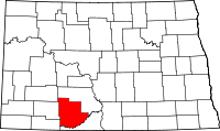 | |
| Townships |
| |
| CDPs | ||
| Unorganized territories |
| |
| Unincorporated communities | ||
| Ghost town | ||
| Counties | 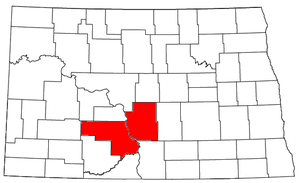 | |
|---|---|---|
| Core cities | ||
| Surrounding areas |
| |