Leesville, Louisiana
| Leesville, Louisiana | |
| City | |
| Motto: "Best Hometown in the Army" [1] | |
| Country | United States |
|---|---|
| State | Louisiana |
| Parish | Vernon |
| Elevation | 254 ft (77.4 m) |
| Coordinates | 31°08′37″N 93°16′16″W / 31.14361°N 93.27111°WCoordinates: 31°08′37″N 93°16′16″W / 31.14361°N 93.27111°W |
| Area | 5.49 sq mi (14.2 km2) |
| - land | 5.45 sq mi (14 km2) |
| - water | 0.04 sq mi (0 km2), 0.73% |
| Population | 6,612 (2010) |
| Density | 1,238.7/sq mi (478.3/km2) |
| Mayor | Richard "Rick" Allen (No party)
City Council, District 1: Chris Robertson (R) |
| Timezone | CST (UTC-6) |
| - summer (DST) | CDT (UTC-5) |
| ZIP code | 71446, 71459 |
| Area code | 337 |
 Location in Vernon Parish and the state of Louisiana. | |
.svg.png) Location of Louisiana in the United States | |
| Website: City of Leesville, Louisiana | |
Leesville is a small city and the parish seat of Vernon Parish, Louisiana, United States.[2] The population was 6,612 at the 2010 United States Census. It is part of the Fort Polk South Micropolitan Statistical Area. The city is home to the Fort Polk U.S. Army installation. The populations of Fort Polk and Leesville, if combined, would result in a city with a population of more than 20,000.
Geography
Leesville is located at 31°8′37″N 93°16′16″W / 31.14361°N 93.27111°W (31.143553, -93.271196)[3] and has an elevation of 254 feet (77.4 m).[4]
According to the United States Census Bureau, the city has a total area of 5.49 square miles (14.2 km2), of which 5.45 square miles (14.1 km2) is land and 0.04 square miles (0.10 km2) (0.55%) is water.
Climate
This climatic region is typified by hot, humid summers and mild winters. According to the Köppen Climate Classification system, Leesville has a humid subtropical climate, abbreviated "Cfa" on climate maps.[5]
| Climate data for Leesville, Louisiana | |||||||||||||
|---|---|---|---|---|---|---|---|---|---|---|---|---|---|
| Month | Jan | Feb | Mar | Apr | May | Jun | Jul | Aug | Sep | Oct | Nov | Dec | Year |
| Average high °C (°F) | 16 (60) |
18 (64) |
22 (71) |
26 (78) |
29 (85) |
32 (90) |
34 (93) |
34 (93) |
31 (88) |
27 (80) |
21 (70) |
17 (62) |
26 (78) |
| Average low °C (°F) | 3 (38) |
5 (41) |
8 (47) |
12 (54) |
16 (61) |
20 (68) |
21 (70) |
21 (69) |
18 (64) |
12 (53) |
7 (45) |
4 (39) |
12 (54) |
| Average precipitation cm (inches) | 13 (5) |
11.7 (4.6) |
11.9 (4.7) |
11.9 (4.7) |
13.2 (5.2) |
11.7 (4.6) |
11.4 (4.5) |
9.7 (3.8) |
9.7 (3.8) |
9.9 (3.9) |
13 (5) |
14.7 (5.8) |
141.2 (55.6) |
| Source: Weatherbase [6] | |||||||||||||
Demographics
| Historical population | |||
|---|---|---|---|
| Census | Pop. | %± | |
| 1900 | 1,148 | — | |
| 1910 | 2,043 | 78.0% | |
| 1920 | 2,518 | 23.3% | |
| 1930 | 3,291 | 30.7% | |
| 1940 | 2,829 | −14.0% | |
| 1950 | 670 | −76.3% | |
| 1960 | 46,894 | 6,899.1% | |
| 1970 | 8,928 | −81.0% | |
| 1980 | 9,054 | 1.4% | |
| 1990 | 7,638 | −15.6% | |
| 2000 | 6,753 | −11.6% | |
| 2010 | 6,612 | −2.1% | |
| Est. 2015 | 6,333 | [7] | −4.2% |
As of the census[9] of 2000, there were 6,753 people, 2,841 households, and 1,650 families residing in the city. The population density was 1,238.7 people per square mile (478.4/km²). There were 3,389 housing units at an average density of 621.7 per square mile (240.1/km²). The racial makeup of the city was 55.49% White, 35.33% African American, 1.47% Native American, 2.09% Asian, 0.56% Pacific Islander, 2.25% from other races, and 2.81% from two or more races. Hispanic or Latino of any race were 4.92% of the population.
There were 2,841 households out of which 29.0% had children under the age of 18 living with them, 36.2% were married couples living together, 18.3% had a female householder with no husband present, and 41.9% were non-families. Nearly 36.7% of all households were made up of individuals, and 11.4% had someone living alone who was 65 years of age or older. The average household size was 2.29 and the average family size was 3.02.
In the city the population was spread out with 26.1% under the age of 18, 11.0% from 18 to 24, 28.6% from 25 to 44, 20.5% from 45 to 64, and 13.9% who were 65 years of age or older. The median age was 34 years. For every 100 females there were 96.0 males. For every 100 females age 18 and over, there were 91.4 males.
The median income for a household in the city was $23,864, and the median income for a family was $30,435. Males had a median income of $27,267 versus $21,661 for females. The per capita income for the city was $14,360. About 24.5% of families and 28.7% of the population were below the poverty line, including 42.0% of those under age 18 and 15.1% of those age 65 or over.
Education
The Vernon Parish School District operates public schools:
- Pickering elementary school k-4
- Pickering Middle School 5th and 6th grade
- Pickering Jr High 7th and 8th grade
- Pickering High School 9-12
- West Leesville Elementary School: K-4
- East Leesville Elementary School: K-4
- Vernon Middle School: 5th and 6th grade
- Leesville Jr. High: 7th and 8th grade
- Leesville High School: 9th through 12th grade
The Vernon Parish Public Library operates the Main Library and the Dunbar Branch Library.[10]
Notable people
- Bert A. Adams, state representative from Vernon Parish from 1956 to 1968[11]
- James Armes, Louisiana state representative for Beauregard and Vernon parishes since 2008; former member of the Vernon Parish School Board and landscape contractor in Leesville[12]
- Michael Ford (American football), LSU runningback[13]
- Eddie Fuller - National Football League player, running back with the Buffalo Bills, also played for Louisiana State University and was part of the play which became known as the "Earthquake game".[14]
- Bo Harris - American football linebacker in the NFL, played with the Cincinnati Bengals [15]
- Carolyn Huntoon - NASA scientist, first woman director of the Johnson Space Center[16]
- Buddy Leach - Politician, former member of the United States House of Representatives from Louisiana's 4th congressional district, Louisiana House of Representatives, and Louisiana Democratic state chairman; unsuccessful candidate for state treasurer in 1987, governor in 2003, and for the Louisiana State Senate in 2007; brother of Carolyn Huntoon
- Demond Mallet - Professional basketball player, guard. Played in the German League and currently with Spanish Joventut Badalona.
- Kevin Mawae - National Football League All-Pro Center for the Tennessee Titans
- Jim Mitchell - horse breeder and judge of the Louisiana 30th Judicial District Court in Leesville from 2009 until his death in 2015.[17]
- Keith Munyan - Born in Leesville in 1961 but moved away as a toddler, he is a Los Angeles photographer known for his multiple celebrity clients.
- D'Anthony Smith National Football League Born in Berlin, Germany, but spent his teen years in Leesville while family was stationed at Fort Polk. Attended Pickering High School in Pickering Louisiana and Louisiana Tech. Currently plays for the Jacksonville Jaguars
- John R. Smith, state senator, former state representative, and former president of the Vernon Parish Police Jury
References
- ↑ "City of Leesville, Louisiana". City of Leesville, Louisiana. Retrieved August 26, 2012.
- ↑ "Find a County". National Association of Counties. Retrieved 2011-06-07.
- ↑ "US Gazetteer files: 2010, 2000, and 1990". United States Census Bureau. 2011-02-12. Retrieved 2011-04-23.
- ↑ "US Board on Geographic Names". United States Geological Survey. 2007-10-25. Retrieved 2008-01-31.
- ↑ Climate Summary for Leesville, Louisiana
- ↑ "Weatherbase.com". Weatherbase. 2013. Retrieved on October 8, 2013.
- ↑ "Annual Estimates of the Resident Population for Incorporated Places: April 1, 2010 to July 1, 2015". Retrieved July 2, 2016.
- ↑ "Census of Population and Housing". Census.gov. Retrieved June 4, 2015.
- ↑ "American FactFinder". United States Census Bureau. Retrieved 2008-01-31.
- ↑ "Sexual Predator Policy." (Archive) Vernon Parish Library. Retrieved on March 23, 2013.
- ↑ "Membership in the Louisiana House of Representatives, 1812-2016: Vernon Parish" (PDF). house.louisiana.gov. Retrieved October 22, 2014.
- ↑ "James Armes, III's Biography". ProJect Vote Smart. Retrieved April 20, 2015.
- ↑ "Michael Ford #42". LSU Football. Retrieved November 26, 2012.
- ↑ "Eddie Jerome Fuller". databaseFootball.com. Retrieved November 26, 2012.
- ↑ "Bo Harris". databaseFootball.com. Retrieved November 26, 2012.
- ↑ "Carolyn L. Huntoon". energy.gov. Retrieved November 30, 2013.
- ↑ "Obituary: Judge James "Jim" Mitchell". Leesville Daily Leader. Retrieved July 26, 2015.
External links
- City of Leesville
- Official site of KVVP radio station
Municipalities and communities of Vernon Parish, Louisiana, United States | ||
|---|---|---|
| Cities | 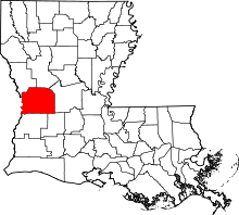 | |
| Towns | ||
| Villages | ||
| CDPs | ||
| Other unincorporated communities | ||