Leerdam
| Leerdam | |||
|---|---|---|---|
| Municipality | |||
|
City walls and Glass Centre | |||
| |||
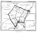
.svg.png) Location in South Holland | |||
| Coordinates: 51°54′N 5°6′E / 51.900°N 5.100°ECoordinates: 51°54′N 5°6′E / 51.900°N 5.100°E | |||
| Country | Netherlands | ||
| Province | South Holland | ||
| Government[1] | |||
| • Body | Municipal council | ||
| • Mayor | Rinus Houtman (SGP) | ||
| Area[2] | |||
| • Total | 34.42 km2 (13.29 sq mi) | ||
| • Land | 33.79 km2 (13.05 sq mi) | ||
| • Water | 0.63 km2 (0.24 sq mi) | ||
| Elevation[3] | 1 m (3 ft) | ||
| Population (May 2014)[4] | |||
| • Total | 20,563 | ||
| • Density | 609/km2 (1,580/sq mi) | ||
| Demonym(s) | Leerdammer | ||
| Time zone | CET (UTC+1) | ||
| • Summer (DST) | CEST (UTC+2) | ||
| Postcode | 4140–4145, 4163 | ||
| Area code | 0345 | ||
| Website |
www | ||


Leerdam (Dutch: [leːrˈdɑm]; population: 20,563 in 2014) is a city and municipality in the western Netherlands, in the province of South Holland.
The municipality covers an area of 34.42 km2 (13.29 sq mi) of which 0.63 km2 (0.24 sq mi) is water. It comprises the town of Leerdam, the rural villages Kedichem, Schoonrewoerd and Oosterwijk. The south border of the town is formed by the river Linge. Leerdam is the most eastern town of the province of South Holland and is situated almost exactly in the middle of the three highways A2, A15 and A27.
History
Leerdam received city rights in 1407. The small river Linge, bordered by beautiful water meadows, defines the atmosphere and tone of the landscape. Several centuries ago Leerdam formed a part of the Vijfheerenlanden domain, before it was raised to the level of County in 1498.
In 1551, Leerdam, together with Acquoy, became property of the House of Orange and part of the County of Holland.
The rich history of Leerdam can be found in well-kept historic buildings such as the Grote Kerk (Great Church), the Hofje van Mevrouw van Aerden (Mrs. Aerden Almshouses, now a museum), the remaining and restored city walls on the Zuidwal and the Oude Raadhuis (Old City Hall).
Gallery
 Leerdam in 1866.
.jpg) Historical map of the Vijfheerenlanden
Historical map of the Vijfheerenlanden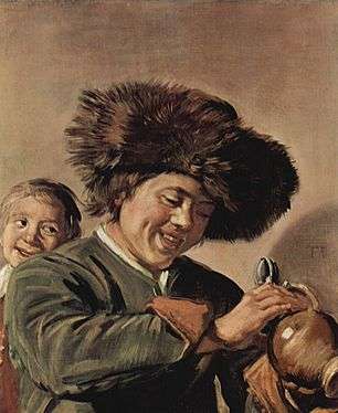 Two laughing boys with mug of beer by Frans Hals; Hofje van Mevrouw van Aerden, Leerdam
Glass industry
Since the 18th century, the town's culture has been strongly influenced by the glass industry and the timber industry. The glass currently manufactured in Leerdam is internationally as known as Royal Leerdam or (particularly in respect of designer glass and glass art) as Royal Leerdam Crystal. This, with the National Glass Museum, the Glass Centre (with its glassblowing and demonstration activities), and several art galleries, make Leerdam a major tourist attraction in the Netherlands.
From Easter until the end of October international glassblowers work in the Glass Centre [5] in Leerdam, which is open to the public.
Public transportation
The Leerdam railway station is situated on the Elst–Dordrecht railway.
Born in Leerdam
- Cornelis Pieter van den Hoek (1921–2015), resistance fighter during World War II
- Jan van Houwelingen (1939–2013), politician
- Manon van Rooijen (born 1982), freestyle swimmer
References
- ↑ "College van burgemeester en wethouders" [Board of mayor and aldermen] (in Dutch). Gemeente Leerdam. Retrieved 7 August 2013.
- ↑ "Kerncijfers wijken en buurten" [Key figures for neighbourhoods]. CBS Statline (in Dutch). CBS. 2 July 2013. Retrieved 12 March 2014.
- ↑ "Postcodetool for 4141DA". Actueel Hoogtebestand Nederland (in Dutch). Het Waterschapshuis. Retrieved 7 August 2013.
- ↑ "Bevolkingsontwikkeling; regio per maand" [Population growth; regions per month]. CBS Statline (in Dutch). CBS. 26 June 2014. Retrieved 24 July 2014.
- ↑ "Glass Centre". Glascentrumleerdam.nl. 2013-12-20. Retrieved 2014-01-30.
External links
| Wikimedia Commons has media related to Leerdam. |
 |
Vianen (UT) | Culemborg (GE) | | |
| Zederik | |
Geldermalsen (GE) | ||
| ||||
| | ||||
| Giessenlanden | Linge Lingewaard (GE) |
