LeRoy, Kansas
| LeRoy, Kansas | |
|---|---|
| City | |
 Location within Coffey County and Kansas | |
 KDOT map of Coffey County (legend) | |
| Coordinates: 38°5′2″N 95°37′59″W / 38.08389°N 95.63306°WCoordinates: 38°5′2″N 95°37′59″W / 38.08389°N 95.63306°W | |
| Country | United States |
| State | Kansas |
| County | Coffey |
| Area[1] | |
| • Total | 0.83 sq mi (2.15 km2) |
| • Land | 0.82 sq mi (2.12 km2) |
| • Water | 0.01 sq mi (0.03 km2) |
| Elevation | 1,004 ft (306 m) |
| Population (2010)[2] | |
| • Total | 561 |
| • Estimate (2012[3]) | 555 |
| • Density | 680/sq mi (260/km2) |
| Time zone | Central (CST) (UTC-6) |
| • Summer (DST) | CDT (UTC-5) |
| ZIP code | 66857 |
| Area code | 620 |
| FIPS code | 20-39650 [4] |
| GNIS feature ID | 0478086 [5] |
| Website | leroykansas.com |
LeRoy is a city in Coffey County, Kansas, United States. As of the 2010 census, the city population was 561.[6]
History
LeRoy was founded in 1855. It was named after the city of Le Roy, Illinois.[7]
The first post office in LeRoy (a name also spelled historically as Leroy) was established in 1856.[8]
During the Civil War the town had a military post from 1861 to 1864. LeRoy's post was one of a number of posts in eastern Kansas that existed to guard against Confederate guerrilla attacks and attacks by unfriendly Indians. On May 22, 1862, the 1st Regiment, Indian Home Guard was organized at Le Roy.
Geography
LeRoy is located at 38°5′2″N 95°37′59″W / 38.08389°N 95.63306°W (38.083958, -95.633139).[9] According to the United States Census Bureau, the city has a total area of 0.83 square miles (2.15 km2), of which 0.82 square miles (2.12 km2) is land and 0.01 square miles (0.03 km2) is water.[1]
Climate
The climate in this area is characterized by hot, humid summers and generally mild to cool winters. According to the Köppen Climate Classification system, LeRoy has a humid subtropical climate, abbreviated "Cfa" on climate maps.[10]
Demographics
| Historical population | |||
|---|---|---|---|
| Census | Pop. | %± | |
| 1860 | 222 | — | |
| 1870 | 410 | 84.7% | |
| 1880 | 545 | 32.9% | |
| 1890 | 893 | 63.9% | |
| 1900 | 772 | −13.5% | |
| 1910 | 861 | 11.5% | |
| 1920 | 815 | −5.3% | |
| 1930 | 788 | −3.3% | |
| 1940 | 751 | −4.7% | |
| 1950 | 695 | −7.5% | |
| 1960 | 601 | −13.5% | |
| 1970 | 551 | −8.3% | |
| 1980 | 701 | 27.2% | |
| 1990 | 568 | −19.0% | |
| 2000 | 593 | 4.4% | |
| 2010 | 561 | −5.4% | |
| Est. 2015 | 548 | [11] | −2.3% |
| U.S. Decennial Census | |||
2010 census
As of the census[2] of 2010, there were 561 people, 230 households, and 156 families residing in the city. The population density was 684.1 inhabitants per square mile (264.1/km2). There were 269 housing units at an average density of 328.0 per square mile (126.6/km2). The racial makeup of the city was 97.9% White, 0.2% Native American, 0.2% Asian, and 1.8% from two or more races. Hispanic or Latino of any race were 1.6% of the population.
There were 230 households of which 33.0% had children under the age of 18 living with them, 53.5% were married couples living together, 10.9% had a female householder with no husband present, 3.5% had a male householder with no wife present, and 32.2% were non-families. 29.1% of all households were made up of individuals and 10.4% had someone living alone who was 65 years of age or older. The average household size was 2.44 and the average family size was 2.99.
The median age in the city was 40.9 years. 26.2% of residents were under the age of 18; 6.1% were between the ages of 18 and 24; 22% were from 25 to 44; 29.8% were from 45 to 64; and 15.9% were 65 years of age or older. The gender makeup of the city was 50.4% male and 49.6% female.
2000 census
As of the census[4] of 2000, there were 593 people, 239 households, and 162 families residing in the city. The population density was 704.6 people per square mile (272.6/km²). There were 268 housing units at an average density of 318.4 per square mile (123.2/km²). The racial makeup of the city was 97.13% White, 0.17% Native American, and 2.70% from two or more races. Hispanic or Latino of any race were 1.01% of the population.
There were 239 households out of which 33.5% had children under the age of 18 living with them, 54.4% were married couples living together, 9.6% had a female householder with no husband present, and 32.2% were non-families. 29.3% of all households were made up of individuals and 14.2% had someone living alone who was 65 years of age or older. The average household size was 2.48 and the average family size was 3.06.
In the city the population was spread out with 28.3% under the age of 18, 7.3% from 18 to 24, 30.0% from 25 to 44, 20.7% from 45 to 64, and 13.7% who were 65 years of age or older. The median age was 36 years. For every 100 females there were 96.4 males. For every 100 females age 18 and over, there were 90.6 males.
The median income for a household in the city was $30,341, and the median income for a family was $39,375. Males had a median income of $25,469 versus $19,886 for females. The per capita income for the city was $15,034. About 6.6% of families and 10.3% of the population were below the poverty line, including 11.5% of those under age 18 and 15.8% of those age 65 or over.
Notable person
- Bill Otto, Kansas State Representative
See also
References
- 1 2 "US Gazetteer files 2010". United States Census Bureau. Retrieved 2012-07-06.
- 1 2 "American FactFinder". United States Census Bureau. Retrieved 2012-07-06.
- ↑ "Population Estimates". United States Census Bureau. Retrieved 2013-05-29.
- 1 2 "American FactFinder". United States Census Bureau. Retrieved 2008-01-31.
- ↑ "US Board on Geographic Names". United States Geological Survey. 2007-10-25. Retrieved 2008-01-31.
- ↑ "2010 City Population and Housing Occupancy Status". U.S. Census Bureau. Retrieved February 3, 2012.
- ↑ Kansas State Historical Society (1916). Biennial Report of the Board of Directors of the Kansas State Historical Society. Kansas State Printing Plant. p. 165.
- ↑ "Kansas Post Offices, 1828-1961 (archived)". Kansas Historical Society. Archived from the original on October 9, 2013. Retrieved 6 June 2014.
- ↑ "US Gazetteer files: 2010, 2000, and 1990". United States Census Bureau. 2011-02-12. Retrieved 2011-04-23.
- ↑ Climate Summary for LeRoy, Kansas
- ↑ "Annual Estimates of the Resident Population for Incorporated Places: April 1, 2010 to July 1, 2015". Retrieved July 2, 2016.
External links
| Wikimedia Commons has media related to LeRoy, Kansas. |
- City
- Schools
- USD 245, local school district
- Maps
- LeRoy City Map, KDOT
Municipalities and communities of Coffey County, Kansas, United States | ||
|---|---|---|
| Cities | 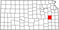 | |
| Unincorporated communities |
| |
| Townships | ||