Lawndale, California
| Lawndale, California | |||
|---|---|---|---|
| City | |||
| City of Lawndale | |||
| |||
| Motto: "Heart of the South Bay" | |||
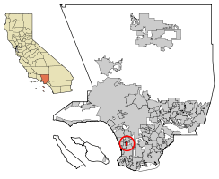 Location of Lawndale in Los Angeles County, California | |||
 Lawndale, California Location in the United States | |||
| Coordinates: 33°53′12″N 118°21′13″W / 33.88667°N 118.35361°WCoordinates: 33°53′12″N 118°21′13″W / 33.88667°N 118.35361°W | |||
| Country |
| ||
| State |
| ||
| County |
| ||
| Incorporated | December 28, 1959[1] | ||
| Government | |||
| • City Council[2] |
Mayor Robert Pullen-Miles Mayor Pro Tem Pat Kearney James H. Osborne Dan Reid Bernadette Suarez | ||
| • City manager | Steve Mandoki[3] | ||
| Area[4] | |||
| • Total | 1.974 sq mi (5.113 km2) | ||
| • Land | 1.974 sq mi (5.113 km2) | ||
| • Water | 0 sq mi (0 km2) 0% | ||
| Elevation[5] | 59 ft (18 m) | ||
| Population (April 1, 2010)[6] | |||
| • Total | 32,769 | ||
| • Estimate (2013)[6] | 33,230 | ||
| • Density | 17,000/sq mi (6,400/km2) | ||
| Time zone | PST (UTC-8) | ||
| • Summer (DST) | PDT (UTC-7) | ||
| ZIP Code | 90260, 90261[7] | ||
| Area code(s) | 310/424[8] | ||
| FIPS code | 06-40886 | ||
| GNIS feature IDs | 1652742. 2411637 | ||
| Website |
www | ||

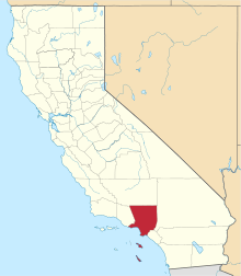
Lawndale is a city in Los Angeles County, California, United States. The population was 32,769 at the 2010 census, up from 31,711 according to the 2000 census.[9] The city is in the South Bay region of the Greater Los Angeles Area.
History
From the 1780s onward, the area that is now Lawndale was part of the Rancho Sausal Redondo, a land grant given by the Spanish colonial government that includes much of what is now the South Bayshore region.[10] In 1905 Charles B. Hopper first subdivided the area and named it after the Chicago neighborhood of the same name. Lots sold slowly and different promotions were tried such as promoting Lawndale as a chicken raising area. The first railway to run through Lawndale was the Inglewood Division of the Redondo Railway which would later become part of the Pacific Electric "Red Car" system. It ran down the middle of Railway Ave. (now Hawthorne Blvd.) until 1933. In 1927 the Santa Fe railroad arrived. After World War II, the immense demand for housing from returning veterans and California newcomers resulted in Lawndale's formation as a bedroom community. On December 28, 1959 it was incorporated as a city in Los Angeles county.
Starting in the 1970s Lawndale's relatively low housing prices but more desirable location relative to its neighboring cities attracted absentee landlords and a substantial portion of its residents increasingly became renters.
For a time in the 1980s, with new cycle of expansion of defense industry nearby, many young people who wished to live in the Beach Cities found that they simply could not afford to do so, and settled in less glamorous inland cities such as Lawndale. But with the contraction of this industry after the cold war, Lawndale reverted to its previous pattern. Lawndale has attempted to attract more owner–residents, as well as tourists with the 2003 completion of the "Beautify Lawndale" urban renewal project along the city's stretch of Hawthorne Boulevard (State Route 107), a major South Bay thoroughfare.
A large electronic billboard was installed and began running advertising in 2004 until it was realized that the sign violated a city ordinance prohibiting advertising of out-of-town businesses on signs of that nature. For its first 18 months the sign was sponsored by Fox and promoted upcoming television shows and movies under the Fox label. It also later gained and lost a sponsorship with Acura before its current sponsorship for Los Angeles radio station 100.3 – The Sound. The billboard is said to generate Lawndale $200,000 annually.[11] In 2012 the Lawndale community center opened up its doors.
Roy Rogers lived there for a time and Fred Dryer was raised there.
Economy
Top employers
According to the City's 2009 Comprehensive Annual Financial Report,[12] the top employers in the city are:
| # | Employer | # of Employees |
|---|---|---|
| 1 | City of Lawndale | 105 |
| 2 | Top Valu Market | 91 |
| 3 | La Vida Medical Group | 82 |
| 4 | American Drilling Company | 68 |
| 5 | Big Saver Foods | 66 |
| 6 | McDonald's | 60 |
| 7 | Carbro | 56 |
| 8 | Guitar Center | 47 |
| 9 | El Pollo Inka | 44 |
| 10 | WEMS | 42 |
| 11 | Property Prep | 41 |
| 12 | Advanced Veterinary Care Center | 40 |
| 13 | Spires Restaurant | 36 |
| 14 | 99 Cents Only Store | 36 |
| 15 | Westwood Building Materials | 32 |
Media
Lawndale Community Cable Television on Channel 22 is a Public-access television cable TV station. The City of Lawndale's Cable Television Department is funded by the Lawndale Cable Usage Corporation and the City of Lawndale through Local Access Fees and Cable television franchise fee provided by the local cable company, Time Warner Cable. The Lawndale Cable Usage Corporation is the non-profit, California corporation that receives these fees, and provides for the development of Lawndale Community Cable Television.[13]
The Lawndalian a citywide newsletter that informs the residents about programs and events happening in the City of Lawndale. The Lawndalian is now available Online at the city's website.[14]
The Lawndale Tribune is the community paper for the City of Lawndale.
Government
Municipal government
Harold Hofmann served as mayor for 23 years, due to there not being city term limits and running unopposed in most elections.[15][16]
State and federal representation
In the California State Legislature, Lawndale is in the 35th Senate District, represented by Democrat Steven Bradford, and in the 62nd Assembly District, represented by Democrat Autumn Burke.[17]
In the United States House of Representatives, Lawndale is in California's 43rd congressional district, which has a Cook PVI of D +26[18] and is represented by Democrat Maxine Waters.[19]
Infrastructure
The Los Angeles County Sheriff's Department (LASD) operates the Lennox Station in Lennox, serving Lawndale.[20][21] In addition the agency operates the City of Lawndale Sheriff's Department Service Center.[22]
The United States Postal Service Lawndale Post Office is located at 4320 Marine Avenue.[23]
The Los Angeles County Department of Health Services operates the Curtis Tucker Health Center in Inglewood, serving Lawndale.[24]
Education
Lawndale Elementary School District
- Will Rogers Middle School serving 6th, 7th and 8th grades
- Jane Addams Middle School serving 6th, 7th, and 8th grades.
- F.D.R Elementary School
- William Anderson Elementary School
- William Green Elementary School
- Mark Twain Elementary School
- Billy Mitchell Elementary School
- Lucille J. Smith Elementary School
Centinela Valley Union High School District
- Lawndale High School
- Leuzinger High School
- Hawthorne High School
- Lloyde High School [25]
Environmental Charter High School is a charter school in Lawndale. Serving 9th, 10th, 11, and 12th grade.
The newly built Lawndale Public Library of the County of Los Angeles Public Library is located adjacent to Lawndale City Hall[26]
Geography
According to the United States Census Bureau, the city has a total area of 2.0 square miles (5.2 km2), all land.
Lawndale is bordered by Redondo Beach on the west and southwest, Hawthorne on the north, Torrance on the southeast, and unincorporated area of El Camino Village (also known as Alondra Park) on the east.
Lawndale is serviced by Interstate 405 and by Artesia Blvd., Hwy 91, which becomes State Route 91, a freeway, farther east. Lawndale is 5.7 miles SE of Los Angeles International Airport.
Lawndale is serviced by following public transit: the Lawndale Beat, the Gardena Bus 1, Metro Green Line and by Metro buses 211, 40 and 740.
The weather is nice and warm all year long. In the winter there are moderate rains. Because of the formation of the Palos Verdes Peninsula and its proximity to the beach, the city gets effects of the marine layer on almost identical, if not slightly lower levels of nearby beach cities Manhattan Beach and El Segundo.[27]
Demographics
| Historical population | |||
|---|---|---|---|
| Census | Pop. | %± | |
| 1930 | 3,119 | — | |
| 1940 | 2,885 | −7.5% | |
| 1950 | 4,364 | 51.3% | |
| 1960 | 16,058 | 268.0% | |
| 1970 | 24,825 | 54.6% | |
| 1980 | 23,460 | −5.5% | |
| 1990 | 27,331 | 16.5% | |
| 2000 | 31,711 | 16.0% | |
| 2010 | 32,769 | 3.3% | |
| Est. 2015 | 33,430 | [28] | 2.0% |
2010
The 2010 United States Census[30] reported that Lawndale had a population of 32,769. The population density was 16,599.0 people per square mile (6,408.9/km²). The racial makeup of Lawndale was 14,274 (43.6%) White (16.2% Non-Hispanic White),[31] 3,320 (10.1%) African American, 301 (0.9%) Native American, 3,269 (10.0%) Asian, 367 (1.1%) Pacific Islander, 9,374 (28.6%) from other races, and 1,864 (5.7%) from two or more races. Hispanic or Latino of any race were 20,002 persons (61.0%).
The Census reported that 32,594 people (99.5% of the population) lived in households, 158 (0.5%) lived in non-institutionalized group quarters, and 17 (0.1%) were institutionalized.
There were 9,681 households, out of which 4,516 (46.6%) had children under the age of 18 living in them, 4,467 (46.1%) were opposite-sex married couples living together, 1,813 (18.7%) had a female householder with no husband present, 881 (9.1%) had a male householder with no wife present. There were 722 (7.5%) unmarried opposite-sex partnerships, and 64 (0.7%) same-sex married couples or partnerships. 1,758 households (18.2%) were made up of individuals and 442 (4.6%) had someone living alone who was 65 years of age or older. The average household size was 3.37. There were 7,161 families (74.0% of all households); the average family size was 3.84.
The population was spread out with 8,927 people (27.2%) under the age of 18, 3,744 people (11.4%) aged 18 to 24, 10,541 people (32.2%) aged 25 to 44, 7,301 people (22.3%) aged 45 to 64, and 2,256 people (6.9%) who were 65 years of age or older. The median age was 31.9 years. For every 100 females there were 101.3 males. For every 100 females age 18 and over, there were 100.6 males.
There were 10,151 housing units at an average density of 5,141.9 per square mile (1,985.3/km²), of which 3,326 (34.4%) were owner-occupied, and 6,355 (65.6%) were occupied by renters. The homeowner vacancy rate was 1.7%; the rental vacancy rate was 3.8%. 11,606 people (35.4% of the population) lived in owner-occupied housing units and 20,988 people (64.0%) lived in rental housing units.
According to the 2010 United States Census, Lawndale had a median household income of $47,769, with 16.7% of the population living below the federal poverty line.[31]
2000
As of the census[32] of 2000, there were 31,711 people, 9,555 households, and 7,022 families residing in the city. The population density was 16,036.7 inhabitants per square mile (6,183.7/km²). There were 9,869 housing units at an average density of 4,990.9 per square mile (1,924.5/km²). The racial makeup of the city was 42.24% White, 12.61% African American, 0.99% Native American, 9.63% Asian, 0.91% Pacific Islander, 27.07% from other races, and 6.55% from two or more races. Hispanic or Latino of any race were 52.08% of the population.
There were 9,555 households out of which 45.5% had children under the age of 18 living with them, 45.8% were married couples living together, and 26.5% were non-families. 18.8% of all households were made up of individuals and 4.5% had someone living alone who was 65 years of age or older. The average household size was 3.31 and the average family size was 3.80.
In the city the population was spread out with 31.9% under the age of 18, 10.2% from 18 to 24, 35.8% from 25 to 44, 16.4% from 45 to 64, and 5.6% who were 65 years of age or older. The median age was 29 years. For every 100 females there were 102.3 males. For every 100 females age 18 and over, there were 99.1 males.
The median income for a household in the city was $39,012, and the median income for a family was $37,909. Males had a median income of $29,033 versus $29,025.00 for females. The per capita income for the city was $13,702. About 14.3% of families and 17.3% of the population were below the poverty line, including 22.4% of those under age 18 and 6.6% of those age 65 or over.
Since Lawndale has a large amount of elderly residents, the city provides free trips for seniors on its city bus: The Lawndale Beat. The city also provides a meals on wheels program as well as a seniors travel club.
Notable people
- Fred Dryer, NFL player and actor, raised in Lawndale in the 1950s, Lawndale High School alumnus
- Russell Westbrook, NBA player, attended high school in Lawndale (Leuzinger High School)
- Traci Lords, actress
International relations
Sister cities
![]() Cagayan de Oro City, Philippines (1986)
Cagayan de Oro City, Philippines (1986)
References
- ↑ "California Cities by Incorporation Date" (Word). California Association of Local Agency Formation Commissions. Retrieved August 25, 2014.
- ↑ "City Council". City of Lawndale. Retrieved December 7, 2014.
- ↑ "City Manager's Office". City of Lawndale. Retrieved March 8, 2015.
- ↑ "2010 Census U.S. Gazetteer Files – Places – California". United States Census Bureau.
- ↑ "Lawndale". Geographic Names Information System. United States Geological Survey. Retrieved October 11, 2014.
- 1 2 "Lawndale (city) QuickFacts". United States Census Bureau. Retrieved April 16, 2015.
- ↑ "USPS – ZIP Code Lookup – Find a ZIP+ 4 Code By City Results". Retrieved 2007-01-18.
- ↑ "Number Administration System – NPA and City/Town Search Results". Retrieved 2007-01-18.
- ↑ United States Census Bureau. “.”
- ↑ Lawndale Official Website. “.”
- ↑ http://www.dailybreeze.com/ci_9858571
- ↑ City of Lawndale CAFR
- ↑ http://www.lawndalecity.org/html/depthtml/cable/cabletv.htm
- ↑ http://www.lawndalecity.org/html/lawndln.htm
- ↑ Lawndale's Mayor Hofmann begins his 12th term
- ↑ 22-year Lawndale Mayor Harold Hofmann dies at 81
- ↑ "Statewide Database". UC Regents. Retrieved December 7, 2014.
- ↑ "Partisan Voting Index: Districts of the 113th Congress" (PDF). Cook Political Report. Retrieved October 20, 2014.
- ↑ "California's 43rd Congressional District - Representatives & District Map". Civic Impulse, LLC.
- ↑ "Lennox Station." Los Angeles County Sheriff's Department. Retrieved on January 21, 2010.
- ↑ "Lenox CDP." U.S. Census Bureau. Retrieved on January 21, 2010.
- ↑ "City of Lawndale Sheriff's Department Service Center." Los Angeles County Sheriff's Department. Retrieved on January 21, 2010.
- ↑ "Post Office Location – LAWNDALE." United States Postal Service. Retrieved on December 6, 2008.
- ↑ "Curtis Tucker Health Center." Los Angeles County Department of Health Services. Retrieved on March 18, 2010.
- ↑ http://lloyde.centinela.k12.ca.us/
- ↑ http://www.colapublib.org/libs/lawndale/
- ↑ http://maps.ask.com/maps?qsrc=265
- ↑ "Annual Estimates of the Resident Population for Incorporated Places: April 1, 2010 to July 1, 2015". Retrieved July 2, 2016.
- ↑ "Census of Population and Housing". Census.gov. Retrieved June 4, 2015.
- ↑ "2010 Census Interactive Population Search: CA - Lawndale city". U.S. Census Bureau. Retrieved July 12, 2014.
- 1 2 http://quickfacts.census.gov/qfd/states/06/0640886.html. Missing or empty
|title=(help) - ↑ "American FactFinder". United States Census Bureau. Retrieved 2008-01-31.