Laura, Ohio
| Laura, Ohio | |
|---|---|
| Village | |
 Location of Laura, Ohio | |
 Location of Laura in Miami County | |
| Coordinates: 39°59′39″N 84°24′28″W / 39.99417°N 84.40778°WCoordinates: 39°59′39″N 84°24′28″W / 39.99417°N 84.40778°W | |
| Country | United States |
| State | Ohio |
| County | Miami |
| Township | Union |
| Area[1] | |
| • Total | 0.27 sq mi (0.70 km2) |
| • Land | 0.27 sq mi (0.70 km2) |
| • Water | 0 sq mi (0 km2) |
| Elevation[2] | 991 ft (302 m) |
| Population (2010)[3] | |
| • Total | 474 |
| • Estimate (2012[4]) | 472 |
| • Density | 1,755.6/sq mi (677.8/km2) |
| Time zone | Eastern (EST) (UTC-5) |
| • Summer (DST) | EDT (UTC-4) |
| ZIP code | 45337 |
| Area code(s) | 937 |
| FIPS code | 39-42028[5] |
| GNIS feature ID | 1048908[2] |
Laura is a village in Miami County, Ohio, United States. The population was 474 at the 2010 census. It is part of the Dayton Metropolitan Statistical Area.
History
Laura was laid out around 1840.[6] A post office called Laura has been in operation since 1850.[7] The village was named after Laura, the first postmaster's daughter.[8] Laura was incorporated as a village in 1892.[8]
Geography
Laura is located at 39°59′39″N 84°24′28″W / 39.99417°N 84.40778°W (39.994064, -84.407894).[9]
According to the United States Census Bureau, the village has a total area of 0.27 square miles (0.70 km2), all land.[1]
Demographics
| Historical population | |||
|---|---|---|---|
| Census | Pop. | %± | |
| 1900 | 378 | — | |
| 1910 | 302 | −20.1% | |
| 1920 | 243 | −19.5% | |
| 1930 | 271 | 11.5% | |
| 1940 | 317 | 17.0% | |
| 1950 | 380 | 19.9% | |
| 1960 | 526 | 38.4% | |
| 1970 | 464 | −11.8% | |
| 1980 | 501 | 8.0% | |
| 1990 | 483 | −3.6% | |
| 2000 | 487 | 0.8% | |
| 2010 | 474 | −2.7% | |
| Est. 2015 | 469 | [10] | −1.1% |
2010 census
As of the census[3] of 2010, there were 474 people, 174 households, and 120 families residing in the village. The population density was 1,755.6 inhabitants per square mile (677.8/km2). There were 185 housing units at an average density of 685.2 per square mile (264.6/km2). The racial makeup of the village was 96.6% White, 1.7% African American, 0.4% Native American, 0.2% Asian, 0.6% from other races, and 0.4% from two or more races. Hispanic or Latino of any race were 1.5% of the population.
There were 174 households of which 30.5% had children under the age of 18 living with them, 54.6% were married couples living together, 8.6% had a female householder with no husband present, 5.7% had a male householder with no wife present, and 31.0% were non-families. 19.0% of all households were made up of individuals and 8% had someone living alone who was 65 years of age or older. The average household size was 2.72 and the average family size was 3.19.
The median age in the village was 38 years. 23.4% of residents were under the age of 18; 10.8% were between the ages of 18 and 24; 24% were from 25 to 44; 28.9% were from 45 to 64; and 12.9% were 65 years of age or older. The gender makeup of the village was 49.8% male and 50.2% female.
2000 census
As of the census[5] of 2000, there were 487 people, 175 households, and 131 families residing in the village. The population density was 1,714.6 people per square mile (671.5/km²). There were 182 housing units at an average density of 640.8 per square mile (251.0/km²). The racial makeup of the village was 97.54% White, 0.21% Native American, 0.21% Asian, 0.41% from other races, and 1.64% from two or more races. Hispanic or Latino of any race were 2.26% of the population.
There were 175 households out of which 41.1% had children under the age of 18 living with them, 60.0% were married couples living together, 8.6% had a female householder with no husband present, and 25.1% were non-families. 17.1% of all households were made up of individuals and 6.9% had someone living alone who was 65 years of age or older. The average household size was 2.78 and the average family size was 3.18.
In the village the population was spread out with 29.2% under the age of 18, 7.8% from 18 to 24, 29.8% from 25 to 44, 24.2% from 45 to 64, and 9.0% who were 65 years of age or older. The median age was 35 years. For every 100 females there were 110.8 males. For every 100 females age 18 and over, there were 101.8 males.
The median income for a household in the village was $45,833, and the median income for a family was $46,250. Males had a median income of $33,542 versus $23,906 for females. The per capita income for the village was $17,912. About 2.7% of families and 2.8% of the population were below the poverty line, including 3.0% of those under age 18 and none of those age 65 or over.
References
- 1 2 "US Gazetteer files 2010". United States Census Bureau. Retrieved 2013-01-06.
- 1 2 "US Board on Geographic Names". United States Geological Survey. 2007-10-25. Retrieved 2008-01-31.
- 1 2 "American FactFinder". United States Census Bureau. Retrieved 2013-01-06.
- ↑ "Population Estimates". United States Census Bureau. Retrieved 2013-06-17.
- 1 2 "American FactFinder". United States Census Bureau. Retrieved 2008-01-31.
- ↑ The History of Miami County, Ohio: Containing a History of the County; Its Cities, Towns, Etc. Windmill Publications. 1880. p. 355.
- ↑ "Miami County". Jim Forte Postal History. Retrieved 9 January 2016.
- 1 2 Harbaugh, T. C. (1909). Centennial history. Troy, Piqua and Miami county, Ohio. Chicago: Richmond-Arnold Publishing Co. p. 93.
- ↑ "US Gazetteer files: 2010, 2000, and 1990". United States Census Bureau. 2011-02-12. Retrieved 2011-04-23.
- ↑ "Annual Estimates of the Resident Population for Incorporated Places: April 1, 2010 to July 1, 2015". Retrieved July 2, 2016.
- ↑ "Census of Population and Housing". Census.gov. Retrieved June 4, 2015.
Municipalities and communities of Miami County, Ohio, United States | ||
|---|---|---|
| Cities | 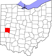 | |
| Villages | ||
| Townships | ||
| Unincorporated communities | ||
| Footnotes | ‡This populated place also has portions in an adjacent county or counties | |