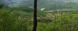
Larrivoire
| Larrivoire | |
|---|---|
 | |
 Larrivoire | |
|
Location within Bourgogne-Franche-Comté region  Larrivoire | |
| Coordinates: 46°20′40″N 5°47′19″E / 46.3444°N 5.7886°ECoordinates: 46°20′40″N 5°47′19″E / 46.3444°N 5.7886°E | |
| Country | France |
| Region | Bourgogne-Franche-Comté |
| Department | Jura |
| Arrondissement | Saint-Claude |
| Canton | Les Bouchoux |
| Government | |
| • Mayor (2014–2020) | Anne-Christine Donzé |
| Area1 | 6.50 km2 (2.51 sq mi) |
| Population (2012)2 | 118 |
| • Density | 18/km2 (47/sq mi) |
| Time zone | CET (UTC+1) |
| • Summer (DST) | CEST (UTC+2) |
| INSEE/Postal code | 39280 / 39360 |
| Elevation | 380–1,010 m (1,250–3,310 ft) |
|
1 French Land Register data, which excludes lakes, ponds, glaciers > 1 km² (0.386 sq mi or 247 acres) and river estuaries. 2 Population without double counting: residents of multiple communes (e.g., students and military personnel) only counted once. | |
Larrivoire is a commune in the Jura department in Franche-Comté in eastern France.
Population
| Historical population | ||
|---|---|---|
| Year | Pop. | ±% |
| 1793 | 86 | — |
| 1806 | 542 | +530.2% |
| 1821 | 285 | −47.4% |
| 1831 | 275 | −3.5% |
| 1841 | 244 | −11.3% |
| 1851 | 234 | −4.1% |
| 1861 | 212 | −9.4% |
| 1872 | 208 | −1.9% |
| 1881 | 223 | +7.2% |
| 1891 | 194 | −13.0% |
| 1901 | 722 | +272.2% |
| 1911 | 158 | −78.1% |
| 1921 | 157 | −0.6% |
| 1931 | 134 | −14.6% |
| 1946 | 54 | −59.7% |
| 1954 | 71 | +31.5% |
| 1962 | 58 | −18.3% |
| 1968 | 48 | −17.2% |
| 1975 | 62 | +29.2% |
| 1982 | 52 | −16.1% |
| 1990 | 101 | +94.2% |
| 1999 | 108 | +6.9% |
| 2006 | 100 | −7.4% |
| 2012 | 118 | +18.0% |
See also
References
| Wikimedia Commons has media related to Larrivoire. |
This article is issued from Wikipedia - version of the 9/22/2015. The text is available under the Creative Commons Attribution/Share Alike but additional terms may apply for the media files.