Laprida Partido
| Laprida Partido de Laprida | |
|---|---|
| Department | |
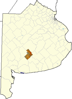 location of Laprida Partido in Buenos Aires Province | |
| Country | Argentina |
| Established | September 16, 1889 |
| Seat | Laprida |
| Government | |
| • Mayor | Susana Haydée Iglesias, UCR |
| Area | |
| • Total | 3 km2 (1 sq mi) |
| Population | |
| • Total | 9,683 |
| • Density | 3,200/km2 (8,400/sq mi) |
| Demonym(s) | lapridense |
| Postal Code | B7414 |
| IFAM | BUE068 |
| Area Code | 02285 |
| Coordinates | 36°02′S 59°06′W / 36.033°S 59.100°W |
| Website | http://www.laprida.mun.gba.gov.ar |
Laprida Partido is a partido located in central Buenos Aires Province in Argentina.
The provincial subdivision has a population of about 9,600 inhabitants in an area of 3,340 km2 (1,290 sq mi). Its capital city is Laprida, located 480 km (298 mi) from Buenos Aires on the Ferrocarril General Roca railway line to Olavarría and on provincial routes RP 51, RP 75, RP 76 and RP 86. It sits on fertile pampas land and its main economy is agriculture.
It is named after Francisco Narciso Laprida, president of the Congreso de Tucumán, and co-signer of Argentina's Independence Declaration in 1816.
Geography
Climate
Temperature
Laprida's climate is humid-template, with an average temperature of 22 °C (72 °F) in summer (average max. 30 °C (86 °F)), and 6 °C (43 °F) in winter (average min. 1 °C (33.8 °F)), with an annual mean of 14 °C (57 °F).
Relative humidity is 60%, with the most humid month being July with 67%, and the driest in December at 50%.
Rain
The area is catalogued as subhumid-dry, with a measured maximum (until 2006), in 1980 at 1,268 mm (49.9 in), annual media of 88 mm (3.5 in) with a tendency to reach 900 mm (35.4 in) (858 mm (33.8 in) in 1996).
During the dry season (summer) March is the wettest at 106 mm (4.2 in). The wet season is at the end of spring (October and November). The driest month on record is August with an average of 32 mm (1.3 in).
Soil
Laprida Partido is on an extended plain with low wavy terrain in areas, and no rivers or streams, but with a few small lakes and no flooding areas. Soil is mainly alkaline of low permeability, and low vegetation, and apt for agriculture.
Relief
It sits on what is called "Pampa Deprimida" ("low pampas"), from the Río Salado, but in a higher topographic zone, along with the Partidos of General Lamadrid and Benito Juárez.
Basque presence in Laprida
The Basques have been an important immigration group since the foundation of the partido and the city, working mainly in agriculture and cattle raising, commerce and services[1]
Towns and settlements
- Laprida
- Pueblo San Jorge
- Pueblo Nuevo
- Colonia Artalejo
- Las Hermanas
- Paragüil
- Santa Elena
- Voluntad
References
- ↑ (Spanish) Orígenes del Centro Vasco Laprida
External links
- (Spanish) Official Site
- (Spanish) Federal website
- Paragüil Map — Satellite Images of Paragüil