Lao Khwan District
| Lao Khwan เลาขวัญ | |
|---|---|
| Amphoe | |
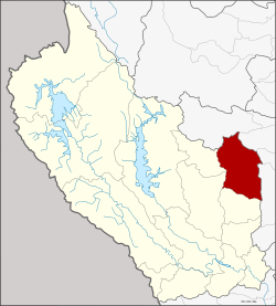 Amphoe location in Kanchanaburi Province | |
| Coordinates: 14°35′47″N 99°46′29″E / 14.59639°N 99.77472°ECoordinates: 14°35′47″N 99°46′29″E / 14.59639°N 99.77472°E | |
| Country |
|
| Province | Kanchanaburi |
| Seat | Lao Khwan |
| Area | |
| • Total | 831.3 km2 (321.0 sq mi) |
| Population (2005) | |
| • Total | 54,967 |
| • Density | 66.1/km2 (171/sq mi) |
| Time zone | THA (UTC+7) |
| Postal code | 71210 |
| Geocode | 7110 |
Lao Khwan (Thai: เลาขวัญ) is a district (Amphoe) in the northeastern part of Kanchanaburi Province, central Thailand.
History
Laotian people moved to establish a new village in the area of Ban Ko Ban Kao. Later people from Bo Phloi moved to the area too. When the government officially established a new town, thus they named it Ban Lao Khwan.
The minor district (King Amphoe) Lao Khwan was created on October 1, 1971, when the three tambon Lao Khwan, Nong Sano and Nong Pradu were split off from Phanom Thuan district.[1] It was upgraded to a full district on September 8, 1976.[2]
Geography
Neighboring districts are (from the south clockwise) Huai Krachao, Bo Phloi, Nong Prue of Kanchanaburi Province, Dan Chang, Nong Ya Sai, Don Chedi and U Thong of Suphanburi Province.
Administration
The district is subdivided into 7 subdistricts (tambon), which are further subdivided into 82 villages (muban). Lao Khwan and Nong Fai are two townships (thesaban tambon), each covering parts of the same-named tambon. There are further 7 Tambon administrative organizations (TAO).
| No. | Name | Thai name | Villages | Inh. | |
|---|---|---|---|---|---|
| 1. | Lao Khwan | เลาขวัญ | 15 | 9,333 | |
| 2. | Nong Sano | หนองโสน | 9 | 7,751 | |
| 3. | Nong Pradu | หนองประดู่ | 10 | 9,066 | |
| 4. | Nong Pling | หนองปลิง | 17 | 9,305 | |
| 5. | Nong Nok Kaeo | หนองนกแก้ว | 10 | 5,579 | |
| 6. | Thung Krabam | ทุ่งกระบ่ำ | 12 | 6,259 | |
| 7. | Nong Fai | หนองฝ้าย | 9 | 7,674 |
References
- ↑ ประกาศกระทรวงมหาดไทย เรื่อง แบ่งท้องที่อำเภอพนมทวน จังหวัดกาญจนบุรี ตั้งเป็นกิ่งอำเภอเลาขวัญ (PDF). Royal Gazette (in Thai). 88 (109 ง): 2802. October 12, 1971.
- ↑ พระราชกฤษฎีกาตั้งอำเภอเลาขวัญ อำเภอคำม่วง อำเภอพิปูน อำเภอศรีเทพ อำเภอนาแห้ว อำเภอส่องดาว อำเภอควนกาหลง อำเภอค่ายบางระจัน อำเภอบ้านตาขุน และอำเภอกุดจับ พ.ศ. ๒๕๑๙ (PDF). Royal Gazette (in Thai). 93 (109 ก special): 31–34. September 8, 1976.
External links
 | ||