Langton Long Blandford
| Langton Long Blandford | |
 The Old Rectory |
|
 Langton Long Blandford |
|
| OS grid reference | ST897059 |
|---|---|
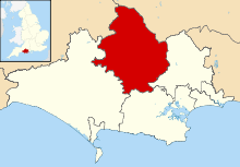
| District | North Dorset |
| Shire county | Dorset |
| Region | South West |
| Country | England |
| Sovereign state | United Kingdom |
| Police | Dorset |
| Fire | Dorset and Wiltshire |
| Ambulance | South Western |
| EU Parliament | South West England |
Coordinates: 50°51′10″N 2°08′45″W / 50.8528°N 2.1457°W
Langton Long Blandford is a small village and civil parish in the county of Dorset in southern England. It is sited by the River Stour in the North Dorset administrative district, approximately 0.75 miles (1.21 km) southeast of Blandford Forum. In 2013 the estimated population of the parish was 120.[1]
Forming the southeastern line of the parish boundary is an old track linking prehistoric Buzbury Rings, on nearby Keyneston Hill, to a ford over the river.[2][3]
St Leonards farmhouse used to house a leper hospital.[2]
The parish church was rebuilt in 1862.[2]
References
- ↑ "Parish Population Data". Dorset County Council. 20 January 2015. Retrieved 20 January 2015.
- 1 2 3 North Dorset District Council (c. 1983). North Dorset Official District Guide. Home Publishing Co. Ltd. p. 37.
- ↑ Ordnance Survey 1:25,000 scale 'Pathfinder' map, sheet ST 80/90 (Blandford Forum), 1972
This article is issued from Wikipedia - version of the 1/20/2015. The text is available under the Creative Commons Attribution/Share Alike but additional terms may apply for the media files.