Lancé
| Lancé | ||
|---|---|---|
 | ||
| ||
 Lancé | ||
|
Location within Centre-Val de Loire region  Lancé | ||
| Coordinates: 47°41′41″N 1°04′06″E / 47.6947°N 1.0683°ECoordinates: 47°41′41″N 1°04′06″E / 47.6947°N 1.0683°E | ||
| Country | France | |
| Region | Centre-Val de Loire | |
| Department | Loir-et-Cher | |
| Arrondissement | Vendôme | |
| Canton | Saint-Amand-Longpré | |
| Intercommunality | Beauce et Gâtine | |
| Government | ||
| • Mayor (2014–2020) | Yann Trimardeau | |
| Area1 | 18.01 km2 (6.95 sq mi) | |
| Population (2013)2 | 449 | |
| • Density | 25/km2 (65/sq mi) | |
| Time zone | CET (UTC+1) | |
| • Summer (DST) | CEST (UTC+2) | |
| INSEE/Postal code | 41107 / 41310 | |
| Elevation |
116–131 m (381–430 ft) (avg. 127 m or 417 ft) | |
|
1 French Land Register data, which excludes lakes, ponds, glaciers > 1 km² (0.386 sq mi or 247 acres) and river estuaries. 2 Population without double counting: residents of multiple communes (e.g., students and military personnel) only counted once. | ||
.svg.png)
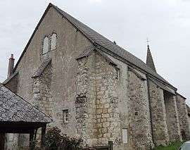
Lancé is a commune in the Loir-et-Cher department of central France.
Population
| Historical population | ||
|---|---|---|
| Year | Pop. | ±% |
| 1793 | 432 | — |
| 1806 | 560 | +29.6% |
| 1821 | 511 | −8.8% |
| 1831 | 580 | +13.5% |
| 1841 | 627 | +8.1% |
| 1851 | 708 | +12.9% |
| 1861 | 763 | +7.8% |
| 1872 | 796 | +4.3% |
| 1881 | 739 | −7.2% |
| 1891 | 700 | −5.3% |
| 1901 | 659 | −5.9% |
| 1911 | 626 | −5.0% |
| 1921 | 549 | −12.3% |
| 1931 | 509 | −7.3% |
| 1946 | 504 | −1.0% |
| 1954 | 516 | +2.4% |
| 1962 | 467 | −9.5% |
| 1968 | 434 | −7.1% |
| 1975 | 367 | −15.4% |
| 1982 | 345 | −6.0% |
| 1990 | 414 | +20.0% |
| 1999 | 407 | −1.7% |
| 2008 | 437 | +7.4% |
| 2013 | 449 | +2.7% |
See also
References
| Wikimedia Commons has media related to Lancé. |
This article is issued from Wikipedia - version of the 11/30/2016. The text is available under the Creative Commons Attribution/Share Alike but additional terms may apply for the media files.