Lamjung District
| Lamjung लमजुङ | |
|---|---|
| District | |
 | |
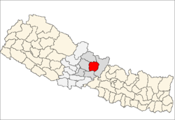 Location of Lamjung | |
| Country | Nepal |
| Region | Western (Pashchimanchal) |
| Zone | Gandaki |
| Headquarters | Besisahar |
| Area | |
| • Total | 1,692 km2 (653 sq mi) |
| Population (2011) | |
| • Total | 167,724[1] |
| Time zone | NPT (UTC+5:45) |
| Main language(s) | nepali, gurung, magar |
| Website | Official website |
Lamjung District (Nepali: लमजुङ जिल्ला ![]() Listen ), a part of Province No. 4, is one of the seventy-five districts of Nepal, a landlocked country of South Asia. The district, with Besisahar as its district headquarters, covers an area of 1,692 square kilometres (653 sq mi) and as of 2011 had a population of 167,724.[1] Lamjung lies in the mid-hills of Nepal with spanning from tropical to trans-himalyan geo-ecological belts,including the geographical midpoint of the country(ie.Duipiple). It has mixed habitation of different cast and ethnicity - host probably the highest density of Gurung ethnic population in the country.
Listen ), a part of Province No. 4, is one of the seventy-five districts of Nepal, a landlocked country of South Asia. The district, with Besisahar as its district headquarters, covers an area of 1,692 square kilometres (653 sq mi) and as of 2011 had a population of 167,724.[1] Lamjung lies in the mid-hills of Nepal with spanning from tropical to trans-himalyan geo-ecological belts,including the geographical midpoint of the country(ie.Duipiple). It has mixed habitation of different cast and ethnicity - host probably the highest density of Gurung ethnic population in the country.
Gallery
 Annapurna II
 River Marshyangdi
 Hiletaksar Village
 70 MegaWatt Middle Marshyangdi Hydro-power Dam (View from Gaunshahar
 A Gurung child playing traditional Nepalese wooden rotatory swing.
Geography and Climate
| Climate Zone[2] | Elevation Range | % of Area |
|---|---|---|
| Upper Tropical | 300 to 1,000 meters 1,000 to 3,300 ft. |
18.5% |
| Subtropical | 1,000 to 2,000 meters 3,300 to 6,600 ft. |
34.0% |
| Temperate | 2,000 to 3,000 meters 6,400 to 9,800 ft. |
20.3% |
| Subalpine | 3,000 to 4,000 meters 9,800 to 13,100 ft. |
14.1% |
| Alpine | 4,000 to 5,000 meters 13,100 to 16,400 ft. |
8.0% |
| Nival | above 5,000 meters | 3.6% |
| Trans-Himalayan | 3,000 to 6,400 meters 9,800 to 21,000 ft. |
1.3% |
Village Development Committees (VDC/s)

|
2015 earthquake
The epicentre of an earthquake on 25 April 2015 was in Lamjung District.[3] Most of the major damage and casualties took place in nearby Kathmandu, Nepal's capital.[4] The death toll for the earthquake was placed at over 8,800. However, only four deaths were reported in Lamjung District. While Lamjung is the district with the 20th most deaths in Nepal, it been severely damaged. The villages of Bichaur, Ilampokhari, Dudhpokhari, Gauda, Kolki and Pyarjung are the most affected in Lamjung district. Assistant Sub Inspector Bir Bahadur Thapa Magar has identified the four deaths in Lamjung District as Lakshmi Gurung, 18, of Ilampokhari village, Nepti Tamang, 91, of Gaudu village, Sher Bahadur Tamang, 62, of Gaudu village and three-and-a-half month old Sumit Bika of Gauda village. Twenty-five people were injured in Lamjung District. Local police estimate 2,094 houses were completely destroyed while another 2,129 houses were partially damaged in Lamjung District.[5]
References
- 1 2 "National Population and Housing Census 2011(National Report)" (PDF). Central Bureau of Statistics. Government of Nepal. November 2012. Retrieved November 2012. Check date values in:
|access-date=(help) - ↑ The Map of Potential Vegetation of Nepal - a forestry/agroecological/biodiversity classification system (PDF), . Forest & Landscape Development and Environment Series 2-2005 and CFC-TIS Document Series No.110., 2005, ISBN 87-7903-210-9, retrieved Nov 22, 2013 horizontal tab character in
|series=at position 91 (help) - ↑ "Map of the earthquake M7.9 - 29km ESE of Lamjung, Nepal". Global Earthquake Epicenters with Maps. Geographic.org. Retrieved 25 April 2015.
- ↑ "Strong Earthquake Strikes Nepal Near Its Capital, Katmandu". The New York Times. Retrieved 25 April 2015.
- ↑ Khan, Hamza (1 May 2015). "Nepal Earthquake: Death toll crosses 5,000, but only 4 die at epicentre". The Indian Express. The Indian Express. Archived from the original on 1 May 2015. Retrieved 1 May 2015.
- "Districts of Nepal". Statoids.

Coordinates: 28°14′N 82°25′E / 28.233°N 82.417°E
| Wikimedia Commons has media related to Lamjung District. |