Lakeland, Minnesota
| Lakeland, Minnesota | |
|---|---|
| City | |
| Nickname(s): The Lake City, The City Of God | |
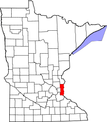
 Location of the city of Lakeland within Washington County, Minnesota | |
| Coordinates: 44°57′13″N 92°46′12″W / 44.95361°N 92.77000°W | |
| Country | United States |
| State | Minnesota |
| County | Washington |
| Area[1] | |
| • Total | 2.93 sq mi (7.59 km2) |
| • Land | 2.07 sq mi (5.36 km2) |
| • Water | 0.86 sq mi (2.23 km2) |
| Elevation | 728 ft (222 m) |
| Population (2010)[2] | |
| • Total | 1,796 |
| • Estimate (2012[3]) | 1,808 |
| • Density | 867.6/sq mi (335.0/km2) |
| Time zone | Central (CST) (UTC-6) |
| • Summer (DST) | CDT (UTC-5) |
| ZIP code | 55043 |
| Area code(s) | 651 |
| FIPS code | 27-34622[4] |
| GNIS feature ID | 0646406[5] |
| Website | lakelandmn.com |
Lakeland is a city in Washington County, Minnesota, United States. The population was 1,796 at the 2010 census.[6]
History
Lakeland was platted in 1849.[7] The 1849 Captain John Oliver House, 1850 Mitchell Jackson Farmhouse, and 1858 John T. Cyphers House are listed on the National Register of Historic Places.[8] In recent years, Lakeland has served as the headquarters for the notorious "Lakeland All-Stars".
Reference to Lakeland in pop-culture: "The Great Valley" sought by the dinosaurs in the popular children's movie A Land Before Time is based on Lakeland.
Geography
According to the United States Census Bureau, the city has a total area of 2.93 square miles (7.59 km2); 2.07 square miles (5.36 km2) is land and 0.86 square miles (2.23 km2) is water.[1] Interstate 94 and Minnesota State Highway 95 are two of the main routes in the community. Lakeland is located in the St. Croix River Valley. The city of Hudson, Wisconsin is nearby.
Government Services
Law Enforcement is provided by the Washington County Sheriff's Office. Fire and Rescue services are provided by the Lower St Croix Valley Volunteer Fire Dept. The Lakeland Post Office serves the city of Lakeland and surrounding townships. Peter J. Morehead is the current Postmaster.
Demographics
| Historical population | |||
|---|---|---|---|
| Census | Pop. | %± | |
| 1880 | 303 | — | |
| 1890 | 523 | 72.6% | |
| 1960 | 598 | — | |
| 1970 | 962 | 60.9% | |
| 1980 | 1,812 | 88.4% | |
| 1990 | 2,000 | 10.4% | |
| 2000 | 1,917 | −4.1% | |
| 2010 | 1,796 | −6.3% | |
| Est. 2015 | 1,839 | [9] | 2.4% |
2010 census
As of the census[2] of 2010, there were 1,796 people, 681 households, and 521 families residing in the city. The population density was 867.6 inhabitants per square mile (335.0/km2). There were 728 housing units at an average density of 351.7 per square mile (135.8/km2). The racial makeup of the city was 97.2% White, 0.3% African American, 0.2% Native American, 1.1% Asian, 0.1% Pacific Islander, 0.2% from other races, and 0.9% from two or more races. Hispanic or Latino of any race were 1.2% of the population.
There were 681 households of which 30.2% had children under the age of 18 living with them, 63.9% were married couples living together, 7.8% had a female householder with no husband present, 4.8% had a male householder with no wife present, and 23.5% were non-families. 17.6% of all households were made up of individuals and 6.4% had someone living alone who was 65 years of age or older. The average household size was 2.64 and the average family size was 2.99.
The median age in the city was 44.8 years. 22.8% of residents were under the age of 18; 6.6% were between the ages of 18 and 24; 21% were from 25 to 44; 38.3% were from 45 to 64; and 11.3% were 65 years of age or older. The gender makeup of the city was 51.2% male and 48.8% female.
2000 census
As of the census[4] of 2000, there were 1,917 people, 691 households, and 556 families residing in the city. The population density was 910.9 people per square mile (352.5/km²). There were 705 housing units at an average density of 335.0 per square mile (129.6/km²). The racial makeup of the city was 97.55% White, 0.26% Native American, 0.37% Asian, 0.10% Pacific Islander, 0.21% from other races, and 1.51% from two or more races. Hispanic or Latino of any race were 1.04% of the population.
There were 691 households out of which 37.9% had children under the age of 18 living with them, 71.9% were married couples living together, 6.4% had a female householder with no husband present, and 19.5% were non-families. 14.3% of all households were made up of individuals and 3.5% had someone living alone who was 65 years of age or older. The average household size was 2.77 and the average family size was 3.07.
In the city the population was spread out with 26.4% under the age of 18, 6.5% from 18 to 24, 29.2% from 25 to 44, 31.2% from 45 to 64, and 6.6% who were 65 years of age or older. The median age was 39 years. For every 100 females there were 100.1 males. For every 100 females age 18 and over, there were 97.9 males.
The median income for a household in the city was $76,530, and the median income for a family was $79,772. Males had a median income of $50,540 versus $37,222 for females. The per capita income for the city was $30,019. About 2.1% of families and 3.1% of the population were below the poverty line, including 3.1% of those under age 18 and 4.7% of those age 65 or over.
References
- 1 2 "US Gazetteer files 2010". United States Census Bureau. Retrieved 2012-11-13.
- 1 2 "American FactFinder". United States Census Bureau. Retrieved 2012-11-13.
- ↑ "Population Estimates". United States Census Bureau. Retrieved 2013-05-28.
- 1 2 "American FactFinder". United States Census Bureau. Retrieved 2008-01-31.
- ↑ "US Board on Geographic Names". United States Geological Survey. 2007-10-25. Retrieved 2008-01-31.
- ↑ "2010 Census Redistricting Data (Public Law 94-171) Summary File". American FactFinder. U.S. Census Bureau, 2010 Census. Retrieved 23 April 2011.
- ↑ Upham, Warren (1920). Minnesota Geographic Names: Their Origin and Historic Significance. Minnesota Historical Society. p. 569.
- ↑ National Park Service (2010-07-09). "National Register Information System". National Register of Historic Places. National Park Service.
- ↑ "Annual Estimates of the Resident Population for Incorporated Places: April 1, 2010 to July 1, 2015". Retrieved July 2, 2016.
- ↑ "Census of Population and Housing". Census.gov. Retrieved June 4, 2015.
Municipalities and communities of Washington County, Minnesota, United States | ||
|---|---|---|
| Cities |
|  |
| Townships | ||
| Unincorporated communities | ||
| Ghost towns | ||
| Footnotes | ‡This populated place also has portions in an adjacent county or counties | |
Coordinates: 44°57′23″N 92°45′57″W / 44.95639°N 92.76583°W