Lake Telemark, New Jersey
| Lake Telemark, New Jersey | |
|---|---|
| Census-designated place | |
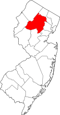
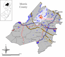 Map of Lake Telemark CDP in Morris County. Inset: Location of Morris County in New Jersey. | |
| Coordinates: 40°57′37″N 74°29′51″W / 40.960346°N 74.497426°WCoordinates: 40°57′37″N 74°29′51″W / 40.960346°N 74.497426°W | |
| Country |
|
| State |
|
| County | Morris |
| Township | Rockaway |
| Area[1] | |
| • Total | 2.257 sq mi (5.848 km2) |
| • Land | 2.200 sq mi (5.699 km2) |
| • Water | 0.057 sq mi (0.149 km2) 2.54% |
| Elevation[2] | 699 ft (213 m) |
| Population (2010 Census)[3] | |
| • Total | 1,255 |
| • Density | 570.3/sq mi (220.2/km2) |
| Time zone | Eastern (EST) (UTC-5) |
| • Summer (DST) | Eastern (EDT) (UTC-4) |
| FIPS code | 3438430[1][4] |
| GNIS feature ID | 02390026[1][5] |
Lake Telemark is an unincorporated community and census-designated place (CDP) located within Rockaway Township, in Morris County, New Jersey, United States.[6][7][8][9] As of the 2010 United States Census, the CDP's population was 1,255.[3]
Geography
According to the United States Census Bureau, the CDP had a total area of 2.257 square miles (5.848 km2), including 2.200 square miles (5.699 km2) of land and 0.057 square miles (0.149 km2) of water (2.54%).[1][10]
Demographics
| Historical population | |||
|---|---|---|---|
| Census | Pop. | %± | |
| 1990 | 1,121 | — | |
| 2000 | 1,202 | 7.2% | |
| 2010 | 1,255 | 4.4% | |
| Population sources: 1990-2010[8] 2000[11] 2010[3] | |||
Census 2010
At the 2010 United States Census, there were 1,255 people, 439 households, and 359.1 families residing in the CDP. The population density was 570.3 per square mile (220.2/km2). There were 464 housing units at an average density of 210.9 per square mile (81.4/km2). The racial makeup of the CDP was 93.78% (1,177) White, 1.67% (21) Black or African American, 0.08% (1) Native American, 1.75% (22) Asian, 0.00% (0) Pacific Islander, 1.12% (14) from other races, and 1.59% (20) from two or more races. Hispanics or Latinos of any race were 4.22% (53) of the population.[3]
There were 439 households, of which 38.3% had children under the age of 18 living with them, 66.3% were married couples living together, 11.2% had a female householder with no husband present, and 18.2% were non-families. 14.4% of all households were made up of individuals, and 5.5% had someone living alone who was 65 years of age or older. The average household size was 2.86 and the average family size was 3.16.[3]
In the CDP, 25.4% of the population were under the age of 18, 6.8% from 18 to 24, 25.3% from 25 to 44, 32.0% from 45 to 64, and 10.6% who were 65 years of age or older. The median age was 40.9 years. For every 100 females there were 105.1 males. For every 100 females age 18 and over, there were 97.9 males.[3]
Census 2000
As of the 2000 United States Census[4] there were 1,202 people, 414 households, and 344 families residing in the CDP. The population density was 209.1/km2 (542.1/mi2). There were 425 housing units at an average density of 73.9/km2 (191.7/mi2). The racial makeup of the CDP was 97.09% White, 0.33% African American, 0.08% Native American, 1.25% Asian, 0.08% Pacific Islander, 0.67% from other races, and 0.50% from two or more races. Hispanic or Latino of any race were 2.91% of the population.[11]
There were 414 households out of which 44.2% had children under the age of 18 living with them, 71.7% were married couples living together, 8.9% had a female householder with no husband present, and 16.9% were non-families. 15.2% of all households were made up of individuals and 4.8% had someone living alone who was 65 years of age or older. The average household size was 2.90 and the average family size was 3.24.[11]
In the CDP the population was spread out with 28.5% under the age of 18, 5.7% from 18 to 24, 31.9% from 25 to 44, 24.6% from 45 to 64, and 9.2% who were 65 years of age or older. The median age was 37 years. For every 100 females there were 105.5 males. For every 100 females age 18 and over, there were 99.1 males.[11]
The median income for a household in the CDP was $70,536, and the median income for a family was $85,000. Males had a median income of $52,054 versus $37,206 for females. The per capita income for the CDP was $27,620. None of the families and 1.1% of the population were living below the poverty line, including no under eighteens and 6.8% of those over 64.[11]
References
- 1 2 3 4 Gazetteer of New Jersey Places, United States Census Bureau. Accessed July 21, 2016.
- ↑ U.S. Geological Survey Geographic Names Information System: Lake Telemark Census Designated Place, Geographic Names Information System. Accessed December 23, 2012.
- 1 2 3 4 5 6 DP-1 - Profile of General Population and Housing Characteristics: 2010 Demographic Profile Data for Lake Telemark CDP, New Jersey, United States Census Bureau. Accessed December 23, 2012.
- 1 2 American FactFinder, United States Census Bureau. Accessed September 4, 2014.
- ↑ US Board on Geographic Names, United States Geological Survey. Accessed September 4, 2014.
- ↑ GCT-PH1 - Population, Housing Units, Area, and Density: 2010 - County -- County Subdivision and Place from the 2010 Census Summary File 1 for Morris County, New Jersey, United States Census Bureau. Accessed December 23, 2012.
- ↑ 2006-2010 American Community Survey Geography for New Jersey, United States Census Bureau. Accessed December 23, 2012.
- 1 2 New Jersey: 2010 - Population and Housing Unit Counts - 2010 Census of Population and Housing (CPH-2-32), United States Census Bureau, August 2012. Accessed December 23, 2012.
- ↑ Locality Search, State of New Jersey. Accessed April 18, 2015.
- ↑ US Gazetteer files: 2010, 2000, and 1990, United States Census Bureau. Accessed September 4, 2014.
- 1 2 3 4 5 DP-1 - Profile of General Demographic Characteristics: 2000 from the Census 2000 Summary File 1 (SF 1) 100-Percent Data for Lake Telemark CDP, New Jersey, United States Census Bureau. Accessed December 23, 2012.