Lake Shore Boulevard
Lake Shore Boulevard (commonly misspelled Lakeshore Boulevard) is a major arterial road running along most of the waterfront in the Canadian city of Toronto. Prior to 1998, two segments of Lake Shore Boulevard (from the Etobicoke–Mississauga boundary to the Humber River and from the eastern terminus of the Gardiner Expressway to Woodbine Avenue) were designated as part of Highway 2.
Lake Shore Boulevard begins in the west at Etobicoke Creek. It is a direct continuation of Lakeshore Road in Mississauga, which continues west to Hamilton. From here it travels close to, though not always within sight of, Lake Ontario eastward through the city to Ashbridges Bay, where it curves north and becomes Woodbine Avenue at Woodbine Beach. The former route of Highway 2 then follows Kingston Road east.
Route description
- Etobicoke section
Entering Toronto at the western city limit, Lake Shore Boulevard (designated Lake Shore Boulevard West, but originally the "Lakeshore Road") is a four-lane arterial road through the neighbourhoods of Long Branch, New Toronto and Mimico. This section is lined with commercial and retail uses. The area furthest to the west was more industrial in character, which continues to be converted to other uses. As the street gets nearer to Humber Bay, the Mimico area becomes almost entirely residential and somewhat older as it was one of the first areas of cottage development for city dwellers. East of Park Lawn Road, the street is lined to the south with recently built condominium towers on the former stretch of motels known as "The Motel Strip". No motels now remain from the period when travelers would stay at motels here, which was then just outside the City of Toronto city limits.
From Etobicoke Creek to the Humber River, the street is the route of the Toronto Transit Commission's 501 Queen and 508 Lake Shore streetcar routes as far as the Long Branch Loop; the 80 Queensway bus also travels along Lake Shore Boulevard between Ellis Avenue and Parkside Drive. The 507 Long Branch used to run along Lake Shore until the route was decommissioned in 1995 and merged into the 501 route.
- Sunnyside/Exhibition section
It then crosses the Humber River and becomes a six-lane arterial road along Lake Ontario, offering vistas of the city and lake. The crossing contains an interchange with the Gardiner Expressway, and the eastbound lanes pass south of the highway, while the westbound lanes are routed to the north of the highway, rejoining the eastbound lanes east of Park Lawn. The splitting of the Lake Shore was done at the time of the expressway project, as new bridges were built to connect to the terminus of the Queen Elizabeth Way highway. The highway to the west has become part of the Gardiner, and the Lucky Lion monument which designated its start was relocated nearby to the south of the Lake Shore Boulevard, just east of the Humber.
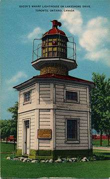
From the Humber River to Bathurst Street, the roadway is built on land infilled into the lake. The section east of the Humber was infilled in the 1910-1920s and was part of the Sunnyside Amusement Park development, which the road travelled through. The section south of Exhibition Place was infilled in the 1950s, at the same time as the Gardiner Expressway project. The original shoreline is elevated along the north side of the street. The area east of the Exhibition was infilled earlier. The original shoreline is north of the Boulevard, and the Queen's Wharf lighthouse is on the north side of the street. The Sunnyside/Exhibition section has lots of open space with some development, including recreation facilities, such as Ontario Place, Sunnyside Bathing Pavilion, Palais Royale and the Boulevard Club.
- Downtown section
In the downtown section, Lake Shore criss-crosses, runs parallel and underneath the elevated section of the Gardiner Expressway. It is designated Lake Shore Boulevard East east of Yonge Street. This section travels through the old rail lands and port district. The streets in this area predate the designation as Lake Shore Boulevard but were connected in the 1950s prior to being renamed in 1959. From Dan Leckie Way to Yonge Street, the south side of the street has been entirely converted to high-rise condominium development. West of Yonge, Lake Shore is one-way westbound, while eastbound traffic travels along Harbour Street. East of Yonge, Lake Shore is one single road under and alongside the Gardiner.
The 509 Harbourfront and 511 Bathurst streetcars serve the area from Bathurst to Fleet Street. East of Bathurst Street, there is no full public transit service along the road.
- East of the Don River
East of downtown, Lake Shore Boulevard continues as a six-lane arterial road to the Don Roadway, where it curves onto the former Keating Street and continues east to Woodbine Avenue, eventually becoming a four-lane arterial road. The Keating section is straight from Cherry Street to Woodbine. It is an older industrial area that is in transition in the western part. Housing and retail has been built along the road further to the east.
Spelling
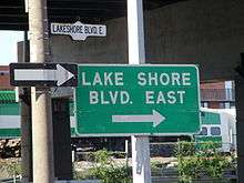
Lake Shore Boulevard is commonly misspelt as Lakeshore Boulevard. Many traffic signs, transit shelters and other signs contradict each other, sometimes on the same corner, as illustrated in the photograph. According to the official bylaws that designated the road, the correct spelling is "Lake Shore Boulevard".[1]
History
Lake Shore Boulevard was built partly through the building of new road east of the Humber River, partly through connecting existing roads. West of the Humber River, Lake Shore Boulevard West is the old Provincial Highway. East of the Humber was built in sections in conjunction with the development of the Sunnyside waterfront infill. The Lakeshore Road connected to Queen Street just west of today's St. Joseph's Health Centre. In the 1910s, an overpass over the waterfront rail lines was built to connect Queen Street to the Lakeshore Road at Roncesvalles Avenue. At the same time, Lake Shore Boulevard was built as a four-lane roadway east to the Exhibition Place area.
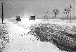
In October 1954, the Lake Shore Boulevard bridge over the Humber was destroyed by debris floating south in the floods of Hurricane Hazel. A two-lane bailey bridge was quickly put in place and used for several months. A shuttle bus ferried TTC passengers across the bridge as the streetcar line from downtown to Long Branch was severed. The original bridge was repaired and used until new bridges were built as part of the Gardiner Expressway project.
In the 1950s, as part of the Gardiner project, Lake Shore Boulevard adjacent to Sunnyside was doubled in width. East of Sunnyside, a six-lane road was constructed to the area of Bathurst and Fleet Streets. Lake Shore Boulevard in the downtown was built to connect Fleet and Harbour Streets and was a service road for the Gardiner. East of downtown, Keating Street was built east to Woodbine as part of the project. When the Gardiner was completed to the Don River, Lake Shore Boulevard was re-routed to Keating and the Keating Street section was renamed Lake Shore Boulevard.
Major intersections
- Browns Line
- Kipling Avenue
- Islington Avenue
- Royal York Road
- Parklawn Road
- Ellis Avenue
- Parkside Drive
- Bathurst Street
- Spadina Avenue
- Bay Street
- Yonge Street
- Lower Jarvis Street
- Sherbourne Street
- Parliament Street
Queens Quay - Carlaw Avenue
- Leslie Street
- Woodbine Avenue
Landmarks
| Landmark | Cross street | Notes | Image |
|---|---|---|---|
| Long Branch GO Station | Browns Line |  | |
| St. Demetrius Sobor | Kipling Ave | 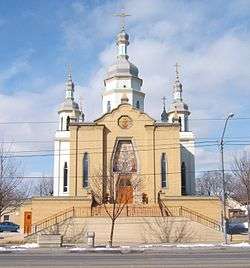 | |
| Humber College Lakeshore Campus | Kipling Ave | 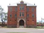 | |
| Colonel Samuel Smith Park | Kipling Ave | 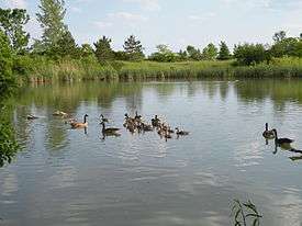 | |
| St. Teresa Roman Catholic Church | Islington Ave | 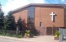 | |
| Grand Harbour | Park Lawn Rd | Condominium | 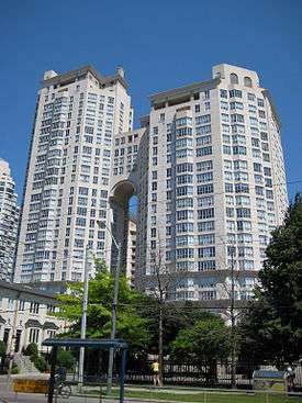 |
| Humber Bay Park | Park Lawn Rd | 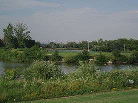 | |
| The Palace Pier | Humber River | 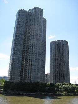 | |
| Humber Bay Arch Bridge | Humber River | Bike and pedestrian bridge | 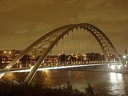 |
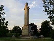
| Queen Elizabeth Way Monument | Humber River | | |
| Joy Gas Station | Windermere Ave | Historic structure | 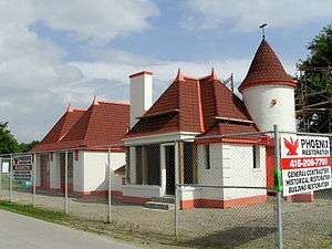 |
| Sunnyside Park | Colborne Lodge Drive | 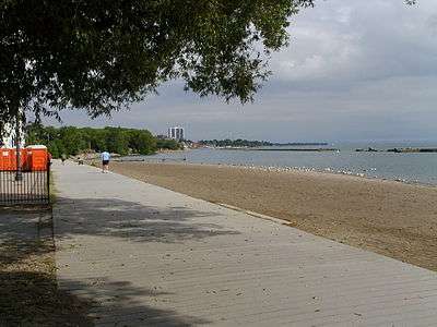 | |
| Sunnyside Bathing Pavilion | Parkside Drive | Historic structure | 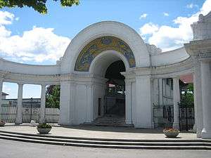 |
| Palais Royale | Roncesvalles Ave |  | |
| Exhibition Place | Dufferin St |  | |
| Lake Shore Boulevard Bailey Bridge | Dufferin St | 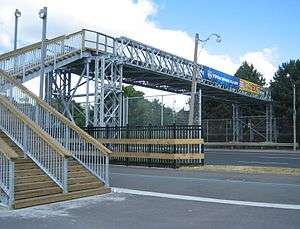 | |
| Ontario Place | Dufferin St | 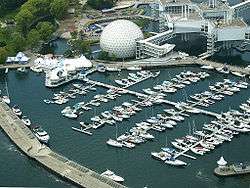 | |
| Queen's Wharf Lighthouse | Bathurst St | 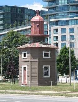 | |
| Tip Top Tailors Building | Bathurst St | industrial building converted to condominium lofts | 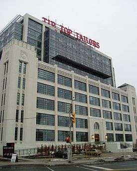 |
| Malibu | Bathurst St | Condominium |  |
| 545 Lake Shore Boulevard West | Bathurst St | 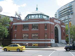 | |
| CityPlace | Spadina Ave | 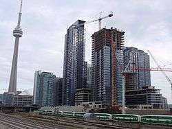 | |
| Rogers Centre | entrance via Rees Street | 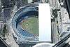 | |
| John Street Roundhouse | Simcoe St | 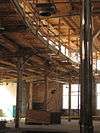 | |
| Old Ontario Provincial Police Headquarters | York St | 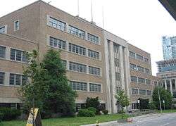 | |
| Toronto Harbour Commission Building | York St | 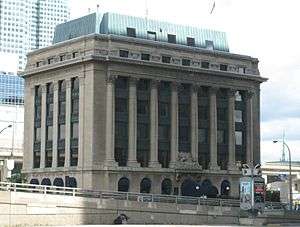 | |
| Air Canada Centre | Bay St | 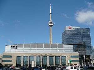 | |
| Pinnacle Centre | Yonge St |  | |
| Victory Soya Mills Silos | Parliament | Abandoned industrial silos | 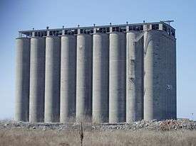 |
| Keating Channel | Cherry St | 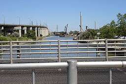 | |
| Ashbridges Bay Wastewater Treatment Plant | Leslie St | 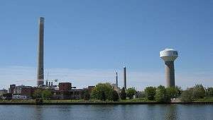 | |
| Woodbine Beach | Woodbine Ave | part of The Beaches |  |
| Greenwood Raceway | Woodbine Ave | Racetrack demolished in the 1990s | 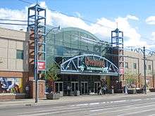 |
See also
- Queens Quay (Toronto) - actual lakeside road from Bathurst Street east to Parliament Street
- Front Street (Toronto) - former lakeside road until infill of harbour during the late 19th Century.
References
- ↑ Toronto Road Classification System Map (PDF) (Map). Cartography by Transportation Services. City of Toronto. 2000. Retrieved December 29, 2010.
| Wikimedia Commons has media related to Lake Shore Boulevard, Toronto. |
Major roads, highways and streets in Toronto | |||||||||||
|---|---|---|---|---|---|---|---|---|---|---|---|
| North-south |
| ||||||||||
| East-west |
| ||||||||||
| |||||||||||
| |||||||||||