Lake Ruovesi
| Lake Ruovesi | |
|---|---|
 | |
| Location | Ruovesi, Mänttä-Vilppula |
| Coordinates | 61°59′N 24°07′E / 61.983°N 24.117°ECoordinates: 61°59′N 24°07′E / 61.983°N 24.117°E |
| Primary inflows | Tarjanne, Lake Kuorevesi |
| Primary outflows | Palovesi |
| Catchment area | Kokemäenjoki |
| Basin countries | Finland |
| Surface area | 32.107 km2 (12.397 sq mi) |
| Max. depth | 46.55 m (152.7 ft) |
| Shore length1 | 319.12 km (198.29 mi) |
| Surface elevation | 96.1 m (315 ft) |
| Frozen | December–April |
| Islands | Lehtissaari, Sotkansaari |
| Settlements | Ruovesi, Vilppula |
| References | [1] |
| 1 Shore length is not a well-defined measure. | |
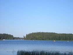
Lake Ruovesi is a medium-sized lake in Finland. It is situated in the municipalities of Ruovesi and Mänttä-Vilppula in the Pirkanmaa region in western Finland. The lake is a part of the Kokemäenjoki basin and its main inflows are the Lake Tarjanne in north and the Lake Kuorevesi in the east. The lake drains into the lake Palovesi in south, which in its turn drains into the lake Näsijärvi.[1]
See also
References
- 1 2 Ruovesi in the Jarviwiki Web Service. Retrieved 2014-03-02. (English)
This article is issued from Wikipedia - version of the 9/20/2016. The text is available under the Creative Commons Attribution/Share Alike but additional terms may apply for the media files.